


Camino Portugués Coastal Route: Stages, Map and Where to Start
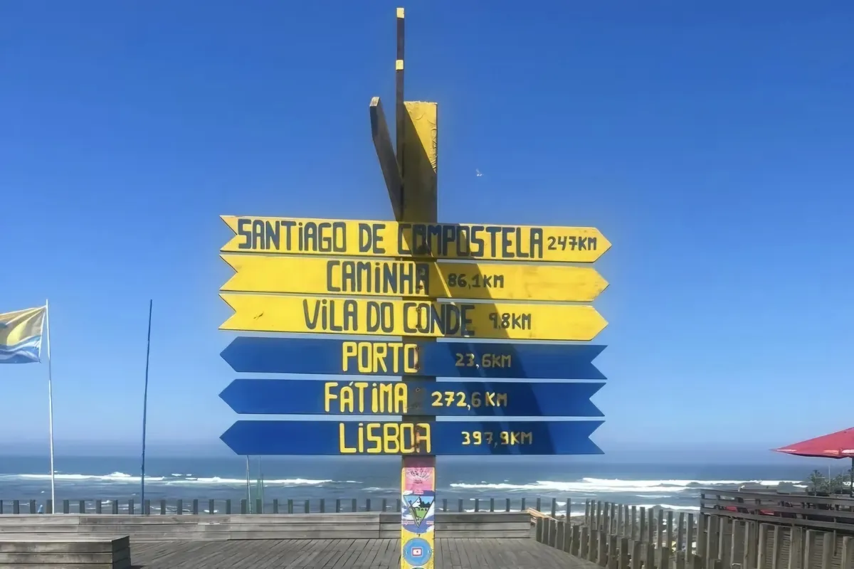
The Camino Portugués Coastal Route, also known as the Portuguese Coastal Camino or the Camino Portuguese Coastal Route, links Porto and Santiago along the Atlantic. It follows the coast of northern Portugal through Póvoa de Varzim and Viana do Castelo, crosses the Minho estuary by ferry from Caminha to A Guarda, the first town in Galicia, passes through Baiona and Vigo and, at Redondela, joins the Central Route of the Camino Portugués to reach Santiago via Pontevedra and Padrón. Our version covers 272.6 km (169 miles) in 12 stages. You can walk all of it or choose a section: from Vigo it’s 100 km in 5 stages, the shortest starting point that qualifies you for the Compostela.
Start with the number of days you have: the selector shows the stages from your starting point, the distance and the walking days. If you’d rather take the inland Central Route, see our Portuguese Camino guide; to compare it with the other routes, see all the Camino de Santiago routes.


- 12 stages · full route
- 272.6 km
- At your own pace · flexible start points and stages
Our Camino Portugués Coastal Route Tours
Accommodation booked for you and support along the route. Luggage transfer included or optional, depending on the tour.
9 tours to choose how you do the Camino.
-
 15 days / 14 nights
Portuguese Way along the coast from Porto to Santiago
13 Stages 271 Kms
From 1954 €Explore this Camino -
 7 days / 6 nights
Portuguese Way along the coast from Porto to A Guarda
5 Stages 120 Kms
From 766 €Explore this Camino -
 7 days / 6 nights
-
 7 days / 6 nights
-
 7 days / 6 nights
-
 8 days / 7 nights
-
 8 days / 7 nights
-
 10 days / 9 nights
-
 7 days / 6 nights
Services we offer on the Camino de Santiago
-
Included in all our routes
-
Accommodation booking
selected according to your budget.
-
Practical information
of the Camino de Santiago in a detailed guide.
-
Telephone assistance on the trail
for any questions or incidents, we are by your side.
-
Travel insurance
with comprehensive coverage.
-
-
On group routes
-
Accompanying guides
professional guides throughout the Camino.
-
Support vehicle
available during the stages.
-
-
Optional services
-
Luggage transport
between stages.
-
Meals and diets
Breakfast or half board option.
-
Private transfers
from/to the point you need.
-
Camino Portugués Coastal Route Map
The map shows the full route of the Camino Portugués Coastal Route, from Porto, in Portugal, to Santiago de Compostela, in Galicia, Spain. This historic pilgrimage route, 272.6 km long (the sum of our 12 stages) and divided into 12 stages, passes through iconic towns and cities such as Viana do Castelo, Caminha, Baiona, Vigo and Padrón.

Camino Portugués Coastal Route Elevation Profile and Sections
Altitude (m) vs. distance from Oporto (km) · 272.6 km · 12 stages
Hover over or tap a stage on the profile to see its details; the number takes you to its row in the table.
- End of stage
- Hardest stages
- Alternating sections
The Camino Portugués Coastal Route, Section by Section
From Porto to Viana do Castelo
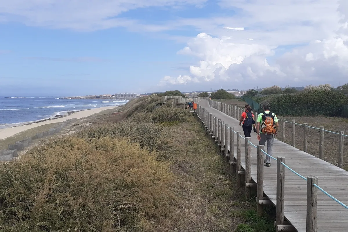
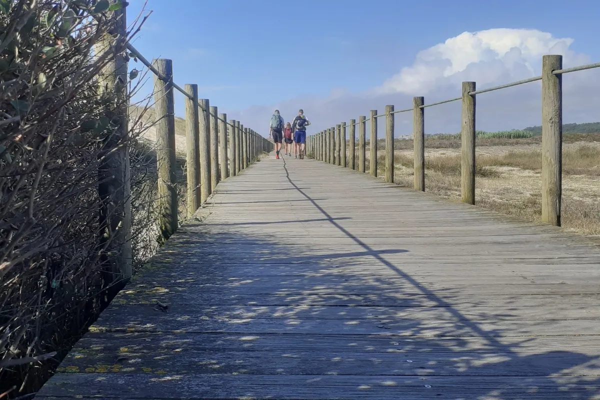
See the 3 stages in this section →Three days with the Atlantic almost always beside you. You leave from Porto’s Sé (cathedral), go down to the Douro and follow its bank to the river mouth at Foz; then come Matosinhos, Leça da Palmeira and kilometers of wooden boardwalks over the dunes to Vila do Conde and Póvoa de Varzim, at the end of a 37 km first stage. The Litoral Norte Natural Park, with its dunes, wetlands and estuaries, leads to Esposende, at the mouth of the Cávado. The third day heads a few kilometers inland, with the descent to the Neiva River, and enters Viana do Castelo over the Eiffel bridge.
On to the Minho and A Guarda
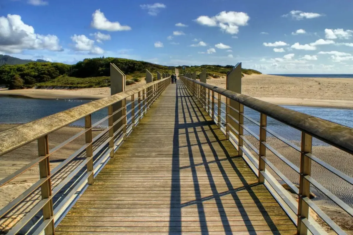
See the 2 stages in this section →Two short stages, 19 km each, to say goodbye to Portugal. From Viana do Castelo you choose between the official route, inland, and the seaside variant, unmarked but easy to follow, to Vila Praia de Âncora, a fishing town with a huge wild beach and the Forte da Lagarteira. The next day, along the coast to Caminha, you cross the mouth of the Minho by ferry and land in Galicia: above you rises Monte Santa Trega (Santa Tecla), with one of the best-preserved Iron Age hillforts in Spain, and below lies A Guarda, a seafaring town famous for its lobster.
The Baixo Miño and the Ría de Vigo
See the 3 stages in this section →The three Galician stages that belong to the Coastal Route alone. A Guarda – Baiona, 30.7 km, follows the rocky southern coast of the Baixo Miño and passes Oia and its monastery of Santa María before reaching Baiona, with its old town, the Monterreal fortress and the replica of the caravel Pinta. At A Ramallosa you choose between the official route and the coastal variant toward Vigo, a long, urban approach. The last stage of the Coastal Route proper leaves along Rúa Urzaiz, offers views of the Ría de Vigo and joins the Central Route of the Camino Portugués at Redondela before reaching Arcade, near Pontevedra, the oyster capital.
Shared Section: Arcade to Santiago
See the 4 stages in this section →The last four stages are those of the Central Route of the Camino Portugués, which comes from inland and shares the same path from Redondela. The Pontesampaio bridge, scene of a battle against Napoleon’s troops in 1809, and the old Brea Vella road take you to Pontevedra, city of the Virgen Peregrina, in just 12 km. Then come riverside woods and vineyards to Caldas de Reis and its thermal waters; Pontecesures and the Ulla before Padrón, a landmark of the Translatio; and finally Iria Flavia and the hamlets of Teo and Ames before the Obradoiro. None of the four is longer than 24.3 km.
All Stages of the Camino Portugués Coastal Route
The 12 stages from Oporto to Santiago de Compostela: 272.6 km in total. Each stage links to its full page (route, profile, where to sleep and what to see); “to Santiago” is the distance left at the end of the stage, and the difficulty is a guide for an average walker with a light backpack.
Daily stages of 12 to 37 km. The longest: Oporto – Póvoa de Varzim (37 km). Factor in the terrain and conditions as well. See in the table
Daily stages of 12 to 30.7 km. The longest: A Guarda – Baiona (30.7 km). Factor in the terrain and conditions as well. See in the table
Daily stages of 12 to 30.7 km. The longest: A Guarda – Baiona (30.7 km). Factor in the terrain and conditions as well. See in the table
Daily stages of 12 to 30.7 km. The longest: A Guarda – Baiona (30.7 km). Factor in the terrain and conditions as well. See in the table
Daily stages of 12 to 30.7 km. The longest: A Guarda – Baiona (30.7 km). Factor in the terrain and conditions as well. See in the table
Daily stages of 12 to 30.7 km. The longest: A Guarda – Baiona (30.7 km). Factor in the terrain and conditions as well. See in the table
Daily stages of 12 to 24.3 km. The longest: Padrón – Santiago de Compostela (24.3 km). Factor in the terrain and conditions as well. See in the table
Daily stages of 12 to 24.3 km. The longest: Padrón – Santiago de Compostela (24.3 km). Factor in the terrain and conditions as well. See in the table
Daily stages of 12 to 24.3 km. The longest: Padrón – Santiago de Compostela (24.3 km). Factor in the terrain and conditions as well. See in the table
Daily stages of 18.6 to 24.3 km. The longest: Padrón – Santiago de Compostela (24.3 km). Factor in the terrain and conditions as well. See in the table
Daily stages of 18.6 to 24.3 km. The longest: Padrón – Santiago de Compostela (24.3 km). Factor in the terrain and conditions as well. See in the table
Daily stages of 24.3 to 24.3 km. The longest: Padrón – Santiago de Compostela (24.3 km). Factor in the terrain and conditions as well. See in the table
From Oporto to Santiago · 12 stages
- Section distance
- 272.6 km
- Walking one stage a day
- 12 days
- Plus travel there and back
- 14 days
From Póvoa de Varzim to Santiago · 11 stages
- Section distance
- 235.6 km
- Walking one stage a day
- 11 days
- Plus travel there and back
- 13 days
From Esposende to Santiago · 10 stages
- Section distance
- 214.6 km
- Walking one stage a day
- 10 days
- Plus travel there and back
- 12 days
From Viana do Castelo to Santiago · 9 stages
- Section distance
- 190.6 km
- Walking one stage a day
- 9 days
- Plus travel there and back
- 11 days
From Vila Praia de Ancora to Santiago · 8 stages
- Section distance
- 171.6 km
- Walking one stage a day
- 8 days
- Plus travel there and back
- 10 days
From A Guarda to Santiago · 7 stages
- Section distance
- 152.6 km
- Walking one stage a day
- 7 days
- Plus travel there and back
- 9 days
From Baiona to Santiago · 6 stages
- Section distance
- 121.9 km
- Walking one stage a day
- 6 days
- Plus travel there and back
- 8 days
From Vigo to Santiago · 5 stages
- Section distance
- 98.9 km
- Walking one stage a day
- 5 days
- Plus travel there and back
- 7 days
From Arcade to Santiago · 4 stages
- Section distance
- 75.9 km
- Walking one stage a day
- 4 days
- Plus travel there and back
- 6 days
From Pontevedra to Santiago · 3 stages
- Section distance
- 63.9 km
- Walking one stage a day
- 3 days
- Plus travel there and back
- 5 days
From Caldas de Reis to Santiago · 2 stages
- Section distance
- 42.9 km
- Walking one stage a day
- 2 days
- Plus travel there and back
- 4 days
From Padrón to Santiago · 1 stage
- Section distance
- 24.3 km
- Walking one stage a day
- 1 day
- Plus travel there and back
- 3 days
We count one day per stage and add two days for travel. Rest days aren’t included; you may need more days if you split stages. Nights and services depend on the tour you choose.
From A Guarda
A Guarda (La Guardia in Spanish), at the mouth of the Minho, is where the Galician section of the Camino Portugués Coastal Route begins: from here it’s 152.6 km in 7 stages to Santiago, from south to north through Pontevedra province. The first follows the rocky coast of the Baixo Miño to Baiona, passing Oia; then come Vigo and, from Redondela, the section shared with the Central Route through Pontevedra, Caldas de Reis and Padrón.
Our Camino Portugués Coastal Route from A Guarda tour splits that 30.7 km first day at Oia, so it takes 8 stages and a 10-day trip. If you arrive with time to spare, climb Monte Santa Trega (Santa Tecla): one of the best-preserved Iron Age hillforts in Spain, with Portugal right across the water.
From Baiona
Baiona, one of the prettiest towns in Galicia, is a good starting point if you have a little over a week: from here it’s 121.9 km in 6 stages to Santiago, more than the 100 km required for the Compostela, and about 8 days including travel there and back. The first day takes you to Vigo, on the official route or the coastal variant from A Ramallosa; the second, to Arcade, after joining the Central Route at Redondela.
We organize it as our Camino Portugués from Baiona (6 stages) tour and its VIP version. Before you set off, walk the walls of the Monterreal fortress, now a parador (historic state-run hotel), and stroll down to the harbor to see the replica of the caravel Pinta.
From Vigo
Vigo, in Galicia, Spain, is the shortest starting point on the Camino Portugués Coastal Route that qualifies you for the Compostela: from Vigo to Santiago it’s 100 km in 5 stages, about 7 days including travel there and back. The first day, to Arcade, is the last one that belongs to the Coastal Route alone, with views of the ría; at Redondela the Central Route of the Camino Portugués joins, and from there you follow the same path through Pontevedra, Caldas de Reis and Padrón.
We organize it self-guided as our Camino Portugués from Vigo (5 stages) tour, with a dog and as a group tour. Before you set off, take in the ría from Monte do Castro and try the oysters on Oyster Street (calle de las Ostras).
See also:How to get to Vigo
From Porto
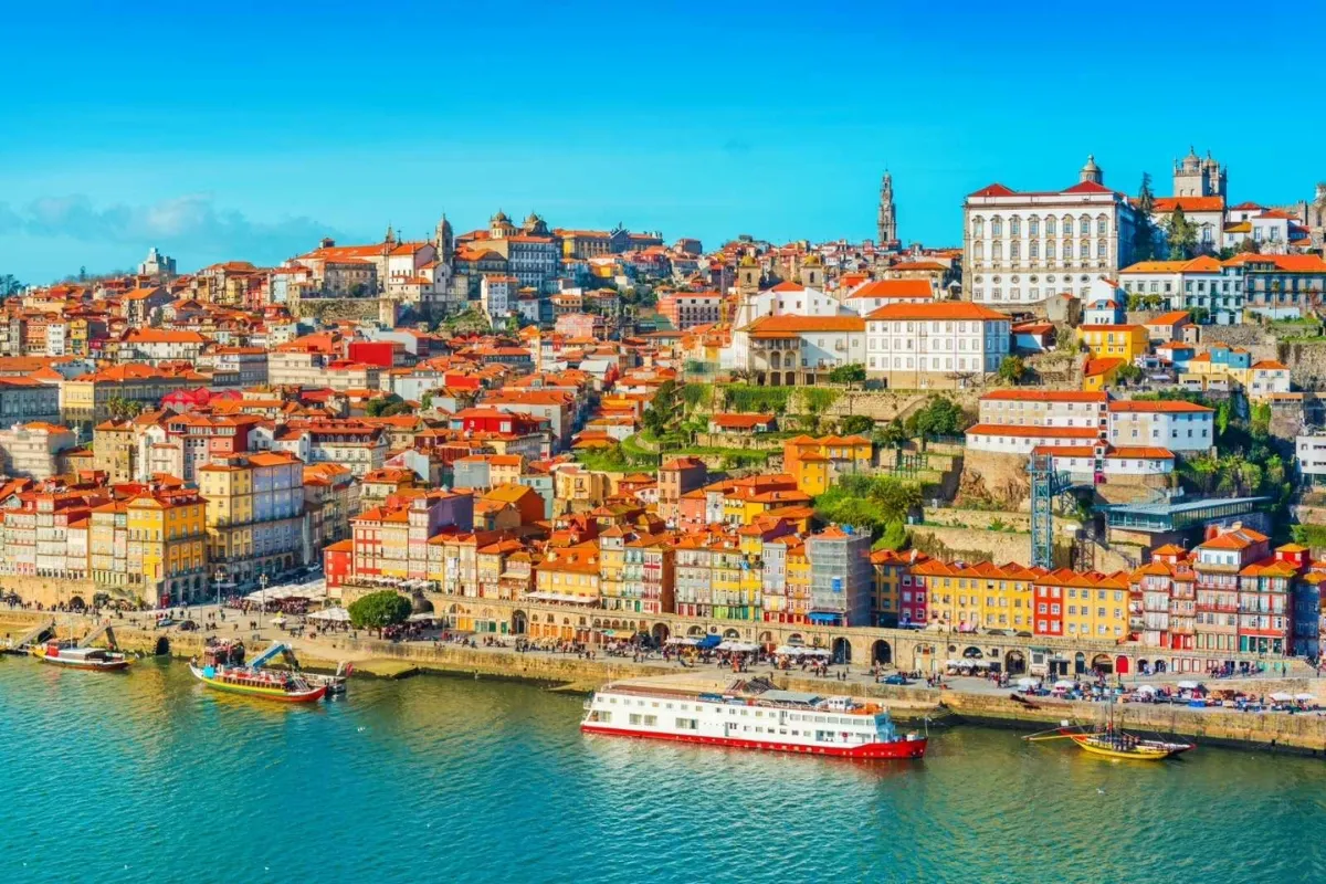
Porto, Portugal’s second-largest city, is the start of the Camino Portugués Coastal Route: from Porto to Santiago it’s 272.6 km in 12 stages. From the mouth of the Douro, the route follows the Portuguese coast through Póvoa de Varzim, Esposende and Viana do Castelo, crosses the Minho by ferry and runs along the coast of Pontevedra province through A Guarda, Baiona and Vigo before joining the Central Route at Redondela. We organize the whole route as our Camino de Santiago from Porto along the coast tour, in 13 stages and 15 days, because it splits the day from A Guarda to Baiona at Oia.
If you have a week, the Camino Portugués Coastal Route from Porto to A Guarda covers the Portuguese part in 5 stages, as far as the ferry across the Minho. You can also do it by bike from Porto: it’s 243 km, more than the 200 km required for the Compostela by bike. Before you set off, take your time saying goodbye to Porto: the Sé, the Ribeira, the Dom Luís I bridge and São Bento station.
The Portuguese Camino also passes through Porto: its Central Route comes from Lisbon and continues inland to Tui.
| # | Stage | Distance | To Santiago | Difficulty |
|---|---|---|---|---|
| From Porto to Viana do Castelo Oporto → Viana do Castelo · 3 stages · 82 km | ||||
| 1 | Oporto – Póvoa de Varzim Stage summaryThe longest stage of the route: 37 km to trade the city for the ocean. You leave Porto’s historic center, next to the Sé, and follow the bank of the Douro to its mouth at Foz. Then come Matosinhos, Leça da Palmeira and the beaches of Angeiras and Labruge: the urban surfaces of the start give way to kilometers of wooden boardwalks over the dunes, past forts, chapels and the Mindelo bird reserve. You cross the Ave River and the historic center of Vila do Conde before reaching Póvoa de Varzim, with its handmade azulejos (glazed tiles), its neoclassical casino from 1934 and the Praia da Lagoa. What to see and do in the towns on this stage | 37 km | 235.6 km | Hard |
| 2 | Póvoa de Varzim – Esposende Stage summaryA stage of contrasts, with the ocean and the beaches for company. You leave Póvoa de Varzim along its seafront promenade and string together the beaches of Fragosinho, Aguçadoura and Apúlia, alternating sand, cobbles, paths and the odd stretch of asphalt; on rainy days, watch out for slippery ground. Much of the day crosses the Litoral Norte Natural Park, with dunes, wetlands, estuaries and traditional fields by the coast, fertilized with sargassum seaweed. An iron bridge over the Cávado leads to Esposende, right at the river mouth; if you’re interested in heritage, visit the Castro de São Lourenço hillfort. What to see and do in the towns on this stage | 21 km | 214.6 km | Easy |
| 3 | Esposende – Viana do Castelo Stage summaryToday the Camino leaves the Esposende coastline for a few kilometers and heads inland, although the ocean reappears on arrival. The best moment of the day is the lovely descent to the Neiva River; then, past chapels and churches, you gradually make progress until you cross the famous Eiffel bridge and enter Viana do Castelo, a city with deep seafaring roots. The sea drifting away for a few kilometers doesn’t make the scenery any less spectacular. Wander through the center to the Praça da República and treat yourself to a good bacalhau (salt cod), the soul of Portuguese cooking. What to see and do in the towns on this stage | 24 km | 190.6 km | Easy |
| On to the Minho and A Guarda Viana do Castelo → A Guarda · 2 stages · 38 km | ||||
| 4 | Viana do Castelo – Vila Praia de Ancora Stage summaryA short stage with spectacular natural scenery, back beside the sea. Leaving Viana do Castelo there are two options: the official route, inland, or the seaside variant, unmarked but easy to follow, which hugs the coast, with views of Portugal’s endless straight shoreline. It’s 19 km to Vila Praia de Âncora, a fishing town almost on the border, with a huge wild beach, the Forte da Lagarteira and the Dolmen da Barrosa. If you’re tempted by a swim, watch out for the waves. It’s your last night in Portugal: tomorrow, Caminha and Galicia. What to see and do in the towns on this stage | 19 km | 171.6 km | Easy |
| 5 | Vila Praia de Ancora – A Guarda Stage summaryOne of the most unusual days on the Camino Portugués Coastal Route. You leave Vila Praia de Âncora along the coast to Caminha and, from there, cross the mouth of the Minho by ferry to land in Galicia; check the ferry timetable beforehand. Once on Galician soil you can climb Monte Santa Trega (Santa Tecla), with one of the best-preserved Iron Age hillforts in Spain and a magnificent view of the river mouth, with Portugal right across the water. A Guarda, a small seafaring town with a lively harbor and excellent seafood, is famous for its lobster: a good place to celebrate reaching Galicia. What to see and do in the towns on this stage | 19 km | 152.6 km | Easy |
| The Baixo Miño and the Ría de Vigo A Guarda → Arcade · 3 stages · 76.7 km | ||||
| 6 | A Guarda – Baiona Stage summaryThe first stage entirely in Galicia and the second longest of the route: 30.7 km along the spectacular rocky coast of the southern Baixo Miño. Along the way you reach Oia, a seafaring village of traditional ways with its monastery of Santa María; on our tours from A Guarda and from Porto to Santiago, the day is split there. Baiona, one of the prettiest towns in Galicia, closes off its bay with the Monterreal fortress, now a parador, surrounded by a wall you can walk all the way around. At the harbor waits the replica of the caravel Pinta, which brought the news of the New World here. Our tours: | 30.7 km | 121.9 km | Moderate |
| 7 | Baiona – Vigo Stage summaryYou leave Baiona along the seafront promenade and, at A Ramallosa, about four and a half kilometers on, it’s time to choose: the official route, which heads inland, or the coastal variant, with beaches and the ría always in sight. Whichever you pick, the approach to Vigo is long and urban. Vigo, nicknamed the “Olive City”, has a huge fishing port, an old town (Casco Vello) with Oyster Street, where they open them in front of you, and Monte do Castro looking out over the ría. Boats leave its port for the Cíes Islands, with Rodas beach. A glass of albariño on a terrace rounds off the day. | 23 km | 98.9 km | Easy |
| 8 | Vigo – Arcade Stage summaryThe last stage that belongs to the Coastal Route alone. You say goodbye to Vigo along Rúa Urzaiz, leaving behind the Casco Vello and Monte O Castro, and pick up the yellow arrows again on the way to Arcade. The day offers one of the best views of the Ría de Vigo, the Rego de Fondón waterfall and the climb to the church of San Andrés de Cedeira. At Redondela the Central Route of the Camino Portugués joins: from here, one path all the way to Santiago. In Arcade, a parish of Soutomaior and the oyster capital, the 12th-century Soutomaior Castle awaits, with its famous camellia trail, along with Muxeira beach. What to see and do in the towns on this stage | 23 km | 75.9 km | Easy |
| Shared Section: Arcade to Santiago Arcade → Santiago de Compostela · 4 stages · 75.9 km | ||||
| 9 | Arcade – Pontevedra Stage summaryJust 12 km, with plenty of time to reach the day’s goal. You leave Arcade over the historic Pontesampaio bridge, scene in 1809 of a decisive battle against Napoleon’s troops, and continue along the evocative Roman road of Brea Vella da Canicouva, with its large stone slabs, through woods and hamlets. Pontevedra, city of the Virgen Peregrina (Pilgrim Virgin), whose church has a curious scallop-shaped floor plan, has the second most important old town in Galicia and the Museo de Pontevedra, with more than 16,000 pieces. | 12 km | 63.9 km | Easy |
| 10 | Pontevedra – Caldas de Reis Stage summaryA gentle, pleasant stage, walked with the joy of the nearing finish. You leave Pontevedra via the Praza da Peregrina and the Ponte do Burgo into a rural setting of riverside woods, vineyards and hamlets, in the shade of centuries-old oaks. The short detour to the Barosa River waterfall is worth it. Caldas de Reis, a spa town since ancient times, invites you to bathe in its waters; to round off your visit, there’s the church of Santa María, with its 12th-century doorway, the botanical garden of camellias and oaks, and the Fervenza de Segade waterfall by the Umia. | 21 km | 42.9 km | Easy |
| 11 | Caldas de Reis – Padrón Stage summaryThe second-to-last day before Santiago, 18.6 km along rural paths and through villages of inland Pontevedra. You pass through Valga and Pontecesures, the old “Port of Compostela”, and cross the Ulla River into the province of A Coruña and Padrón, a landmark of the Jacobean Translatio: the church of Santiago Apóstol keeps the pedrón, the stone to which, according to tradition, the boat carrying the Apostle’s remains was moored. The Casa-Museo de Rosalía de Castro, the poet who spent her last years here, and the famous peppers complete the arrival. | 18.6 km | 24.3 km | Easy |
| 12 | Padrón – Santiago de Compostela Stage summaryThe last stage: leave Padrón early to make the most of your day in Santiago. You soon pass through Iria Flavia, whose collegiate church was the first cathedral in Galicia and in whose cemetery, under an olive tree, lies the humble grave of Camilo José Cela. Then come the last hamlets and more and more built-up areas, through the municipalities of Teo and Ames, a sign that the finish is near, until you reach the Praza do Obradoiro and the Cathedral. You collect the Compostela at the Pilgrim’s Office; don’t miss the pilgrims’ Mass. | 24.3 km | 0 km | Easy |


Why Choose the Camino Portugués Coastal Route?
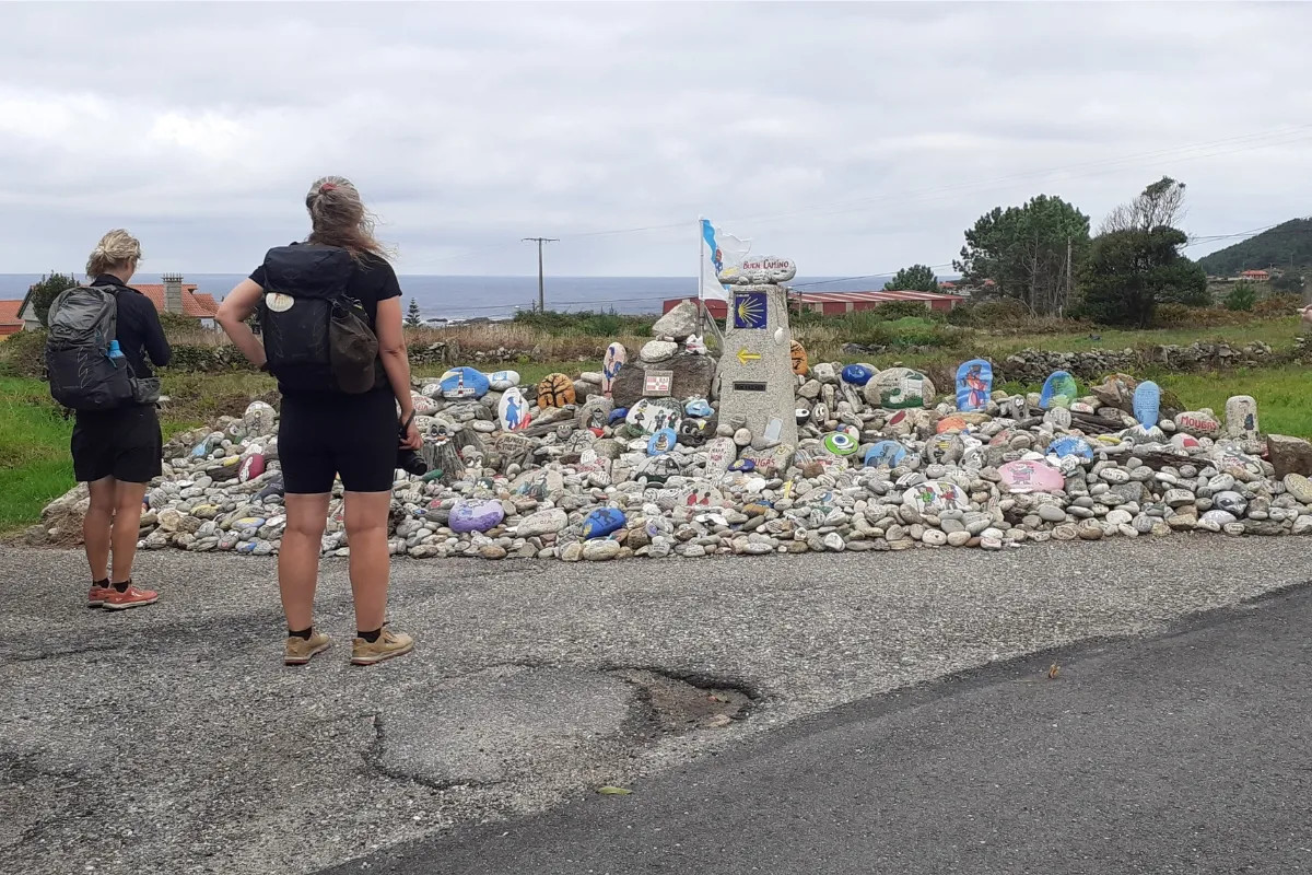
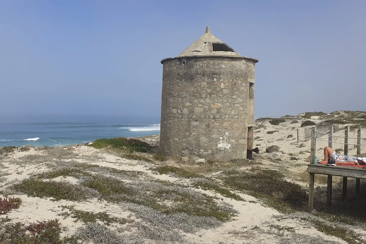
The Camino Portugués Coastal Route treats you to an endless succession of dunes, beaches and coastline.
The Camino Portugués Coastal Route is an easy route that suits all kinds of pilgrims. As well as its undeniable scenic beauty, it’s the perfect route to walk at any time of year. In summer you can enjoy the beach atmosphere of the coastal towns and take the odd dip, while in winter it’s the perfect route for anyone who wants to escape the crowds and bustle of busier routes.
Not every Camino route can offer you a swim at the beach at the end of each stage. The sea breeze on your face, sun and sand: what more could you ask for?
What to See and Do on the Camino Portugués Coastal Route
Endless beaches, the scent of salt air, fishing villages and plenty of history.
- Porto Cathedral
- Dom Luís I Bridge, Porto
- São Bento Station, Porto
- Litoral Norte Natural Park, Esposende
- Viana do Castelo
- Monte Santa Trega (Santa Tecla), A Guarda
- Monastery of Santa María de Oia
- Ría de Vigo
- Samil Beach, Vigo
- Ponte Sampaio Bridge, Arcade
- Church of Santiago Apóstol, Padrón
- Santiago de Compostela Cathedral
What to Plan Before You Go
Adjust how you split the stages to the way you walk, the time of year and the accommodation available.
Terrain: Few Climbs, Plenty of Changes Underfoot
The Coastal Route has gentle gradients; what tires you out is the variety of surfaces and the length of some days. In Portugal you alternate between urban surfaces leaving Porto, seafront promenades, wooden boardwalks over the dunes, sand, cobbles and the odd stretch of asphalt, and on rainy days the ground gets slippery. The longest stage is Porto–Póvoa de Varzim (37 km), and in Galicia, A Guarda–Baiona (30.7 km), which our tours from A Guarda and from Porto to Santiago split at Oia.
Twice you can choose between the official route, inland, and a variant by the sea: leaving Viana do Castelo, on the seaside variant, unmarked but easy to follow, and at A Ramallosa, on the way to Vigo. The approach to Vigo is long and urban; Vigo–Arcade (23 km) brings the climb to the church of San Andrés de Cedeira, and Arcade–Pontevedra (12 km) the Brea Vella, an old road paved with large stone slabs.
Best Time to Go: Rain, Waves and the Minho Ferry
You can walk it all year round. In summer the coastal towns have a beach atmosphere and a dip at the end of the stage is tempting, though you should keep an eye on the waves on these beaches open to the Atlantic; in winter it’s a way to escape the busier routes. In spring and fall temperatures are more comfortable, but there’s no guarantee of dry weather: northern Portugal and Galicia can be rainy, and in the rain sand, cobbles and paths get slippery.
In winter there are fewer hours of daylight and the services available change: don’t assume all accommodation is open. Whatever your dates, check the timetable of the ferry from Caminha to A Guarda beforehand, on Vila Praia de Âncora–A Guarda (19 km).
Getting to the Start and Back from Santiago
Choose your starting point first, then fit the transport around it. If you start in Porto, set aside time for the city before you walk: the Sé, the Ribeira, the Dom Luís I bridge and São Bento station. To start in Vigo, see how to get to Vigo; if you’re starting in A Guarda or Baiona, check the connections for your dates before you book your accommodation. As an optional service, we organize private transfers to or from wherever you need.
Add the time to get there and back to your walking days: our tours from Vigo take 7 days; from Baiona, 8; from A Guarda, 10; and the full tour from Porto, 15. The Porto to A Guarda tour ends in Galicia, after crossing the Minho. The last stage ends in Santiago: leaving your return for the next day gives you time to collect the Compostela and see the city.
Where to Sleep and Luggage Transfer
Use the stage pages and the albergue directory to place your overnight stops, especially on the two long days. If you want to split one, A Guarda–Baiona can be broken at Oia, as we do on our tours from A Guarda and from Porto to Santiago.
Depending on the tour type, you’ll sleep in a private albergue (pilgrim hostel), a private room in guesthouses, rural houses and small hotels, charming hotels or VIP accommodation; the dog tour uses dog-friendly accommodation. On our tours, luggage transfer is included on group, dog and VIP tours; on the others it can be added as an optional service. Your quote should show what you’ve chosen.
History of the Camino Portugués Coastal Route
The Camino Portugués Coastal Route has been officially recognized only relatively recently. Even so, its history is as old as that of the original route of the Camino Portugués.
The Birth of the Route
The history of this route begins in the 9th century, after the discovery of the remains of the Apostle James and the start of the pilgrimages that spread across Europe. As those most interested in the history of the Iberian Peninsula will know, in the 12th century the Kingdom of Portugal gained its independence from the Kingdom of León, and Afonso I was proclaimed King of Portugal. This, together with the fervent Christian devotion of the Portuguese people, led to the consolidation of the Portuguese routes to Santiago de Compostela. The existing Roman roads, for their part, were used to lay out the pilgrimage routes.
Its Golden Age
Many illustrious figures made the pilgrimage from Portugal to Santiago de Compostela, notably Elizabeth of Portugal, “the Holy Queen”, the Portuguese king Manuel I in the 16th century, and even the wealthy Florentine Cosimo de’ Medici. Naturally, another factor that helped consolidate the coastal variant of the Camino Portugués was the arrival of many pilgrims by sea, who landed at the main Portuguese ports and began their pilgrimage from there.
Centuries of Decline
Like the other Camino routes, from the late 16th century it went through a period of decline and decay, caused by the political, social and religious tensions in Europe in the 16th and 17th centuries.
Its Great Success Today
Those crises are now well and truly behind it: in the 21st century the route has established itself as the third busiest Camino route on the Iberian Peninsula, and it keeps growing steadily and unstoppably.
Frequently asked questions about Camino Portugués Coastal Route
-
How long is the Camino Portugués Coastal Route, and how many stages does it have?
As we organize it in our stage pages, the Camino Portugués Coastal Route has 12 stages and 272.6 km (169 miles) from Porto to Santiago de Compostela. The first eight belong to the Coastal Route alone, as far as Arcade; the last four are those of the Central Route of the Camino Portugués, which it joins at Redondela. From A Guarda it’s 152.6 km in 7 stages, and from Baiona, 121.9 km in 6. The split is a convention: each stage can be split or combined to suit your pace and where you can sleep.
-
Where does the Camino Portugués Coastal Route start?
In Porto: the first stage leaves from the historic center, next to the Sé, goes down to the Douro and follows its bank to the Atlantic at Foz. You can also start in Galicia: in A Guarda, where you land after crossing the Minho by ferry from Caminha, 152.6 km from Santiago; in Baiona, 121.9 km away; or in Vigo, 100 km away, the shortest starting point that qualifies you for the Compostela.
-
How long does it take to walk the Camino Portugués Coastal Route?
From Porto, 12 days of walking at one stage a day, plus the days to get there and back; our full tour from Porto takes 15 days because it splits the A Guarda to Baiona stage at Oia. From A Guarda it’s 7 stages (our tour does it in 8, in a 10-day trip); from Baiona, 6 (8 days); and from Vigo, 5 (7 days). Rest days or split stages add time.
-
Where do the last 100 km of the Camino Portugués Coastal Route start?
The Pilgrim’s Office requires 100 continuous km on foot toward Santiago along a single route (200 km by bike), and on that stretch you need to get your pilgrim passport (credencial) stamped at the start and end of each stage. On the Coastal Route, the shortest starting point that qualifies you for the Compostela is Vigo, at 100 km; Baiona, A Guarda, Porto and any point in between also qualify. From Arcade or Pontevedra you no longer reach the minimum. See the Compostela requirements.
-
How difficult is the Camino Portugués Coastal Route?
It isn’t a technical route and its gradients are gentle: what you notice most are the surfaces and the length of some days. The first, Porto – Póvoa de Varzim, is 37 km, and A Guarda – Baiona 30.7 km along a rocky coast; none of the rest is longer than 24.3 km. There are wooden boardwalks, sand, cobbles and asphalt, and in the rain the ground gets slippery. In Galicia there’s the odd climb, such as the one to the church of San Andrés de Cedeira after leaving Vigo, but no big changes in elevation.
-
What is the hardest stage of the Camino Portugués Coastal Route?
The most demanding is the first, Porto – Póvoa de Varzim: 37 km, the longest stage of the route, with urban surfaces leaving Porto and then kilometers of boardwalks over the dunes. It’s followed by A Guarda – Baiona, 30.7 km along the rocky coast of the Baixo Miño, which our tours split at Oia. None of the other stages is longer than 24.3 km.
-
What is the most beautiful stage of the Camino Portugués Coastal Route?
Every pilgrim has their own favorite. The ones we’d single out: the Litoral Norte Natural Park on the way to Esposende; the seaside variant from Viana do Castelo to Vila Praia de Âncora; the ferry crossing of the Minho from Caminha to A Guarda, with Monte Santa Trega; the rocky coast from A Guarda to Baiona; the views of the Ría de Vigo on the way to Arcade; and the stage from Pontevedra to Caldas de Reis, in the shade of centuries-old oaks.
-
When is the best time of year to walk the Camino Portugués Coastal Route?
You can walk it all year round. In summer there’s a beach atmosphere and a swim at the end of the stage is tempting, but be careful with the waves; in spring and fall temperatures are more comfortable, although northern Portugal and Galicia can be rainy, and in the rain the ground gets slippery. In winter there are fewer hours of daylight and services change: check the accommodation and the timetable of the ferry from Caminha to A Guarda before you fix your stages.
-
How much does it cost to walk the Camino Portugués Coastal Route?
It depends on where you start, your dates and the accommodation: a private albergue, a private room in guesthouses, rural houses and small hotels, charming hotels or VIP accommodation. Our tours include booked accommodation and support along the route; luggage transfer is included on group, dog and VIP tours. The five stages from Vigo are the most affordable option; for your dates, design your route and see the price instantly.
-
Which is better: the Coastal Route or the Central Route of the Camino Portugués?
From Porto there are two routes that meet at Redondela, and they don’t go the same way. The Coastal Route follows the Atlantic through Póvoa de Varzim, Esposende and Viana do Castelo, crosses the Minho by ferry to A Guarda and passes through Baiona and Vigo: 272.6 km in 12 stages from Porto. The Central Route of the Camino Portugués, which comes from Lisbon, runs inland through Barcelos, Ponte de Lima and Tui, with the climb to the Alto da Portela: 242.4 km in 11 stages from Porto. In 2025, after the Camino Francés, they were the two most walked routes: 100,815 pilgrims on the Central Route and 89,512 on the Coastal Route. From Pontevedra, already on the shared section, the Spiritual Variant branches off.
-
Can you cycle the Camino Portugués Coastal Route?
Yes, and its gentle profile makes it very well suited to cycling. For the Compostela by bike you need to cover at least 200 km, so you start in Porto: from A Guarda, Baiona or Vigo you don’t reach the minimum. We organize it as our Camino Portugués Coastal Route by bike from Porto tour, with 243 km in 5 stages.
-
Can you walk the Camino Portugués Coastal Route with a dog?
Yes. We organize it from Vigo, with dog-friendly accommodation and luggage transfer included, as our Camino Portugués from Vigo with a dog (5 stages) tour. Find out more in The Camino de Santiago with a dog.
-
Can you walk the Camino Portugués Coastal Route in sections?
Yes. The Pilgrim’s Office accepts doing the Camino in stages as long as they follow on in time and along the route; over the minimum distance, get your pilgrim passport (credencial) stamped at the start and end of each stage, with the date, to show that you picked up where you left off. A convenient break is A Guarda: the Porto to A Guarda tour covers the Portuguese part in 5 stages, and the tour from A Guarda the rest of the way to Santiago. You request the Compostela when you reach Santiago, with the pilgrim passport covering all the sections.
All the Camino de Santiago routes
-

Camino Francés
33 Stages 769 KmsFrom Saint-Jean-Pied-de-Port to Santiago de Compostela. Follow the most recommended route of the Camino.
view route -

Camino Portugués
27 Stages 620 KmsFrom Lisbon to Santiago de Compostela. Enjoy a Camino through the basins of the Tagus, Douro, and Miño rivers.
view route -

Camino Portugués Coastal Route
12 Stages 273 KmsFrom Porto to Santiago de Compostela. The Atlantic Ocean will guide your steps along the Portuguese and Galician coastline.
view route -

Camino Portugués Spiritual Variant
4 Stages 106 KmsFrom Pontevedra to Padrón. Relive the final stretch of the Apostle Saint James’s posthumous journey.
view route -

Camino Finisterre and Muxía
5 Stages 120 KmsFrom Santiago de Compostela to Muxía. A mystical and spiritual journey to the ends of the Earth.
view route -

Camino del Norte
36 Stages 833 KmsFrom Irún to Santiago de Compostela. An unforgettable experience with breathtaking landscapes.
view route -

Camino Primitivo
14 Stages 317 KmsFrom Oviedo to Santiago de Compostela. It follows the first Camino de Santiago, tracing the footsteps of Alfonso II.
view route -

Camino Inglés
5 Stages 117 KmsFrom Ferrol to Santiago de Compostela. Immerse yourself in the naval and historical heritage of a truly unique Camino.
view route -

Camino Sanabrés
14 Stages 367 KmsFrom Granja de Moreruela to Santiago de Compostela. Cross the region of Sanabria and the mountains of Ourense.
view route -

Camino de Invierno
11 Stages 256 KmsFrom Ponferrada to Santiago de Compostela., through the regions of Valdeorras and Ribeira Sacra.
view route -

Ruta del Padre Sarmiento
8 Stages 190 KmsThe Father Sarmiento Way links Pontevedra to Santiago de Compostela, offering a scenic journey through beautiful landscapes.
view route -

Camino dos Faros
8 Stages 200 KmsFrom Malpica to Finisterre. A 200-kilometre journey along the coast and through the wildest nature.
view route
