


Camino Finisterre and Muxía: Stages, Map and Distances
The Camino Finisterre, also known as the Camino de Fisterra, carries the pilgrimage on from Santiago to the Costa da Morte (Coast of Death), and it’s the only Camino that starts in Santiago instead of ending there: it sets out from Praza do Obradoiro, crosses Ponte Maceira and Negreira, meets the Atlantic at Cee and reaches Cape Finisterre, the Romans’ end of the world, before continuing to the Virxe da Barca sanctuary in Muxía. Our route covers 119.6 km (74 mi) in 5 stages: 88.6 km (55 mi) in 4 stages to Finisterre and a fifth, 31 km long, to Muxía. At the end you don’t receive the Compostela but the route’s own certificates: the Fisterrana and the Muxiana.
Start with the number of days you have: four walking days take you to Finisterre and five to Muxía; the selector shows the stages, the distance and the walking days. If you’d rather reach Finisterre along the coast from Malpica, take a look at the Camino dos Faros (Way of the Lighthouses); to compare it with the other routes, see all the Camino de Santiago routes.


- 5 stages · full route
- 119.6 km
- At your own pace · flexible start points and stages
Our Camino Finisterre and Muxía Tours
Accommodation booked for you and support along the route. Luggage transfer included or optional, depending on the tour.
6 tours to choose how you do the Camino.
-
 7 days / 6 nights
-
 4 days / 3 nights
-
 6 days / 5 nights
-
 6 days / 5 nights
-
 6 days / 5 nights
-
 7 days / 6 nights
Services we offer on the Camino de Santiago
-
Included in all our routes
-
Accommodation booking
selected according to your budget.
-
Practical information
of the Camino de Santiago in a detailed guide.
-
Telephone assistance on the trail
for any questions or incidents, we are by your side.
-
Travel insurance
with comprehensive coverage.
-
-
On group routes
-
Accompanying guides
professional guides throughout the Camino.
-
Support vehicle
available during the stages.
-
-
Optional services
-
Luggage transport
between stages.
-
Meals and diets
Breakfast or half board option.
-
Private transfers
from/to the point you need.
-
Camino Finisterre and Muxía Route Map
The map shows the route of the Camino Finisterre and Muxía, a natural extension of the Camino de Santiago that sets out from Santiago de Compostela and ends at the iconic destinations of Finisterre and Muxía, on the Galician coast. This route, 88.6 km to Finisterre plus another 31 km to Muxía (119.6 km, the total of our 5 stages), stands out for its spectacular coastal scenery, its countryside and picturesque villages such as Negreira, Olveiroa and Cee.

Camino Finisterre and Muxía Elevation Profile and Sections
Altitude (m) vs. distance from Santiago de Compostela (km) · 119.6 km · 5 stages
Hover over or tap a stage on the profile to see its details; the number takes you to its row in the table.
- End of stage
- Hardest stages
- Alternating sections
The Camino Finisterre and Muxía, Section by Section
Inland: Santiago to A Picota
See the 2 stages in this section →Two days inland, heading west. From Praza do Obradoiro the Camino leaves Santiago through the Carballeira de San Lourenzo oak grove, looks back over the city from Sarela de Abaixo and crosses woods and hamlets to Ponte Maceira, one of the most beautiful villages in Spain, with its medieval bridge over the Tambre. Negreira, the town of the Pazo do Cotón manor house, closes the first stage. The second is the long one: 31 km of meadows, native woodland and hamlets such as Vilaserío and Santa Mariña, to A Picota, the main town of Mazaricos, just over a kilometer off the route.
Toward the Sea: A Picota to Finisterre
See the 2 stages in this section →The two days on which the Camino meets the Atlantic. From A Picota you cross the Xallas at A Ponte Olveira and pass through Olveiroa, a hamlet of centuries-old hórreos (traditional Galician granaries), to Hospital, where the route forks toward Finisterre or Muxía; after that, open, lonely hills. From the Alto do Cruceiro da Armada the ocean finally comes into view, with Cape Finisterre in the distance, and you drop down to Cee, in the heart of the Costa da Morte. The next day brings Corcubión, the beaches of Sardiñeiro and Langosteira and, at last, Finisterre, the Romans’ end of the world, with its lighthouse and its sunsets.
Beyond the End of the World: Finisterre to Muxía
See the 1 stages in this section →A single 31 km stage links the two capes that for centuries were thought to be the end of the world. You leave Finisterre via San Martiño de Duio and Rostro beach, one of the wildest stretches of sand on the Costa da Morte, and the Camino heads into the Lires valley among hórreos, cruceiros (stone wayside crosses) and pine woods. Lires, the only village with services, lets you split the day in two. After Facho de Lourido you descend with the Atlantic ahead of you to Muxía and the Virxe da Barca sanctuary, where, according to tradition, the Virgin arrived in a stone boat to encourage the Apostle James.
All Stages of the Camino Finisterre and Muxía
The 5 stages from Santiago de Compostela to Santiago de Compostela: 119.6 km in total. Each stage links to its full page (route, profile, where to sleep and what to see); “to Santiago” is the distance left at the end of the stage, and the difficulty is a guide for an average walker with a light backpack.
Daily stages of 16 to 31 km. The longest: Negreira – A Picota (31 km). Factor in the terrain and conditions as well. See in the table
Daily stages of 16 to 31 km. The longest: Negreira – A Picota (31 km). Factor in the terrain and conditions as well. See in the table
Daily stages of 16 to 31 km. The longest: Fisterra – Muxía (31 km). Factor in the terrain and conditions as well. See in the table
Daily stages of 16 to 31 km. The longest: Fisterra – Muxía (31 km). Factor in the terrain and conditions as well. See in the table
Daily stages of 31 to 31 km. The longest: Fisterra – Muxía (31 km). Factor in the terrain and conditions as well. See in the table
From Santiago de Compostela to Santiago · 5 stages
- Section distance
- 119.6 km
- Walking one stage a day
- 5 days
- Plus travel there and back
- 7 days
From Negreira to Santiago · 4 stages
- Section distance
- 99 km
- Walking one stage a day
- 4 days
- Plus travel there and back
- 6 days
From A Picota to Santiago · 3 stages
- Section distance
- 68 km
- Walking one stage a day
- 3 days
- Plus travel there and back
- 5 days
From Cee to Santiago · 2 stages
- Section distance
- 47 km
- Walking one stage a day
- 2 days
- Plus travel there and back
- 4 days
From Fisterra to Santiago · 1 stage
- Section distance
- 31 km
- Walking one stage a day
- 1 day
- Plus travel there and back
- 3 days
We count one day per stage and add two days for travel. Rest days aren’t included; you may need more days if you split stages. Nights and services depend on the tour you choose.
| # | Stage | Distance | To Santiago | Difficulty |
|---|---|---|---|---|
| Inland: Santiago to A Picota Santiago de Compostela → A Picota · 2 stages · 51.6 km | ||||
| 1 | Santiago de Compostela – Negreira Stage summaryYou set off right from Praza do Obradoiro, and the first stage is fairly easy. You leave Santiago through the Carballeira de San Lourenzo, enjoy a lovely view of the city from Sarela de Abaixo and walk on through countryside, among chestnut, pine and eucalyptus trees, woods and hamlets. The highlight of the day is Ponte Maceira, one of the most beautiful villages in Spain: crossing its medieval stone bridge over the Tambre River and strolling among its houses is a treat for the senses. Soon after, you reach Negreira, a town that keeps its rural character, at the end of the stage. What to see and do in the towns on this stage | 20.6 km | 99 km | Easy |
| 2 | Negreira – A Picota Stage summaryA long day: 31 km, one of the two longest stages on the route, but with no real difficulties. You say goodbye to Negreira by the Pazo do Cotón and its chapel of San Mauro and head west into the hills and hamlets of inland A Coruña: purely rural scenery, among meadows, native woodland and small hamlets of friendly people, through Vilaserío, As Maroñas and Santa Mariña. After Santa Mariña you turn just over a kilometer off the route to sleep in A Picota, the main town of Mazaricos, with a deep-rooted cattle-farming tradition: don’t miss its Monument to the Cows or the Mural of the Ganaderas (women cattle farmers). What to see and do in the towns on this stage | 31 km | 68 km | Moderate |
| Toward the Sea: A Picota to Finisterre A Picota → Fisterra · 2 stages · 37 km | ||||
| 3 | A Picota – Cee Stage summaryToday you rejoin the Camino: A Picota lies just over a kilometer off the route. You pass Corzón and its cruceiro, cross the Xallas River at A Ponte Olveira and carry on through Olveiroa, a hamlet of centuries-old hórreos, to Hospital, where the route forks toward Finisterre or Muxía. After that the path is empty, across open hills, and at O Marco do Couto the sculpture of the Vákner awaits you, the beast of a 15th-century legend. Past the Alto do Cruceiro da Armada comes your first view of the ocean, with Cape Finisterre in the distance, and a steep descent brings you to Cee, the first seaside town of the trip. | 21 km | 47 km | Moderate |
| 4 | Cee – Fisterra Stage summaryThe day you reach the end of the world, on a lovely walk with the Atlantic guiding your steps. You leave Cee and soon reach Corcubión, a listed historic site of stone houses well worth a stroll. Then it’s pure Costa da Morte: tree-lined paths, trails through flowering broom with the sea in the background, and beaches such as Sardiñeiro and the long Langosteira, where many take a dip. Finisterre was the end of the world for the Romans and a place of sun worship for the Celts. Don’t miss the climb to the lighthouse, with its km 0.00 waymarker, to watch one of the most beautiful sunsets in the world. | 16 km | 31 km | Easy |
| Beyond the End of the World: Finisterre to Muxía Fisterra → Muxía · 1 stage · 31 km | ||||
| 5 | Fisterra – Muxía Stage summaryBeyond the end of the world: on to Muxía, one of the prettiest towns on the Costa da Morte. It’s 31 km through countryside and along dirt tracks, with the odd climb, and you’ll meet pilgrims walking the other way, toward Finisterre. Lires, the only village with services, is a good place for a break or, if 30 km feels like too much, to split the stage. Then you climb Facho de Lourido, the highest point, and drop down to Lourido beach, with Muxía already in sight. When you arrive, ask for your Muxiana and head over to the Virxe da Barca sanctuary, facing the wild Atlantic. | 31 km | 0 km | Hard |
From Santiago
All our tours start in Santiago de Compostela, right from Praza do Obradoiro: the Camino Finisterre and Muxía doesn’t end in Santiago, it begins there. To Muxía it’s 119.6 km in 5 stages; to Finisterre, at the end of the fourth, 88.6 km in 4. Many pilgrims link it to the Camino they’ve just finished, and the tour begins with a night in Santiago: time for the Pilgrim’s Mass and the Cathedral.
To Finisterre, in 4 stages and a 6-day trip: the Camino to Finisterre via A Picota (89 km), which stops overnight in A Picota; the Santiago to Finisterre Camino (via Olveiroa, 84 km), which stops in Olveiroa, and the Camino to Finisterre with an organized group (94 km), with walking guides and a support vehicle. By bike, the Santiago to Finisterre by bike tour covers 88 km in 2 stages, on a 4-day trip.
To Muxía, in 5 stages and a 7-day trip: the Camino to Finisterre and Muxía (A Picota), 120 km, and the Camino to Finisterre and Muxía, 115 km. The fifth stage carries on from Finisterre along the Costa da Morte to the Virxe da Barca sanctuary; if it feels too long, you can split it at Lires.


Why Choose the Camino Finisterre and Muxía?
The route that takes you to the Atlantic Ocean and the End of the World.
The Camino Finisterre and Muxía is a quiet route with no big climbs. You’ll find fascinating villages such as Ponte Maceira, listed among the Most Beautiful Villages in Spain. You’ll pass picturesque rural hamlets, pazos (manor houses), cruceiros and countless hórreos. Once on the Costa da Morte, you’ll enjoy stunning landscapes framed by the most rugged, untamed coastline: proud seafaring towns, idyllic beaches, lighthouses and sheer cliffs from which to watch the most beautiful sunsets in Spain.
What’s more, this route has its own pilgrim passport and certificates, the Fisterrana in Finisterre and the Muxiana in Muxía, so you can add to your pilgrim collection and take home a very special keepsake of a route that, whatever happens, you’ll never forget.
What to See and Do on the Camino Finisterre and Muxía
A route to the Costa da Morte, Galicia’s fearsome, mystical and wild Atlantic coast.


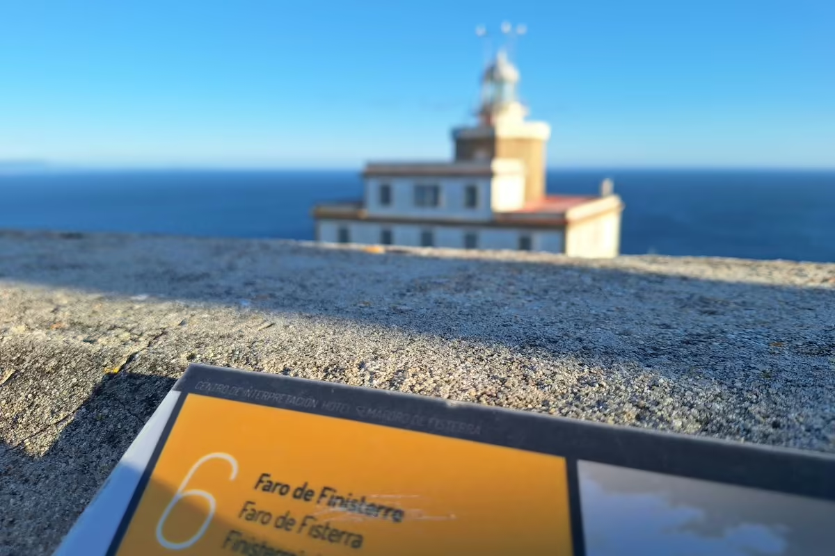


What to Plan Before You Go
Adjust how you split the stages to the way you walk, the time of year and the accommodation available.
Terrain: The Two 31 km Stages Are the Real Test
The Camino Finisterre and Muxía is a quiet route with no big climbs; what you notice most is the distance. The two long days are 31 km each: Negreira–A Picota (31 km), through purely rural scenery and with no real difficulties, and Fisterra–Muxía (31 km), along dirt tracks, with the odd climb and the ascent to Facho de Lourido. If that last one feels like too much, its stage page recommends splitting it and sleeping in Lires.
On A Picota–Cee (21 km), after the Alto do Cruceiro da Armada, the descent to Cee is steep: take it slowly. The other two stages are manageable: Santiago–Negreira (20.6 km), fairly easy, and Cee–Fisterra (16 km), a stroll along tree-lined paths and beaches with the Atlantic beside you.
Services: Few Villages Inland and on the Last Stage
Between Negreira and Cee the Camino crosses hills and small hamlets, and accommodation is scarce: that’s why many pilgrims detour just over a kilometer to A Picota to sleep. After Hospital, a good last stop, the path runs empty until the fork for Finisterre and Muxía. On the last stage, Lires is the only village with services; from there to Muxía is one of the longest stretches with nowhere to stock up, so set off with water and something to eat.
There are pilgrim albergues (hostels) in Negreira, Vilaserío, Finisterre and Muxía, and in Cee there’s the O Bordón albergue; for the rest, see the albergue directory. On our tours you can choose a private albergue or a private room in guesthouses, rural houses and small hotels; on foot, the night in A Picota is in a private room, and on arrival in Santiago there are also boutique hotels.
The Fisterrana and the Muxiana: Bring Your Pilgrim Passport
The Compostela is collected in Santiago: the goal of the Camino is the Apostle’s tomb, and the pilgrimage is made in that direction (see the Compostela requirements). This route starts there and has its own certificates; many pilgrims arrive in Finisterre with the Compostela already in their backpack. The Fisterrana is the official certificate for reaching the “end of the world”: according to Fisterra Town Council, you get it at the municipal pilgrim albergue or at the Tourist Office, and you prove the distance you’ve walked with your pilgrim passport (credencial), stamped or signed by parishes, albergues or landmark places in the towns you pass through. If you’re in a group of more than 10 people, let the Tourist Office or the albergue know in advance.
The Muxiana is requested when you arrive in Muxía, at the Tourist Office, with your stamped pilgrim passport. On the group tour, the guides hand out the pilgrim passports on the afternoon you arrive in Santiago.
Getting to Santiago and Back from Finisterre or Muxía
The tour starts in Santiago: you arrive the day before and set off walking from Praza do Obradoiro the following day. If you’re coming from another Camino, you can link the two, as many pilgrims do when they reach the city of the Apostle. On the group tour, you meet the guides that afternoon; they go through the itinerary and hand out the pilgrim passports and luggage tags.
Add the time to get there and back to your walking days: to Finisterre, the 4 stages make a 6-day, 5-night trip; to Muxía, the 5 stages make 7 days and 6 nights; and by bike, the 2 stages, 4 days and 3 nights. To get back from Finisterre or Muxía you can add private transfers as an optional service. And keep your last evening free: the sunset from the Finisterre lighthouse or the waves in front of the Virxe da Barca are worth it.
History of the Camino Finisterre and Muxía
Its story begins many centuries ago, when the Romans were convinced that the Earth was flat, a kind of solid slab floating on a mysterious, enigmatic ocean known as the Mare Tenebrosum. Finisterre, or Finis Terrae, was considered the last place on Earth.
Ancient Origins
But this Camino had already been a place of pilgrimage for the Celts, who chose it as an important site of sun worship, the Ara Solis. Here the sun was seen for the last time each day, giving way to the great mystery: the world of the dead or the island of eternal youth. So the route was born as a pagan path that had nothing to do with Christianity.
The Preaching of the Apostle James
However, with the discovery of the remains of the Apostle James and the Christianization of the Iberian Peninsula, it soon became part of the network of routes used by pilgrims heading to Compostela. Once the Camino de Santiago was established in the Middle Ages, more and more pilgrims chose to continue on to Finisterre, in search of the supernatural mysticism that surrounded the Costa da Morte. But Christianity is also part of the history of the Camino Finisterre. It’s said that the Apostle himself destroyed the altar of the Ara Solis on his travels through the peninsula and built the hermitage of San Guillermo, now gone, in its place.
In the Middle Ages
The Codex Calixtinus also records that the Apostle’s remains were taken to Duio, a village near Finisterre, to ask the king’s permission to bury them. According to legend, the disciples’ journey through this place was a trap set by Queen Lupa to prevent the saint from being buried in Galicia. Like the other Camino routes, the Camino Finisterre flourished in the Middle Ages.
Decline and Revival
However, it also went into a sharp decline from the 16th century onward. It wasn’t until the 20th century that public authorities, associations and local bodies brought the Camino Finisterre back into the spotlight. They did important work to publicize and promote it, and created the route’s own pilgrim certificates, such as the Fisterrana and the Muxiana, which certify that the pilgrim has completed the route.
Frequently asked questions about Camino Finisterre and Muxía
-
How many stages are there from Santiago to Finisterre?
Four, as we organize them on our stage pages: Santiago de Compostela – Negreira (20.6 km), Negreira – A Picota (31 km), A Picota – Cee (21 km) and Cee – Fisterra (16 km). Add a fifth, Fisterra – Muxía (31 km), and the full Camino comes to 5 stages. The split is a convention: the last one, for example, can be broken at Lires. In 4 stages, to Finisterre, you have the Camino to Finisterre via A Picota, the Camino to Finisterre via Olveiroa and the Camino to Finisterre with an organized group; in 5, to Muxía, the Camino to Finisterre and Muxía and the Camino to Finisterre and Muxía (A Picota).
-
How many kilometers is the Camino Finisterre and Muxía?
As we organize it on our stage pages, the Camino Finisterre and Muxía is 119.6 km (74 mi) from Santiago de Compostela to Muxía: 88.6 km (55 mi) to Finisterre, at the end of the fourth stage, and 31 km more to Muxía. Depending on the variant, our tours cover 84 to 94 km to Finisterre (via A Picota, via Olveiroa or with a group) and 115 to 120 km to Muxía.
-
What is the route from Santiago to Finisterre called?
Its official name is the Camino de Fisterra y Muxía: that’s the title used on the official Xacobeo website, run by the Xunta de Galicia (the Galician regional government). Finisterre is Fisterra in Galician, and the name comes from the Latin “finis terrae”, the Romans’ end of the earth; that’s why you’ll also see it called the Camino de Finisterre or the Camino to Finisterre. It’s also known as the Epílogo (“epilogue”), because many pilgrims walk it after finishing another Camino, once they reach the city of the Apostle. That’s what makes it unique: it’s the only Camino that doesn’t end in Santiago but starts there, right from Praza do Obradoiro.
-
How long does it take to walk the Camino Finisterre?
4 days of walking, at one stage a day; our tours to Finisterre last 6 days and 5 nights including arrival in Santiago and the trip home. To Muxía, 5 days of walking and a 7-day, 6-night trip. If you split the Finisterre–Muxía stage at Lires, add one more day. By bike, Santiago to Finisterre takes 2 stages and a 4-day trip.
-
How difficult is the Camino Finisterre?
Moderate, according to the official Xacobeo website. It isn’t a technical route: it’s quiet, with no big climbs, and what weighs most are its two 31 km stages: Negreira – A Picota, rural and with no real difficulties, and Fisterra – Muxía, with the odd climb and the ascent to Facho de Lourido. On A Picota – Cee (21 km), the path runs empty across open hills and the final descent to Cee is steep. The first stage, 20.6 km, is fairly easy, and the one from Cee to Finisterre, 16 km, is a seaside stroll.
-
What is the hardest stage of the Camino Finisterre and Muxía?
For us, Fisterra – Muxía: 31 km through countryside and along dirt tracks, with the odd climb, the ascent to Facho de Lourido, its highest point, and Lires as the only village with services. If 30 km feels like too much, split it at Lires. Negreira – A Picota is just as long, at 31 km, but with no real difficulties. And the steepest descent comes at the end of A Picota – Cee, with Cee already in sight.
-
What is the most beautiful stage of the Camino Finisterre and Muxía?
Every pilgrim has their favorite. The ones we’d single out: the first, for the medieval bridge at Ponte Maceira over the Tambre, one of the most beautiful villages in Spain; A Picota – Cee, for the first view of the ocean from the Alto do Cruceiro da Armada, with Cape Finisterre in the distance; Cee – Fisterra, for Corcubión, Langosteira beach and the sunset from the lighthouse; and Fisterra – Muxía, for the Virxe da Barca sanctuary, facing the Atlantic.
-
What do pilgrims do when they reach Finisterre?
First, climb up to the Finisterre lighthouse: next to it stands the km 0.00 waymarker, and from there you can watch one of the most beautiful sunsets in the world. Fisterra Town Council recalls the two rites of the pilgrims of old: the purifying swim at Langosteira beach, two kilometers before you enter the town, and watching the sunset, the death of the sun in the sea and its resurrection the next day. Then it’s time to collect your Fisterrana, with your stamped pilgrim passport, at the municipal pilgrim albergue or the Tourist Office.
-
What are the Fisterrana and Muxiana certificates?
They’re this route’s own certificates, proof that you’ve walked it: the Compostela isn’t issued here; it’s collected in Santiago. The Fisterrana is the official certificate for reaching the “end of the world”: according to Fisterra Town Council, you get it at the municipal pilgrim albergue or at the Tourist Office. The Muxiana is requested at the Muxía Tourist Office. For both, show your pilgrim passport with the stamps from the route. More details in our article on the Fisterrana and the Muxiana.
-
Is it better to finish the Camino in Finisterre or in Muxía?
Both are endpoints of the route, so it mostly depends on how many days you have. In Finisterre, 4 stages from Santiago, the lighthouse, the km 0.00 waymarker and the sunset await you; in Muxía, one stage further, the Virxe da Barca sanctuary, facing the Atlantic. Our stages go to Finisterre first and then to Muxía, but you can do it the other way round: the Camino forks at Hospital, on the third stage, into the Finisterre branch and the Muxía branch, and on the Finisterre–Muxía stage you’ll meet pilgrims walking it in the opposite direction. The official Xacobeo website gives both options: 118.8 km via Finisterre and then Muxía, and 119.9 km via Muxía and then Finisterre. Some pilgrims, after visiting both, even walk back to Santiago, on an almost circular route.
-
Which is better: via A Picota or via Olveiroa?
They’re two ways of splitting the inland part, between Negreira and Cee. Via A Picota, the variant on our stage pages, the second stage ends in A Picota, the main town of Mazaricos, just over a kilometer off the route: many pilgrims detour there to sleep because accommodation is scarce in these hills, and the next day they rejoin the Camino through Olveiroa. It’s 89 km to Finisterre on the Camino to Finisterre via A Picota. Via Olveiroa you spend the night in the hamlet of centuries-old hórreos itself, right on the route: the Camino to Finisterre via Olveiroa covers 84 km.
-
How much does it cost to walk the Camino Finisterre?
It depends on the variant, on whether you go on to Muxía, on your dates and on the accommodation: a private albergue or a private room in guesthouses, rural houses and small hotels, and in Santiago also boutique hotels. Our tours include booked accommodation, phone assistance on the trail and travel insurance; the group tour also includes walking guides and a support vehicle. On foot, the Camino to Finisterre via Olveiroa has the lowest starting price; for your dates, design your route and see the price instantly.
-
Can you cycle the Camino Finisterre?
Yes. We organize it as the Santiago to Finisterre by bike tour: 88 km in 2 stages on a 4-day trip, from Santiago to A Picota (54.2 km), via Ponte Maceira and Negreira, and from A Picota to Finisterre (34 km), via Olveiroa, Cee and Corcubión. If you need a bike, you pick it up in Santiago before you set off, from our partner shop: bike rental (MTB or e-bike) is one of our optional services.
All the Camino de Santiago routes
-

Camino Francés
33 Stages 769 KmsFrom Saint-Jean-Pied-de-Port to Santiago de Compostela. Follow the most recommended route of the Camino.
view route -

Camino Portugués
27 Stages 620 KmsFrom Lisbon to Santiago de Compostela. Enjoy a Camino through the basins of the Tagus, Douro, and Miño rivers.
view route -

Camino Portugués Coastal Route
12 Stages 273 KmsFrom Porto to Santiago de Compostela. The Atlantic Ocean will guide your steps along the Portuguese and Galician coastline.
view route -

Camino Portugués Spiritual Variant
4 Stages 106 KmsFrom Pontevedra to Padrón. Relive the final stretch of the Apostle Saint James’s posthumous journey.
view route -

Camino Finisterre and Muxía
5 Stages 120 KmsFrom Santiago de Compostela to Muxía. A mystical and spiritual journey to the ends of the Earth.
view route -

Camino del Norte
36 Stages 833 KmsFrom Irún to Santiago de Compostela. An unforgettable experience with breathtaking landscapes.
view route -

Camino Primitivo
14 Stages 317 KmsFrom Oviedo to Santiago de Compostela. It follows the first Camino de Santiago, tracing the footsteps of Alfonso II.
view route -

Camino Inglés
5 Stages 117 KmsFrom Ferrol to Santiago de Compostela. Immerse yourself in the naval and historical heritage of a truly unique Camino.
view route -

Camino Sanabrés
14 Stages 367 KmsFrom Granja de Moreruela to Santiago de Compostela. Cross the region of Sanabria and the mountains of Ourense.
view route -

Camino de Invierno
11 Stages 256 KmsFrom Ponferrada to Santiago de Compostela., through the regions of Valdeorras and Ribeira Sacra.
view route -

Ruta del Padre Sarmiento
8 Stages 190 KmsThe Father Sarmiento Way links Pontevedra to Santiago de Compostela, offering a scenic journey through beautiful landscapes.
view route -

Camino dos Faros
8 Stages 200 KmsFrom Malpica to Finisterre. A 200-kilometre journey along the coast and through the wildest nature.
view route
