


Camino de Invierno: Stages, Map and Where to Start
The Camino de Invierno, or Winter Way, sets out from Ponferrada, in El Bierzo, and enters Galicia through the Sil Valley instead of climbing to O Cebreiro: it’s thought to have been the pilgrims’ alternative when snow closed the pass. It crosses Las Médulas, Valdeorras and the Ribeira Sacra, passes through all four Galician provinces and, at Lalín, joins the Camino Sanabrés and the Vía de la Plata for the final stretch. Our route covers 256.3 km (159 miles) in 11 stages. You can walk all of it or start closer to Santiago: from Monforte de Lemos it’s 132.6 km in 6 stages, and from Chantada, 102.9 km in 5 stages.
Start with the number of days you have: the selector shows the stages from your starting point, the distance and the walking days. If you’d rather carry on from Ponferrada via O Cebreiro, take a look at the Camino Francés; to compare it with the other routes, see all the Camino de Santiago routes.


- 11 stages · full route
- 256.3 km
- At your own pace · flexible start points and stages
Services we offer on the Camino de Santiago
-
Included in all our routes
-
Accommodation booking
selected according to your budget.
-
Practical information
of the Camino de Santiago in a detailed guide.
-
Telephone assistance on the trail
for any questions or incidents, we are by your side.
-
Travel insurance
with comprehensive coverage.
-
-
On group routes
-
Accompanying guides
professional guides throughout the Camino.
-
Support vehicle
available during the stages.
-
-
Optional services
-
Luggage transport
between stages.
-
Meals and diets
Breakfast or half board option.
-
Private transfers
from/to the point you need.
-
Camino de Invierno Map
The map shows the full route of the Camino de Invierno, a variant of the Camino de Santiago that runs from Ponferrada to Santiago de Compostela, in Galicia, Spain. This historic route, 256.3 km long (the sum of our 11 stages), passes through places such as Las Médulas, O Barco de Valdeorras, Monforte de Lemos and Chantada, following the course of the Sil River and offering pilgrims a more accessible alternative in the colder months.

Camino de Invierno Elevation Profile and Sections
Altitude (m) vs. distance from Ponferrada (km) · 256.3 km · 11 stages
Hover over or tap a stage on the profile to see its details; the number takes you to its row in the table.
- End of stage
- Hardest stages
- Alternating sections
The Camino de Invierno, Section by Section
El Bierzo and Las Médulas
See the 2 stages in this section →Two days to cross from the province of León into Galicia. The route leaves Ponferrada, the capital of El Bierzo, across the Boeza, and the climb up Monte Pajariel opens up the loveliest part of the Bierzo: Villalibre and its Romanesque chapel of the Vera Cruz, the Santalla viewpoint and Carucedo, with its lake born of Roman gold mining. The second stage takes you on foot through Las Médulas, the reddish landscape left behind by the Roman gold mines, follows the Camino Real (the old royal road) to Puente Domingo Flórez and, alongside the Sil, enters Galicia as far as O Barco de Valdeorras, capital of an area famous for its wines: 48 km in two days.
Valdeorras and the Sil Valley
See the 2 stages in this section →Land of wine and Roman gold, always with the Sil for company. A very short stage, just 14 km, crosses the vineyards of Valdeorras through Arcos and Vilamartín, where some wineries occupy caves dug long ago in search of gold, to A Rúa, built on the ancient Forum Cigurorum. The next sets off over the Roman bridge of A Cigarrosa toward Petín and reaches Montefurado, where in the 2nd century the Romans bored through the mountain to divert the river and mine its gold. Quiroga, a land of olive oil and wine at the foot of the Serra do Courel, already in the province of Lugo, closes the section.
The Ribeira Sacra and Monte Faro
See the 3 stages in this section →The three toughest days on the Camino de Invierno. The first, 35.4 km, is the longest of the route: it crosses the heart of the Ribeira Sacra through San Clodio and A Pobra do Brollón, with the climbs to O Castro da Lama and the Alto da Serra, to Monforte de Lemos, regarded as its capital. The second, 29.7 km, drops down the Cóbados de Belesar, an old paved road that zigzags toward the Miño, and climbs to Chantada. The third tops out at the O Faro chapel, at over 1,000 meters, on the boundary between Lugo and Pontevedra, and descends to Rodeiro.
Deza and the Shared Stretch to Santiago
See the 4 stages in this section →Four gentler stages to finish, through Deza, an area of Pontevedra province, and the Ulla valley. From Rodeiro to Lalín the Camino follows the Arnego River at times along wooded paths, through Laxas and the Coto de Anta, to the town known for its cocido (Galician boiled meat stew). There it joins the Camino Sanabrés and the Vía de la Plata, and the last three days are those of that shared stretch: from Lalín to Bandeira, among castros (Iron Age hillforts), pazos (manor houses) and cattle-farming hamlets; from Bandeira to Santa Cruz de Rivadulla, crossing the Ulla at Ponte Ulla; and the arrival in Santiago via Lestedo, near Pico Sacro, and the Sar district.
All Stages of the Camino de Invierno
The 11 stages from Ponferrada to Santiago de Compostela: 256.3 km in total. Each stage links to its full page (route, profile, where to sleep and what to see); “to Santiago” is the distance left at the end of the stage, and the difficulty is a guide for an average walker with a light backpack.
Daily stages of 14 to 35.4 km. The longest: Quiroga – Monforte de Lemos (35.4 km). Factor in the terrain and conditions as well. See in the table
Daily stages of 14 to 35.4 km. The longest: Quiroga – Monforte de Lemos (35.4 km). Factor in the terrain and conditions as well. See in the table
Daily stages of 14 to 35.4 km. The longest: Quiroga – Monforte de Lemos (35.4 km). Factor in the terrain and conditions as well. See in the table
Daily stages of 15 to 35.4 km. The longest: Quiroga – Monforte de Lemos (35.4 km). Factor in the terrain and conditions as well. See in the table
Daily stages of 15 to 35.4 km. The longest: Quiroga – Monforte de Lemos (35.4 km). Factor in the terrain and conditions as well. See in the table
Daily stages of 15 to 29.7 km. The longest: Monforte de Lemos – Chantada (29.7 km). Factor in the terrain and conditions as well. See in the table
Daily stages of 15 to 25.4 km. The longest: Chantada – Rodeiro (25.4 km). Factor in the terrain and conditions as well. See in the table
Daily stages of 15 to 23.5 km. The longest: Rodeiro – Lalín (23.5 km). Factor in the terrain and conditions as well. See in the table
Daily stages of 15 to 22 km. The longest: Santa Cruz de Rivadulla – Santiago de Compostela (22 km). Factor in the terrain and conditions as well. See in the table
Daily stages of 15 to 22 km. The longest: Santa Cruz de Rivadulla – Santiago de Compostela (22 km). Factor in the terrain and conditions as well. See in the table
Daily stages of 22 to 22 km. The longest: Santa Cruz de Rivadulla – Santiago de Compostela (22 km). Factor in the terrain and conditions as well. See in the table
From Ponferrada to Santiago · 11 stages
- Section distance
- 256.3 km
- Walking one stage a day
- 11 days
- Plus travel there and back
- 13 days
From Carucedo to Santiago · 10 stages
- Section distance
- 236.3 km
- Walking one stage a day
- 10 days
- Plus travel there and back
- 12 days
From Barco de Valdeorras to Santiago · 9 stages
- Section distance
- 208.3 km
- Walking one stage a day
- 9 days
- Plus travel there and back
- 11 days
From A Rúa de Valdeorras to Santiago · 8 stages
- Section distance
- 194.3 km
- Walking one stage a day
- 8 days
- Plus travel there and back
- 10 days
From Quiroga to Santiago · 7 stages
- Section distance
- 168 km
- Walking one stage a day
- 7 days
- Plus travel there and back
- 9 days
From Monforte de Lemos to Santiago · 6 stages
- Section distance
- 132.6 km
- Walking one stage a day
- 6 days
- Plus travel there and back
- 8 days
From Chantada to Santiago · 5 stages
- Section distance
- 102.9 km
- Walking one stage a day
- 5 days
- Plus travel there and back
- 7 days
From Rodeiro to Santiago · 4 stages
- Section distance
- 77.5 km
- Walking one stage a day
- 4 days
- Plus travel there and back
- 6 days
From Lalín to Santiago · 3 stages
- Section distance
- 54 km
- Walking one stage a day
- 3 days
- Plus travel there and back
- 5 days
From Bandeira to Santiago · 2 stages
- Section distance
- 37 km
- Walking one stage a day
- 2 days
- Plus travel there and back
- 4 days
From Santa Cruz de Rivadulla to Santiago · 1 stage
- Section distance
- 22 km
- Walking one stage a day
- 1 day
- Plus travel there and back
- 3 days
We count one day per stage and add two days for travel. Rest days aren’t included; you may need more days if you split stages. Nights and services depend on the tour you choose.
From Ponferrada
From Ponferrada, the capital of El Bierzo, to Santiago de Compostela you’ll cover 256.3 km in 11 stages: about 13 days including travel there and back. It’s the complete Camino de Invierno: El Bierzo and Las Médulas, the Sil Valley through Valdeorras, the Ribeira Sacra, Monte Faro and, from Lalín, the stretch shared with the Camino Sanabrés and the Vía de la Plata.
Arrive the day before: the afternoon is enough for Ponferrada Castle (the Templar castle), the Basílica de la Encina, the old town and a stroll along the Sil. We organize it as our Camino de Invierno from Ponferrada tour, with the accommodation for each day already booked; if you’d like a different split of stages, design your route and see the price instantly.
From Monforte de Lemos
Monforte de Lemos, a town with a long Camino tradition on the banks of the Cabe, regarded as the capital of the Ribeira Sacra, is a starting point for a little over a week: from here to Santiago it’s 132.6 km in 6 stages, about 8 days including travel there and back. You skip El Bierzo, Valdeorras and the longest stage of the route, but not the Ribeira Sacra: the first day, 29.7 km, drops down the Cóbados de Belesar to the Miño and climbs to Chantada, and the second tops out on Monte Faro.
Before you set off, go up to the monastery complex of San Vicente del Pino, now a parador (historic state-run hotel), and the Torre del Homenaje, the castle keep, which tower over the town. To do it with your accommodation booked, design your route and see the price instantly.
From Chantada
Chantada, in the heart of Galicia, between the Miño canyon and Monte Faro, is the shortest starting point in this guide: from here to Santiago it’s 102.9 km in 5 stages according to our stage pages, a little more than the 100 continuous km on foot that the Pilgrim’s Office requires for the Compostela. Including travel there and back, it takes about 7 days.
The first day is the toughest: the climb along the Camino de la Virgen to the O Faro chapel, at over 1,000 meters, with views that are worth every step. Then come Rodeiro, Lalín and the stretch shared with the Sanabrés and the Vía de la Plata all the way to Santiago. Before you set off, stroll through the old town, with the arcades of Rúa del Comercio. For your dates, design your route and see the price instantly.
| # | Stage | Distance | To Santiago | Difficulty |
|---|---|---|---|---|
| El Bierzo and Las Médulas Ponferrada → Barco de Valdeorras · 2 stages · 48 km | ||||
| 1 | Ponferrada – Carucedo Stage summaryThe first stage leaves Ponferrada across the Boeza River and climbs Monte Pajariel into the loveliest part of El Bierzo. You pass through Toral de Merayo; through Villalibre, with its Romanesque chapel of the Vera Cruz; and through Santalla, whose viewpoint gives you the whole valley. Then come the chapel of the Virgen del Carmen and Borrenes, and the day ends in Carucedo, a small Bierzo village with a lake born of the gold mining at Las Médulas. That reddish landscape, one of the most representative sites of the Roman presence in the Iberian Peninsula, is just a step away. What to see and do in the towns on this stage | 20 km | 236.3 km | Easy |
| 2 | Carucedo – Barco de Valdeorras Stage summaryThe Camino de Invierno takes you into Galicia straight away: tonight you’re already sleeping on Galician soil. You pass through Las Médulas again, this time on foot, with the reddish landscape left by the Roman gold mines, and follow the Camino Real to Puente Domingo Flórez. Then you pick up the course of the Sil River, which you cross as you enter Quereño, and carry on beside the river through Pumares, Sobradelo and Entoma. You reach O Barco de Valdeorras, capital of the area and well known for its wines, with Enciña da Lastra Natural Park and the Trevinca Massif, home to the highest peaks in Galicia, nearby. What to see and do in the towns on this stage | 28 km | 208.3 km | Moderate |
| Valdeorras and the Sil Valley Barco de Valdeorras → Quiroga · 2 stages · 40.3 km | ||||
| 3 | Barco de Valdeorras – A Rúa de Valdeorras Stage summaryA very short stage, designed to break up the walk to Quiroga and spread the days out better. It has a wine-country flavor: you walk among the vineyards of Valdeorras and pass through Arcos and Vilamartín de Valdeorras, where some wineries are housed in caves dug long ago in search of gold. You reach A Rúa, built on what was the oldest settlement in the area, the Forum Cigurorum. Very close to the center, a walk of just over a kilometer takes you to the Roman bridge of A Cigarrosa, which you’ll cross on the next stage. What to see and do in the towns on this stage | 14 km | 194.3 km | Easy |
| 4 | A Rúa de Valdeorras – Quiroga Stage summaryThe Sil River is still your traveling companion on a quiet stage through countryside of great natural value. You leave A Rúa de Valdeorras over the Roman bridge of A Cigarrosa, heading for Petín, between vineyards and the Sil Valley. The highlight of the day is Montefurado: in the 2nd century the Romans bored through the mountain to divert the river and mine the gold, and that colossal feat gave the village its name (‘pierced mountain’). Then O Ermidón and Bendilló bring you to Quiroga, a land of olive oil and wine at the foot of the Serra do Courel. What to see and do in the towns on this stage | 26.3 km | 168 km | Moderate |
| The Ribeira Sacra and Monte Faro Quiroga → Rodeiro · 3 stages · 90.5 km | ||||
| 5 | Quiroga – Monforte de Lemos Stage summaryThe longest stage of the Camino de Invierno crosses the heart of the Ribeira Sacra: it’s worth setting off early so you can take it easy. From Quiroga you pass through San Clodio and Carballo de Lor and climb to O Castro da Lama, an old Roman gold mine. In A Pobra do Brollón a riverside picnic area awaits, a good place to catch your breath. Then come the cruceiro (stone wayside cross) of Cereixa, with its carving of Saint James the Pilgrim, the Alto da Serra and the final descent to Monforte de Lemos, a town with a long Camino tradition on the banks of the Cabe River, regarded as the capital of the Ribeira Sacra. What to see and do in the towns on this stage | 35.4 km | 132.6 km | Hard |
| 6 | Monforte de Lemos – Chantada Stage summaryAnother long stage, and a very beautiful one: the landscapes of the Ribeira Sacra stay with you the whole way. You leave Monforte de Lemos across the Cabe on its medieval bridge and continue among meadows, oak woods and hamlets, with stops such as the church of San Salvador de Moreda and the pazo (manor house) of O Reguengo. The finale is memorable and is also the only hard part of the day: the descent along the Cóbados de Belesar, an old paved road that zigzags down toward the Miño and the Belesar reservoir, and the climb that follows up to Chantada. What to see and do in the towns on this stage | 29.7 km | 102.9 km | Hard |
| 7 | Chantada – Rodeiro Stage summaryInland Galicia at its purest, and the crossing into the province of Pontevedra. You leave Chantada through Centulle and Casasoa and link up dirt tracks between hamlets such as Boán and Lucenza as far as Penasillás, a good spot to catch your breath. Then comes the main event: the climb along the Camino de la Virgen to the O Faro chapel, at over 1,000 meters, on Monte Faro, the natural boundary between the provinces of Lugo and Pontevedra, with views that are worth every step. Afterward you descend toward the pazo of Camba and Rodeiro, which has a fine Romanesque heritage. | 25.4 km | 77.5 km | Hard |
| Deza and the Shared Stretch to Santiago Rodeiro → Santiago de Compostela · 4 stages · 77.5 km | ||||
| 8 | Rodeiro – Lalín Stage summaryA quiet stage through the Pontevedra countryside, following the Arnego River at times along charming wooded paths. You pass through Eirexe de Pedroso and Laxas, famous for its trout, cross a stone bridge and climb gradually toward the Coto de Anta. Then a lovely country lane takes you to Palmaz and, over the last few kilometers, to Lalín, famous for its cocido stew. It’s the last stage that belongs to the Camino de Invierno alone: from Lalín it joins the Camino Sanabrés and the Vía de la Plata on their final stretch to Santiago. What to see and do in the towns on this stage | 23.5 km | 54 km | Easy |
| 9 | Lalín – Bandeira Stage summaryThe first day on the stretch the Camino de Invierno shares with the Sanabrés. You leave Lalín, known as Galicia’s “kilometer zero”, the largest municipality in the province of Pontevedra and home of the region’s most celebrated cocido, for a manageable 17-kilometer stage heading west. The landscape is the typical green of inland Pontevedra: castros, stately pazos such as the one at Liñares, and cattle-farming hamlets keep you company at an easy pace. You finish in Bandeira, set in unbeatable natural surroundings, with the Fervenza do Toxa waterfall nearby as its big natural attraction. | 17 km | 37 km | Easy |
| 10 | Bandeira – Santa Cruz de Rivadulla Stage summaryA short, quiet stage through the green Galician interior, now on the stretch shared by the Vía de la Plata, the Camino Sanabrés and the Camino de Invierno. From Bandeira, among woods, hamlets and gentle paths, you leave the Silleda area behind and approach the Ulla valley: you cross the river on the historic Ponte Ulla bridge and enter the municipality of Vedra, now in the province of A Coruña. Before you finish, the pazo of Santa Cruz de Rivadulla, famous for its camellia gardens, next to the village church, is worth a stop. Santiago is now just a step away: tomorrow, the finish. | 15 km | 22 km | Easy |
| 11 | Santa Cruz de Rivadulla – Santiago de Compostela Stage summaryLast day! Set off early to make the most of Santiago. The first kilometers run under leafy oak and eucalyptus woods to Lestedo, from where you can detour to the mythical Pico Sacro, the legendary mountain that watches over the way into the city, with views over the whole area. The Camino enters Santiago through the Sar district, crosses its Roman bridge and climbs into the historic center through the Arco de Mazarelos. Savor the last steps to Praza do Obradoiro and the final embrace at the cathedral: you’ve completed the Camino de Invierno. | 22 km | 0 km | Easy |


Why Choose the Camino de Invierno?
The alternative way into Galicia.
This way into Galicia, unknown to many pilgrims, is the only route that passes through all four Galician provinces (Ourense, Lugo, Pontevedra and A Coruña). And by now you’re probably wondering… “So what can the Camino de Invierno offer me?” Well, the Camino de Invierno offers pilgrims the most complete escape there is, along with the chance to discover stunning natural landscapes that have stayed untouched over the years.
If you want to disconnect so you can reconnect with yourself, discover exceptional places and enjoy incredible food, this is the route for you.
What to See and Do on the Camino de Invierno
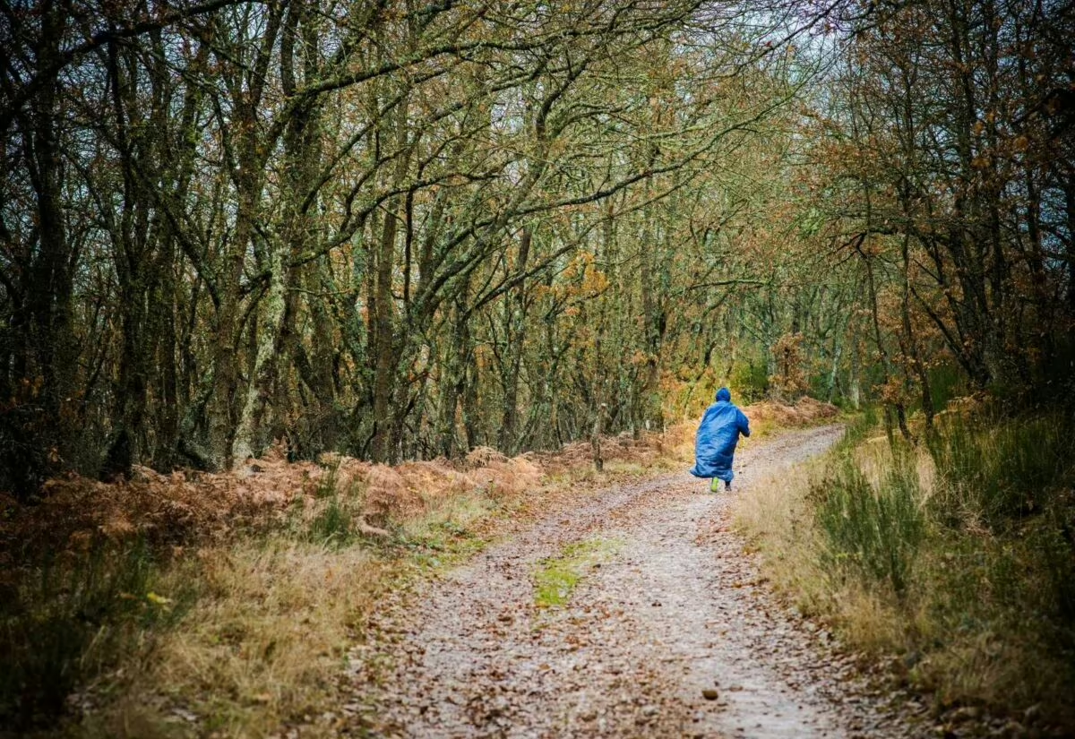
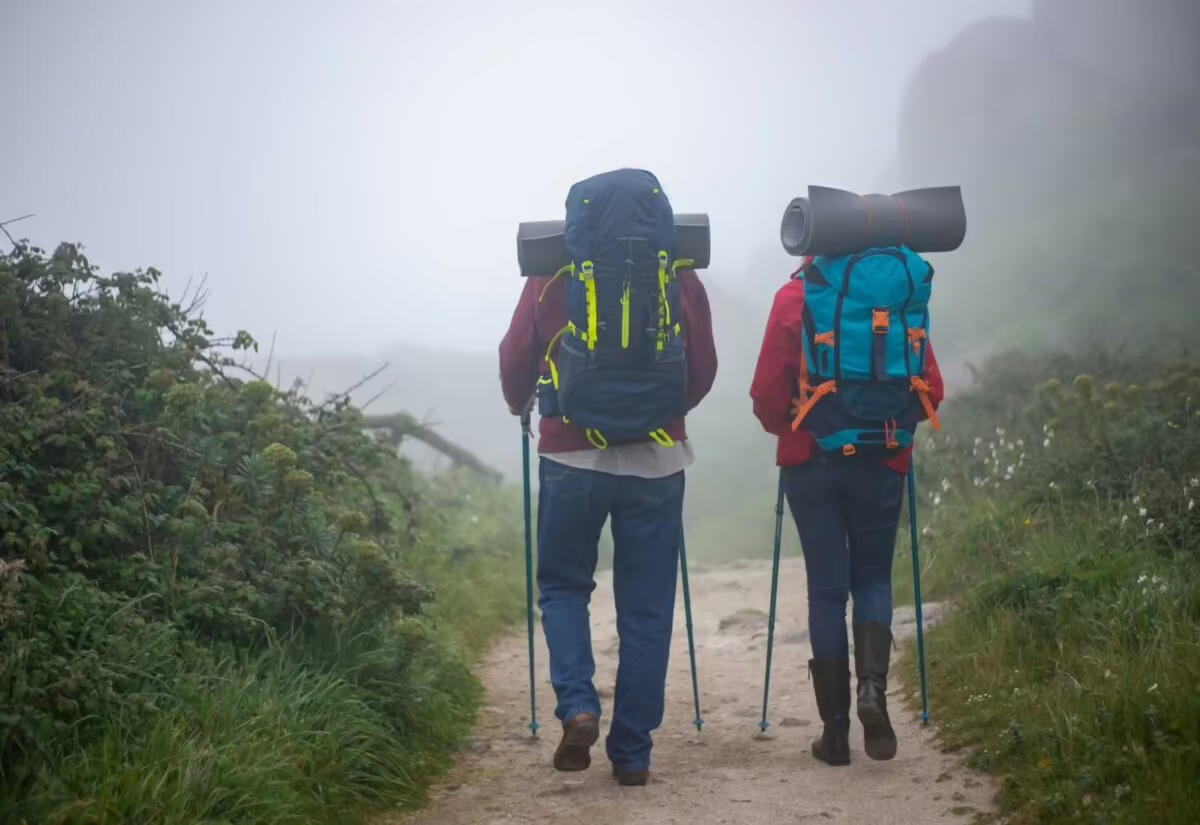
Mountains, canyons, rivers and terraced vineyards.




What to Plan Before You Go
Adjust how you split the stages to the way you walk, the time of year and the accommodation available.
Terrain: The Hard Part Is in the Ribeira Sacra
The hardest part of the Camino de Invierno is concentrated in the middle. The longest stage is Quiroga – Monforte de Lemos (35.4 km), with the climbs to O Castro da Lama and the Alto da Serra: set off early. The next one, Monforte de Lemos – Chantada (29.7 km), saves the descent along the Cóbados de Belesar to the Miño and the climb to Chantada for the end, and on Chantada – Rodeiro (25.4 km) you climb to the O Faro chapel, at over 1,000 meters. The Xunta de Galicia (Galicia’s regional government) rates the route as moderate to hard.
Before that, the short O Barco de Valdeorras – A Rúa (14 km) stage spreads out the effort on the way to Quiroga, and from Lalín no stage is longer than 22 km. It’s a little-traveled Camino: it has fewer albergues (pilgrim hostels) and services than the more popular routes and, although the waymarking has improved, on some stretches it isn’t as clear, so keep an eye out for the arrows and carry a map or an app as a backup.
Best Time to Go: Don’t Let the Name Fool You
It’s called “de Invierno” (Spanish for “winter”) because it’s thought to have been the alternative way into Galicia, without climbing to O Cebreiro, when snow closed the pass, but you can walk it all year round. Spring and fall are the best times, with moderate temperatures, although in spring rain is frequent in Galicia and in fall the mornings and nights can be chilly.
In winter, cold, frost and even snow are common in the mountain areas, and it rains often: go equipped for the cold and the damp. In summer, the low-lying areas and the valleys, especially in El Bierzo, can be hot; set off early, particularly on the long stages in the Ribeira Sacra.
Getting to Ponferrada and Back from Santiago
Choose your starting point first, then fit the transport around it. If you start in Ponferrada, arrive the day before: the first day of the trip is your arrival day, and the afternoon is enough for Ponferrada Castle (the Templar castle), the Basílica de la Encina, the old town and a stroll along the Sil. As an optional service we arrange private transfers to or from wherever you need.
Add the time to get there and back to your walking days: the 11 stages from Ponferrada make a trip of about 13 days; the 6 from Monforte de Lemos, about 8; and the 5 from Chantada, about 7. The last stage ends in Santiago: leaving your return for the next day gives you time to collect your Compostela and see the city.
Where to Sleep and Luggage Transfer
There are fewer albergues and services than on the busier Caminos, so plan your stages carefully and book ahead, especially at the busiest times of year. The stage pages list accommodation at the stops: the San Nicolás de Flüe pilgrim albergue, in Ponferrada; the Xagoaza albergue, in O Barco; the Vilamartín de Valdeorras municipal albergue; the Quiroga municipal albergue; Pensión Miño, in Monforte de Lemos; the Albergue-Hostal Carpinteiras, in Rodeiro; and, on the shared stretch, the pilgrim albergues of A Laxe, in Lalín, and Outeiro, in Vedra.
On our tours we book accommodation to suit your budget; luggage transfer between stages can be added as an optional service, and you can also add breakfast or half board. Your quote should show what you’ve chosen.
History of the Camino de Invierno
Although historians don’t fully agree on how this route came about, the most widely accepted theory seems to be that it was a variant of the Camino Francés that branched off when the latter reached Ponferrada.
The Historical Rationale
If we stop to think and put ourselves in the shoes of medieval pilgrims, it seems reasonable to assume that they looked for an alternative to the O Cebreiro pass to enter Galicia, given the huge snowfalls that blocked the way. Hence the name “Camino de Invierno” (invierno means “winter”).
Recent Official Recognition
This detour allowed pilgrims to enter Galicia through the valley of the Sil River, a natural way in with far more favorable terrain than the alternative over the mountain passes. It was recognized by the Xunta de Galicia as an official pilgrimage route in 2016.
Frequently asked questions about Camino de Invierno
-
How long is the Camino de Invierno, and how many stages does it have?
As we organize it in our stage pages, the Camino de Invierno has 11 stages and 256.3 km (159 miles) from Ponferrada to Santiago de Compostela. The first eight, as far as Lalín, are its own; the last three are those of the stretch shared with the Camino Sanabrés and the Vía de la Plata. From Monforte de Lemos it’s 132.6 km in 6 stages, and from Chantada, 102.9 km in 5. The split is a convention: each stage can be split or combined to suit your pace and where you can sleep.
-
Where does the Camino de Invierno start?
In Ponferrada, the capital of El Bierzo, in the province of León. There pilgrims leave the Camino Francés, which carries on toward O Cebreiro, and take the Sil Valley through Las Médulas, Valdeorras and the Ribeira Sacra. If you’re not going to walk the whole route, you can start in Monforte de Lemos, 132.6 km from Santiago, or in Chantada, 102.9 km away.
-
How long does it take to walk the Camino de Invierno?
The whole route, from Ponferrada, takes 11 days of walking at one stage a day, about 13 including travel there and back. From Monforte de Lemos it’s 6 days of walking (about 8 including travel) and from Chantada, 5 (about 7). Rest days or split stages add time.
-
Where do the last 100 km of the Camino de Invierno start, to get the Compostela?
According to our stage pages, in Chantada: from there it’s 102.9 km to Santiago, a little over the 100 continuous km on foot toward Santiago that the Pilgrim’s Office requires (200 km by bike). The Office doesn’t set a starting town for each route. Monforte de Lemos (132.6 km) and Ponferrada (256.3 km) are comfortably over that, and from Rodeiro (77.5 km) you fall short. See the Compostela requirements.
-
How difficult is the Camino de Invierno?
The Xunta de Galicia rates it as moderate to hard. It has long stages and demanding climbs, concentrated in the Ribeira Sacra: Quiroga – Monforte de Lemos (35.4 km, the longest), Monforte de Lemos – Chantada (29.7 km, with the descent to Belesar and the climb to Chantada) and Chantada – Rodeiro (25.4 km, with the climb to the O Faro chapel, at over 1,000 m). There are also fewer albergues and services than on the more popular routes, and the waymarking isn’t always as clear. From Lalín, no stage is longer than 22 km.
-
What is the hardest stage of the Camino de Invierno?
Quiroga – Monforte de Lemos: 35.4 km, the longest stage of the route, with the climbs to O Castro da Lama and the Alto da Serra; it’s worth setting off early. Two days later, on Chantada – Rodeiro (25.4 km), comes the climb along the Camino de la Virgen to the O Faro chapel, at over 1,000 meters, on the boundary between Lugo and Pontevedra. Between the two, Monforte de Lemos – Chantada (29.7 km) saves the descent along the Cóbados de Belesar to the Miño and the climb to Chantada for the end.
-
Is the Camino de Invierno beautiful?
Yes: it’s a Camino of valleys, vineyards and mountains, with fewer pilgrims than the better-known routes. Everyone has their favorite stages; the ones we highlight most: the first, for the loveliest part of El Bierzo and the Santalla viewpoint; the walk through Las Médulas, on the way to O Barco; the Roman tunnel of Montefurado, between A Rúa and Quiroga; the landscapes of the Ribeira Sacra and the descent along the Cóbados de Belesar, from Monforte de Lemos to Chantada; the views from the O Faro chapel, on the way to Rodeiro; and the country lane to Palmaz, before Lalín.
-
When is the best time to walk the Camino de Invierno?
Spring and fall, with moderate temperatures and milder weather, although in spring rain is frequent in Galicia and in fall the mornings and nights can be chilly. Despite its name, you can walk it all year round: in winter, cold, frost and even snow are common in the mountain areas, and it rains often; in summer, the low-lying areas and the valleys, especially in El Bierzo, can be hot. If you’re going in the cold months, see our tips for walking the Camino in winter.
-
How much does it cost to walk the Camino de Invierno?
It depends on where you start, your dates and the accommodation. Our tours include accommodation booked to suit your budget, practical information about the Camino, phone assistance on the trail and travel insurance; luggage transfer, meals and transfers can be added as optional services. We organize it from Ponferrada as our Camino de Invierno from Ponferrada tour; for your dates, or to start in Monforte de Lemos or Chantada, design your route and see the price instantly.
-
What is the difference between the Camino de Invierno and the Camino Francés?
From Ponferrada there are two ways to reach Santiago, and they enter Galicia at different points. The Camino Francés, the most popular, climbs to O Cebreiro and continues through Sarria and Portomarín: from Ponferrada it’s 205.7 km in 9 stages. The Camino de Invierno, the one in this guide, avoids O Cebreiro by way of the Sil Valley, Valdeorras and the Ribeira Sacra: 256.3 km in 11 stages, with fewer pilgrims and also fewer albergues and services. If you’re looking for peace and quiet and want to escape the crowds on the Galician stretch of the Francés, the Invierno is your route; if you’d rather have more company and more services, the Francés.
-
What are the stages and albergues on the Camino de Invierno?
There are 11 stages: Ponferrada – Carucedo (20 km), Carucedo – Barco de Valdeorras (28 km), Barco de Valdeorras – A Rúa de Valdeorras (14 km), A Rúa de Valdeorras – Quiroga (26.3 km), Quiroga – Monforte de Lemos (35.4 km), Monforte de Lemos – Chantada (29.7 km), Chantada – Rodeiro (25.4 km), Rodeiro – Lalín (23.5 km), Lalín – Bandeira (17 km), Bandeira – Santa Cruz de Rivadulla (15 km), Santa Cruz de Rivadulla – Santiago de Compostela (22 km). Each stage page lists where to sleep at the end of the day; among others, the San Nicolás de Flüe pilgrim albergue, in Ponferrada; the Xagoaza albergue, in O Barco; the Quiroga municipal albergue; the Albergue-Hostal Carpinteiras, in Rodeiro; and the pilgrim albergues of A Laxe, in Lalín, and Outeiro, in Vedra. There are fewer albergues than on the busier Caminos: plan your stages and book ahead, or check the albergue directory.
-
Can you cycle the Camino de Invierno?
For the Compostela by bike, the Pilgrim’s Office requires at least 200 km under the same conditions as on foot: from Ponferrada, with 256.3 km, or from O Barco de Valdeorras, with 208.3 km, you cover more than that; from Monforte de Lemos (132.6 km), you don’t. Our stage pages describe the stages on foot; if you’d like to cycle it, bike rental (MTB and e-bike) is among our optional services, and you can also take a look at our cycling routes.
-
Can you walk the Camino de Invierno in sections, from Monforte de Lemos or Chantada?
Yes. The Pilgrim’s Office accepts doing the Camino in stages as long as they follow on in time and along the route; if you only walk the minimum distance, get your pilgrim passport (credencial) stamped at the start and end of each section, with the date, to show that you picked up where you left off. The most convenient breaks are the starting points in this guide: Ponferrada, Monforte de Lemos and Chantada. You request the Compostela when you reach Santiago, with the pilgrim passport covering all the sections.
All the Camino de Santiago routes
-

Camino Francés
33 Stages 769 KmsFrom Saint-Jean-Pied-de-Port to Santiago de Compostela. Follow the most recommended route of the Camino.
view route -

Camino Portugués
27 Stages 620 KmsFrom Lisbon to Santiago de Compostela. Enjoy a Camino through the basins of the Tagus, Douro, and Miño rivers.
view route -

Camino Portugués Coastal Route
12 Stages 273 KmsFrom Porto to Santiago de Compostela. The Atlantic Ocean will guide your steps along the Portuguese and Galician coastline.
view route -

Camino Portugués Spiritual Variant
4 Stages 106 KmsFrom Pontevedra to Padrón. Relive the final stretch of the Apostle Saint James’s posthumous journey.
view route -

Camino Finisterre and Muxía
5 Stages 120 KmsFrom Santiago de Compostela to Muxía. A mystical and spiritual journey to the ends of the Earth.
view route -

Camino del Norte
36 Stages 833 KmsFrom Irún to Santiago de Compostela. An unforgettable experience with breathtaking landscapes.
view route -

Camino Primitivo
14 Stages 317 KmsFrom Oviedo to Santiago de Compostela. It follows the first Camino de Santiago, tracing the footsteps of Alfonso II.
view route -

Camino Inglés
5 Stages 117 KmsFrom Ferrol to Santiago de Compostela. Immerse yourself in the naval and historical heritage of a truly unique Camino.
view route -

Camino Sanabrés
14 Stages 367 KmsFrom Granja de Moreruela to Santiago de Compostela. Cross the region of Sanabria and the mountains of Ourense.
view route -

Camino de Invierno
11 Stages 256 KmsFrom Ponferrada to Santiago de Compostela., through the regions of Valdeorras and Ribeira Sacra.
view route -

Ruta del Padre Sarmiento
8 Stages 190 KmsThe Father Sarmiento Way links Pontevedra to Santiago de Compostela, offering a scenic journey through beautiful landscapes.
view route -

Camino dos Faros
8 Stages 200 KmsFrom Malpica to Finisterre. A 200-kilometre journey along the coast and through the wildest nature.
view route

