


Vía de la Plata (Silver Route) Map
06 November, 2026
The Vía de la Plata links Seville and Santiago in almost 1,000 km and 37 stages through Andalusia, Extremadura, Castile and León and Galicia. On the map you will see its route, the elevation profile, the longest stages and how to do it in sections.

The Vía de la Plata (Silver Route) is the great Camino de Santiago route that comes up from the south: it starts in Seville and crosses the peninsula from south to north, following for much of the way the ancient Roman road that linked Mérida and Astorga. Its name has nothing to do with the metal: the most widely accepted explanation ties it to the Arabic word balat, a paved road. It is almost 1,000 km in 37 stages to Santiago, and on this map you have the full route and the elevation profile.

Map and profile of the Vía de la Plata, from Seville to Santiago de Compostela along the Sanabrés Way.
How to read the map of the Vía de la Plata
The route crosses four autonomous communities and eight provinces: Seville, in Andalusia; Badajoz and Cáceres, in Extremadura; Salamanca and Zamora, in Castile and León; and Ourense, Pontevedra and A Coruña, in Galicia.
The profile shows three parts: from Seville to Salamanca, through open pastureland and fields, with the climbs of Sierra Morena and the Béjar pass; the flat plateau of Salamanca and Zamora; and the final section, which climbs to Sanabria and enters Galicia over the high points of Padornelo and A Canda, above 1,200 metres, before descending through the Galician valleys to Ourense and Santiago.
At Granja de Moreruela (Zamora), the historic Vía de la Plata continues north to Astorga, where it joins the French Way. This map shows the other option, the one that goes straight to Santiago: the Sanabrés Way, which turns west through Sanabria and Ourense.
And one detail that is often mixed up: the Vía de la Plata is not the Mozarabic Way. The Mozarabic Way starts from several cities in Andalusia, such as Granada or Córdoba, and joins the Vía de la Plata at Mérida.

Seville, the traditional starting point of the Vía de la Plata.
The long stages worth marking on the map
The stages of the Vía de la Plata are long and the towns with services are far apart, especially between Seville and Salamanca. These ones go over 35 km:
- Mérida – Alcuéscar, about 36 km.
- Alcuéscar – Cáceres, about 37 km.
- Carcaboso – Aldeanueva del Camino, about 38 km, the longest on the route.
- Salamanca – El Cubo de la Tierra del Vino, about 36 km.
- Santa Marta de Tera – Mombuey, about 36 km.
Set off early, always carry water and something to eat, and plan carefully where you are going to stop each day. In summer the heat bears down in Andalusia and Extremadura and there are stretches with very little shade: avoid walking in the middle of the day.
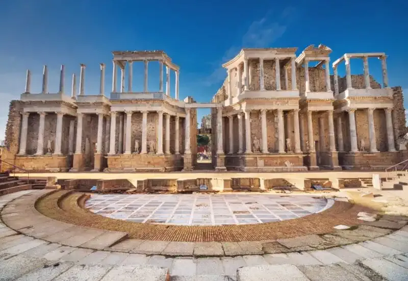
The Roman theatre of Mérida, one of the great stops on the Vía de la Plata.
Where should you start the Vía de la Plata?
Doing the whole thing takes more than a month, so the most practical option is usually to split it into sections of one or two weeks:
- From Seville to Mérida: about 214 km in 9 stages, the traditional start.
- From Mérida to Salamanca: about 290 km in 10 stages, passing through Cáceres.
- From Salamanca to Puebla de Sanabria: about 225 km in 8 stages, through Zamora and Granja de Moreruela.
- From Puebla de Sanabria to Ourense: about 143 km in 5 stages, entering Galicia through the mountains.
- From Ourense: about 109 km in 5 stages to Santiago, the shortest option that lets you earn the Compostela.
If you prefer to cycle, the Vía de la Plata by bike from Seville covers the whole route in 16 stages.
If you are looking for another route, check the map of the Portuguese Way or the map of the French Way, or take a look at all the Camino de Santiago routes.
Once you know which section you want to start with and how many days you have, work out the price of your Vía de la Plata here and get ready to walk one of the quietest routes to Santiago.