


Silver Way from Seville to Mérida is a journey designed for independent travelers to cover the stretch between Seville and Mérida with the peace of mind of having the main organization taken care of. The route is completed in 11 days and 10 nights and totals 210 km, a proposal suitable for those seeking a long, consistent, and well-structured experience on one of the major Jacobean routes in the southern peninsula.
With prices starting from 565 €, this journey includes luggage transfer and travel insurance, two services that make a difference when facing a multi-day itinerary. Silver Way from Seville to Mérida is particularly well-suited for travelers who already enjoy walking several consecutive days and want to undertake a demanding route with greater comfort, without giving up the freedom to progress at their own pace and with clear planning from the start.
Photos
Accommodations
- Most popular
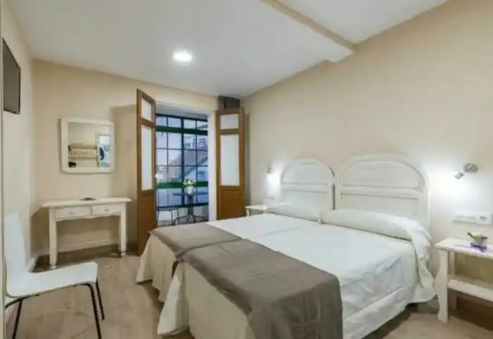
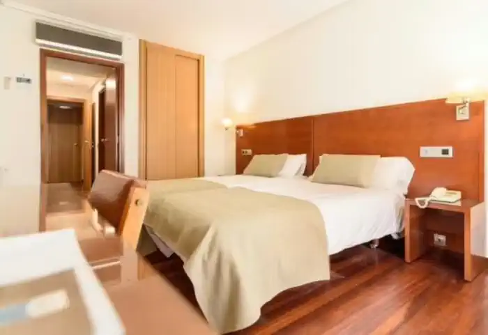
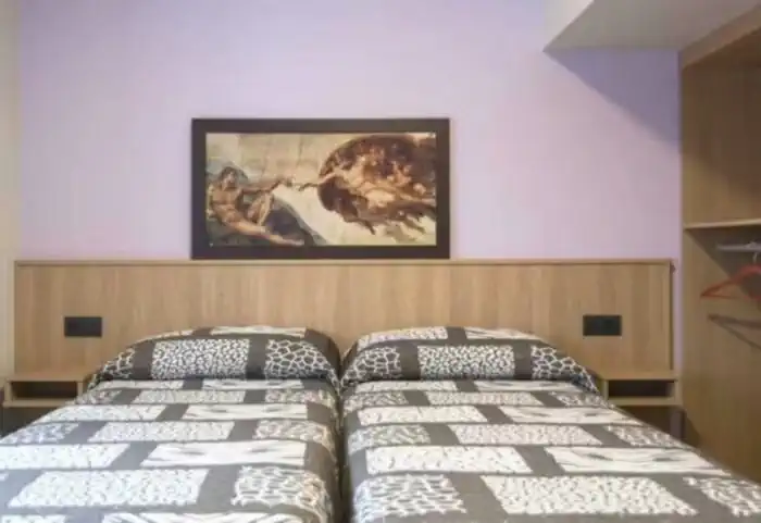
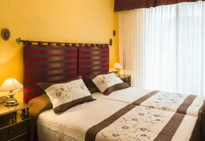
Private comfort (Guesthouses, rural houses and small hotels)
The perfect balance between charm and comfort. Guesthouses, B&Bs and country houses await you in the villages along the Camino with private rooms, private bathrooms, TV, and daily cleaning service. Simple and welcoming, they are the ideal place to truly rest and enjoy the peaceful rural essence that only the Camino can offer.
Services
Included in all our routes
- Accommodation
11 days / 10 nights
- 11 days / 10 nights accommodation
- Complete documentation (Dossier and material for the Camino)
- Luggage transfer during the stages. (1 piece per person max 15 kgs)
- On-the-road emergency telephone assistance
- Pilgrim's Credential
- Travel insurance
Optional
- Extra night
- Breakfast
- MP (Breakfast and dinner)
- Cancellation Insurance
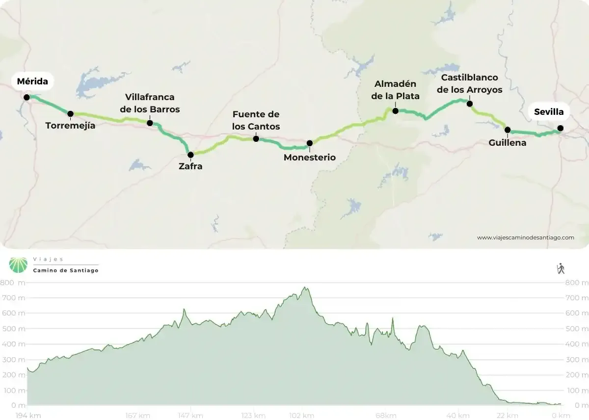
Map of the Silver Route from Seville to Mérida
Stages
- day 1
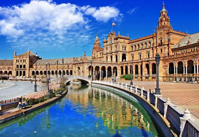
Arrival at Sevilla
The truth is that starting the Vía de la Plata from Ourense is a luxury. This city, crossed by the river Minho, has its maximum identifier in the multiple bridges that cross its flow to unite the two parts of the city. You can visit its Cathedral, in which the Portico del Paraíso stands out, a tribute to the Pórtico de la Gloria of Santiago de Compostela. You can also visit the convent of San Francisco and its very well preserved old town, full of leisure, atmosphere and good food. Finally, every good pilgrim visits the thermal baths of the city, some of which, such as Chavasqueira, are free of charge. We assure you that there is no better start to the Camino than a relaxing bath and a zen atmosphere like the one offered by these thermal baths. Are you ready to find out? - day 2
Stage 1. Sevilla - Guillena (21.6 km)
We say goodbye to Seville from the Seville Cathedral, taking the path towards Guillena. We cross the Puerta de Triana and the Triana Bridge, crossing the Guadalquivir dock. We continue to Carlos III Avenue, where we find a fork: we can go towards Camas or follow the course of the river until we divert towards Santiponce.
We leave Santiponce behind via Extremadura Avenue, pass through the Roman city of Itálica, and continue towards the N-630. We cross the A-66 via an underpass and continue along service roads until we reach Guillena.
Things to consider
Hot stage, especially in summer, with temperatures exceeding 40º. It is recommended to avoid the central hours of the day and to stay well hydrated.
Places of interest
- Cathedral of Santa María – Seville
- Plaza de España – Seville
- The Giralda – Seville
- Torre del Oro – Seville
- Triana Bridge – Seville
- Itálica – Santiponce
- Cortijo Torre de la Reina – Guillena
- Palacio Parladé – Guillena
Typical dishes
- Olive oil
- Whiskey sirloin
- Huevos a la macarena
- Huevos a la flamenca
- Sevillana beef
- Yemas de San Leandro
- Oil cakes
- day 3
Stage 2. Guillena - Castilblanco de los Arroyos (18.3 km)
We will leave Grimaldo from the road to Holguera, from where we will reach an underpass where we cross the A-66. We continue along the path through the pastures and cork oak forests until we reach a detour at the height of two green gates.
On one side, the path diverts us towards Riolobos, advancing along a dirt road protected by a stone wall until we reach a track that leads us to the bank of the Jerte. We reach Riolobos, where we will find all the necessary services to rest and regain strength. From here we find another detour: the shorter option takes us to the right of the CC-293 until we reunite with the original path; the other option goes along the road, crosses the stream of El Boquerón del Rivero and arrives at the hermitage of Our Lady of Argamasa, continuing on to Galisteo.
The original path continues straight ahead, crossing the same stream and resuming the road from Riolobos. We cross the canal on the right bank of the Jerte and continue until the Arroyo de las Monjas, which takes us directly to Galisteo.
We leave Galisteo from the Plaza de España, cross the wall and exit to the Roman Bridge that crosses the Jerte, actually a medieval bridge. From here we reach the EX-A1 and continue on to Aldehuela del Jerte. Finally, we follow the road for about 5 kilometers until Carcaboso.
Things to consider
This stage is quite long and offers several alternatives to adapt it according to preferences. It can be made shorter or longer depending on the chosen detours. We recommend planning the stage well the day before. Additionally, the next stage is 38 kilometers, so it is advisable not to shorten this day too much.
Places of interest
- Manrique de Lara Bridge – Galisteo
- Galisteo Wall – Galisteo
- Picota Tower – Galisteo
- Church of the Assumption – Galisteo
- Church of Santiago Apostle – Carcaboso
Typical dishes
- Blood sausages and tripe
- Potato in vinegar
- Potato salad
- Migas and fried galisteo
- Landrillas and chanfaina
- Tongue in the galisteña style
- Huesillos and coquillos
- day 4
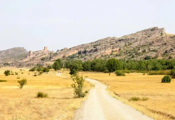
Stage 3. Castilblanco de los Arroyos - Almadén de la Plata (28.2 km)
We begin this route from Castiblanco de los Arroyos along the avenue of Antonio Machado, which will take us for practically 15 kilometers along the shoulder of the SE-5405 on our way to Almadén de la Plata, surrounded by extensive pastures. This section does not present much traffic, but, as always, we recommend exercising caution when walking along shoulders. The profile of this stage is simple until it is not, as in the last 6 kilometers we will begin to ascend to reach the estate El Berrocal.
We will leave the road to cross the dehesa del Berrocal, with the beautiful landscapes of the Sierra Norte de Sevilla, specifically in a natural park of 177,000 hectares. Among gentle paths, we leave behind the Cortijo de La Morilla, heading towards the abandoned village of El Berrocal, which, without passing through it, announces our arrival at the ascent of the hill of Calvario, with a very steep height where we will climb 100 meters in 300 meters of length. We arrive at the top of Calvario, where we see the viewpoints over the pastures, and then descend through some rocky sections among gentle paths that lead us to Almadén de la Plata.
Things to consider
Although long, the elevation changes of this stage are very specific, and most of it runs along the road, so we recommend caution with the shoulders. It is very important to stock up in Castiblanco de los Arroyos and carry enough water, as you will not find points to replenish along much of the route. It is advisable to start early to avoid the hottest hours before reaching Almadén de la Plata.
Places of interest
- Church of Santa María de Gracia – Almadén de la Plata
- Viewpoint of Alto del Calvario – Almadén de la Plata
- Fountain of Santiago – Almadén de la Plata
- Fountain of the Clock – Almadén de la Plata
- Chapel of the Divine Shepherdess – Almadén de la Plata
Typical dishes
- Deer stew
- Migas molineras
- Game meat
- Caldillo de Almadén
- Iberian meats grilled
- Pestiños and hornazos
- day 5
Stage 4. Almadén de la Plata - Monesterio (33.6 km)
We leave the town of Almadén de la Plata behind, passing the bullring, to continue around the hill of Covachos, from where we will head towards the town of Monesterio. A little further on, we will cross a stone bridge that leads us to a path through pastures and holm oaks, cork oaks, and rockroses, with some moderate elevation changes. We cross the Arroyo Mateos and continue ascending until we reach the Old Road of Almadén de la Plata, which will take us to the town of El Real de la Jara.
We leave behind El Real de la Jara via a street leading to a medieval castle before crossing the Arroyo de la Víbora, at the entrance to Extremadura. This part of the stage will be a constant ascent to the town of Monesterio, so gather your strength and supplies. We cross into Extremadura and pass by the ruins of the Castle of las Torres, advancing along a dirt track between pastures until we reach the Hermitage of San Isidro and the Venta el Culebrín. Further ahead, we will find the Hotel-Restaurante Leo, where we can take a short break and tackle the final stretch along the shoulder of the national road until we reach a path parallel to the highway. Along this path, we will leave behind the picnic area of the Cruz del Puerto to finally arrive at the town of Monesterio.
Things to consider
This is a long route that crosses the border between Extremadura and Andalusia. It traverses the bucolic pastures from Almadén de la Plata to Monesterio. Do not despair, as the architectural sites are worth it. Remember to carry enough water, as although there are some intermediate points, they are quite far apart.
Places of interest
- Church of San Bartolomé – El Real de la Jara
- Medieval castle – El Real de la Jara
- Ham Museum – Monesterio
- Castle of las Torres – Monesterio
- Church of San Pedro – Monesterio
Typical dishes
- Lomo a la presa de entraña
- Iberian ham
- Cured meats
- Potatoes with spine
- Rice with offal
- Morcones
- day 6
Stage 5. Monesterio - Fuente de Cantos (20.7 km)
We will depart from Monesterio along the avenue of Extremadura, which leads us to a dirt track, from where we will continue until we cross the Bodión Chico stream heading towards Fuente de Cantos. We follow this path to reach the road to Calera de León, from where, through pastures and crops, we will advance until we descend again to the Bodión Chico stream, the lowest point of the stage. From here, we will cross the stream again to climb about a hundred meters until we see Fuente de Cantos on the horizon. From here, we will continue towards the town, accessing via Romanones street.
Things to consider
This stage is practically a rest from the previous one, with fewer elevation changes and shorter length. Nevertheless, it is important to stay well hydrated and carry enough water from Monesterio, as the route lacks supply points until reaching Fuente de Cantos. Remember to exercise caution in the sections near the road, even though traffic is sparse.
Places of interest
- Archaeological site of Los Castillejos – Fuente de Cantos
- Convent of the Carmelites – Fuente de Cantos
- Church of Our Lady of Granada – Fuente de Cantos
- Zurbarán Museum House – Fuente de Cantos
Typical dishes
- Extremaduran gazpacho
- Pork products
- Iberian ham
- Chanfaina
- Migas
- day 7
Stage 6. Fuente de Cantos - Zafra (24.2 km)
We leave the town of Fuente de Cantos via the Constitution square, heading towards the road to Medina de las Torres, from where we will divert to an ancient Roman road towards Zafra. Not long after, we arrive at Calzadilla de los Barros, sheltered by the fields. From here, we will continue along a path parallel to the N-630, from which we will soon diverge while crossing several streams. We keep moving through fields and livestock farms, cross the railway tracks, and head towards Puebla de Sancho Pérez, where we can take a short break before tackling the last 4 kilometers. We leave this town behind and continue along a path parallel to the Old Puebla road until we enter Zafra.
Things to consider
This is not a very long stage, but it can be shortened by staying overnight in Puebla de Sancho Pérez. It is quite a monotonous stage, as from Fuente de Cantos we pass through agricultural areas with little tourist appeal until we reach Zafra. These stretches can be ideal for reflection and self-discovery, an essential part of the Camino de Santiago.
Places of interest
- Church of Santa Lucía – Puebla de Sancho Pérez
- Church of San Salvador – Calzadilla de los Barros
- Chapel of Our Lady of Bethlehem
- Collegiate Church of Candelaria – Zafra
- House of Ajimez – Zafra
Typical dishes
- Retinto
- Lamb or pork stew
- Oxtail
- Migas
- Almond hearts
- Santa Clara pastries
- day 8
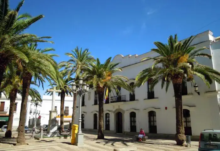
Stage 7. Zafra - Villafranca de los Barros (19.8 km)
We leave Zafra via the Plaza Grande towards the N-432, passing by the San Francisco tower and ascending to the Alto de San Cristóbal, from where we can see Villafranca de los Barros. After reaching the height, we descend towards Los Santos de Maimona and continue along paths through fields until we cross the train tracks.
We access the N-630, cross the A-66 via an underpass, and arrive at Villafranca de los Barros, entering through Zurbarán street until we reach the Plaza de España.
Things to consider
Short and simple stage. Some pilgrims extend it to the next town, but this is not recommended due to the distance.
Places of interest
- Palacio de la Encomienda – Los Santos de Maimona
- Plaza de España – Los Santos de Maimona
- Ermita de Nuestra Señora de la Coronada – Villafranca de los Barros
- Iglesia de Nuestra Señora del Valle – Villafranca de los Barros
Typical dishes
- Migas
- Game meats
- Cold cuts
- Calderetas
- Pestiños and prestín
- Garlic and bay leaf
- day 9
Stage 8. Villafranca de los Barros - Torremejía (26.7 km)
We leave Villafranca de los Barros from the Plaza de España to the hermitage of the Coronada. We exit the municipality and continue along a dirt path towards Torremejía, crossing the stream of Bonhabal.
If desired, it is possible to divert to Almendralejo on the Vereda de la Mina. Otherwise, we continue straight to the EX-212 and cross the train tracks through a tunnel, finally entering Torremejía.
Things to consider
Monotonous stage, with long stretches of similar landscape. Some pilgrims prefer to extend the previous stage. The solitude of the Camino is also part of the experience.
Places of interest
- Convent and church of Santa Clara – Almendralejo
- Church of the Heart of Mary – Almendralejo
- Palace of the Mexía – Torremejía
- Church of the Immaculate Conception – Torremejía
Typical dishes
- Extra virgin olive oil
- Sheep and goat cheeses
- Cold cuts
- Rice casserole
- Vigil stew
- Sponge cakes
- day 10
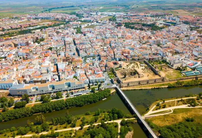
Stage 9. Torremejía - Mérida (20.6 km)
We leave behind Torremejía along a path parallel to the N-630, which connects Seville and Mérida. We alternate between sections of trail and shoulder until we cross the EX-105 and continue along a dirt road that brings us closer to the Vega del Guadiana.
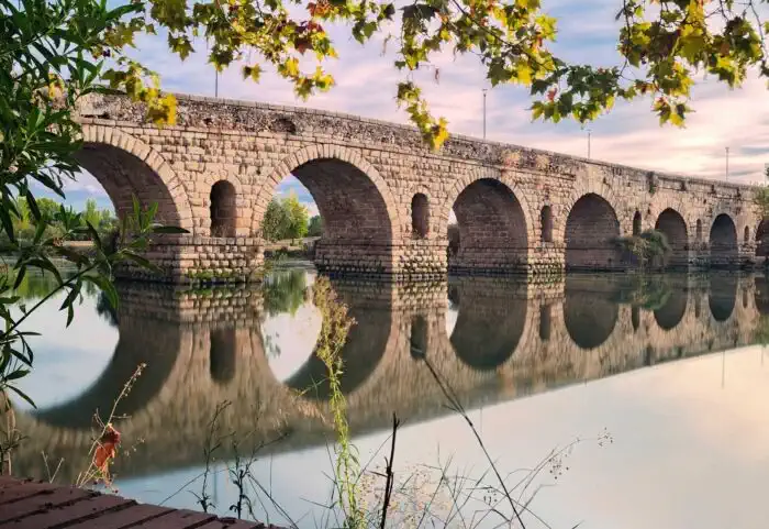
We enter Mérida through the Bellavista neighborhood, cross the Roman Bridge over the Guadiana, and conclude the stage at Plaza de España.
Things to consider
Simple and somewhat monotonous stage. It is recommended to arrive early in Mérida to enjoy its heritage. Caution is advised on the road sections.
Places of interest
- Amphitheater – Mérida
- Roman Theater – Mérida
- Plaza de España – Mérida
- National Museum of Roman Art – Mérida
Typical dishes
- Patatas al rebujón
- Gazpacho
- Ajo blanco
- Stewed legumes
- Game meats
- Trout
- day 11
End of the Camino
After arriving... End of the Camino
Frequently Asked Questions
-
How long does it take to travel the Silver Route?
The Silver Route starts in Seville and has almost 1,000 kilometres to Santiago de Compostela. In terms of days and stages, it can be divided in two ways, as it depends on which Camino you end up on. This route shares the final stretch with the French Way from Astorga (León), or with the Sanabrés Way in Granja de Moreruela (Zamora):- For the French Way, it has 38 stages, therefore, 38 days;
- For the Sanabrés Way, it has 36 stages, therefore, 36 days.
-
How many stages does the Silver Route have?
The Silver Route starts in Seville and has almost 1000 kilometres to Santiago de Compostela. As for the stages, it can be divided in two ways, as it depends on which Camino you end up on. This route shares the final stretch with the French Way from Astorga (León), or with the Sanabrés Way in Granja de Moreruela (Zamora):- For the French Way, it has 38 stages;
- For the Sanabrés Way, it has 36 stages.
-
How many kilometers are there on the Silver Route?
The total kilometers of the Silver Route from Seville depend on how you get to Santiago de Compostela. This historic route has two possible ‘endings’: By the French Way from Astorga (León): about 1000 kilometres; By the French Way from Granja de Moreruela (Zamora): about 970 kilometres. It should be borne in mind that this distance may vary depending on the possible variants or complementary and alternative paths that the pilgrim decides to take during the route. -
Which rivers does the Silver Route cross?
The Silver Route, one of the historic routes of the Camino de Santiago, crosses several important rivers, streams, creeks, reservoirs and lakes along its route from Seville to Santiago de Compostela. Among the most prominent rivers crossed by pilgrims on this route are:- Guadalquivir (Seville)
- Guadiana (Mérida)
- Tagus (Cáceres)
- Tormes (Salamanca)
- Duero (Zamora)
- Esla (Zamora)
- Órbigo (León)
- Sil (León)
- Miño (Lugo)
- Miño (Ourense)
- Ulla (A Coruña)
- Sar (A Coruña)
-
Who created the Silver Route?
The Silver Route was not originally created as a pilgrimage route, but as a Roman road built during the Roman Empire. Its main purpose was to connect the cities of Emerita Augusta (present-day Mérida) and Asturica Augusta (present-day Astorga), facilitating trade, military transport and communications throughout the Iberian Peninsula. Over time, this route became a strategic route for trade, warfare and the pilgrims from southern Spain who used it to reach Santiago de Compostela. Silver’ has nothing to do with the transport of this material. The name of this route comes from the pronunciation of the Arabic term ‘balath’, which means ‘paved road’, in relation to the Roman road.
