The Camino de Santiago from Puebla de Sanabria, the Sanabrés way descending from Castile into Galicia. 174 kilometres through A Gudiña, Laza and Xunqueira de Ambía to Ourense, among the lake of Sanabria, mountain ranges, chestnut trees and the first Galician hamlets.
You walk; we provide the logistics: accommodation, daily luggage transfer, your pilgrim's credential, full documentation and travel insurance, from 395 €.
The Sanabrés Way from Puebla de Sanabria to Ourense is an itinerary organised by Viajes Camino de Santiago®.
Services
Included in all our routes
- Accommodation
7 days / 6 nights
- 7 days / 6 nights accommodation
- Complete documentation (Dossier and material for the Camino)
- Luggage transfer during the stages. (1 piece per person max 15 kgs)
- On-the-road emergency telephone assistance
- Pilgrim's Credential
- Travel insurance
Optional
- Extra night
- Supplement for single room
- Breakfast
- MP (Breakfast and dinner)
- Cancellation Insurance
Accommodations
- Most popular
Private comfort (Guesthouses, rural houses and small hotels)
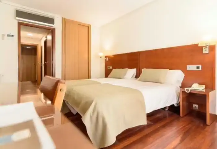
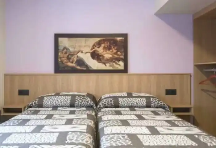
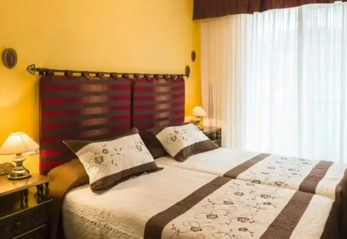
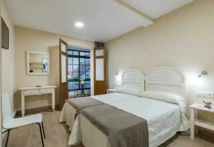
The perfect balance between charm and comfort. Guesthouses, B&Bs and country houses await you in the villages along the Camino with private rooms, private bathrooms, TV, and daily cleaning service. Simple and welcoming, they are the ideal place to truly rest and enjoy the peaceful rural essence that only the Camino can offer.
Photos
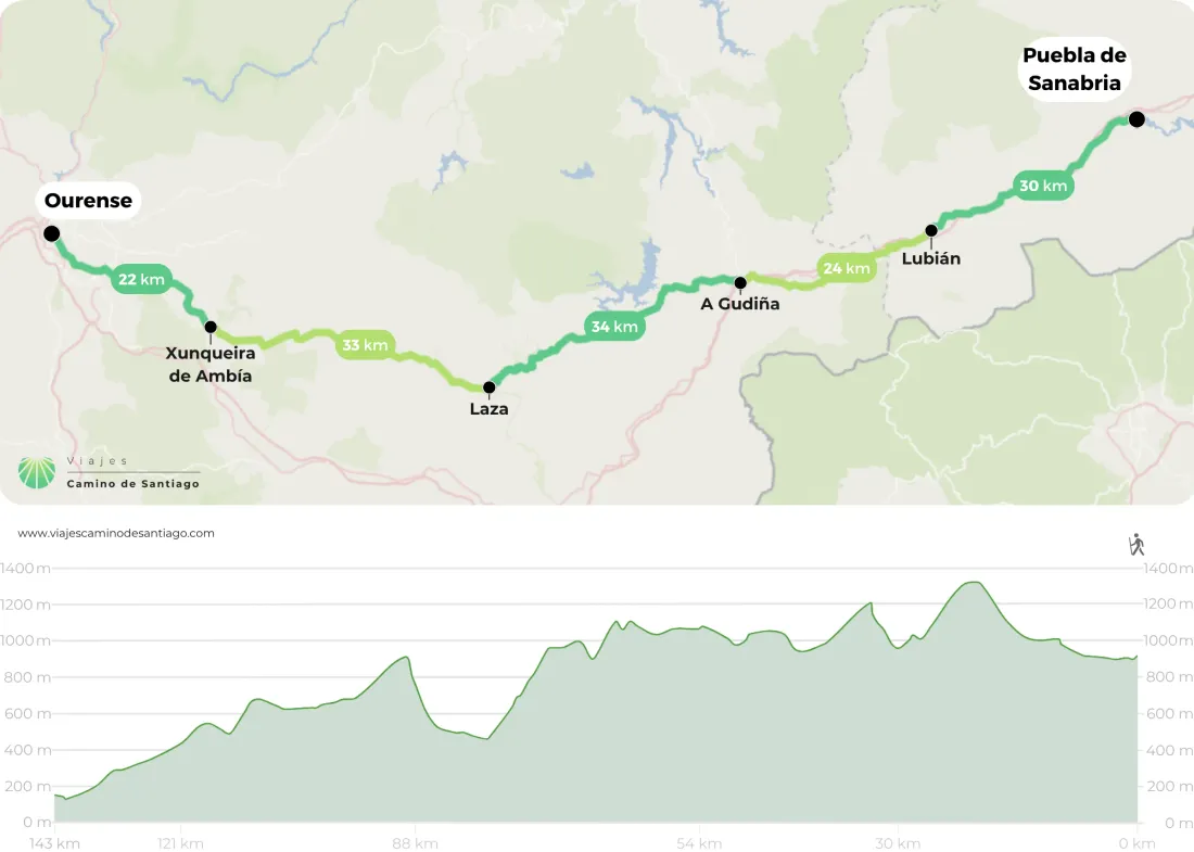
Map of the Silver Route from Puebla de Sanabria to Ourense

Stages
- day 1
Arrival at Puebla de Sanabria
We leave Mombuey from the Church of Santa María, along a tree-lined path that follows the road towards Puebla de Sanabria. We cross the highway bridge and follow the signs to Valdemerilla, with the possibility of seeing the Church of San Lorenzo. We continue to Cernadilla, which has a Baroque temple dedicated to the Purification and a tower with good panoramic views. We proceed until we enter Palanzuelo, continuing along forest tracks to Entrepeñas and Asturianos. Both towns offer accommodation.
We have 15 km left to Puebla de Sanabria, and we continue without losing our way, passing through the towns of Palacios de Sanabria, Remesal, Otero de Sanabria, and Triufé. From this last town, we have only 4 km left to our destination. We cross the bridge over the Tera River and turn left to reach the old town, concluding our stage in the fabulous Puebla de Sanabria.
Things to consider
It is advisable to start the stage well supplied with food and drink for the entire route. This is because in the more than thirty kilometers that separate Mombuey from Puebla de Sanabria, you will only find services in the towns of Asturianos and Palacios de Sanabria.
The Natural Park of Sanabria Lakes is the largest glacial lake in the entire Iberian Peninsula. It is located 13 km from the town, off the Camino. However, it is worth taking a taxi to visit it and/or adding an extra day to your trip.
Places of interest
- Castle of the Counts of Benavente - Puebla de Sanabria
- Church of Our Lady of Azogue - Puebla de Sanabria
- Museum of Giants and Big-heads - Puebla de Sanabria
- Natural Park of Lake Sanabria
Typical dishes
- Habones a la sanabresa
- Caldo sanabrés
- Salmon trout
- Bacalao
- Veal
- Botillo and Farinatos
- Torrijas and Buñuelos
Fried milk
Cheese ice cream
- day 2
Stage 1. Puebla de Sanabria - Lubián (29.6 km)
We begin the stage from Puebla de Sanabria, a locality that gives its name to our Camino; we skirt the old town and cross the Castro River via the road towards Lubián. Following a dirt path, we descend to the riverbank, advancing parallel to it. Passing a factory, we emerge onto the national road and continue to the village of Terroso, passing by the church of Santiago.
We cross the A-52 highway via a bridge and continue along a dirt track, in a very pleasant green stretch. We divert onto a path to the left that leads to a beautiful forest. We return to the highway and after crossing a bridge, we arrive at Requejo. From the cemetery of Requejo, we see a junction; the arrows on the milestone lead us to the start of the trail, straight ahead. (Cyclists should follow the road)
The trail ends at the foot of the AVE viaduct. We reach the old road and continue to Padornelo, where we find a bar. We leave Padornelo via the road towards Lubián, crossing the highway and the road through an underpass. We turn left onto a dirt path. After crossing the river, we access Lubián, located in Alta Sanabria, where we find the Santuario de Tuiza, declared Asset of Cultural Interest.
Things to consider
In the nearly thirty kilometers of the stage since we left Puebla de Sanabria, we will find services in Requejo, where there is a bar restaurant at the national road, and in Padornelo, with a bar in the village and a restaurant at the exit towards Lubián.
Places of interest
- Church of San Mamés - Lubián
- Shrine of the Virgin of Tuiza - Lubián
- Castro de Muradellas - Lubián
- Wolf's Cortello - Lubián
- Concha Fountain - Lubián
Typical dishes
- Octopus á feira with cachelos
- Bacalao and trout
- Beef from Aliste Sanabresa
- Venison and wild boar
- Slaughter products: chorizos, salchichones, mondongos, picadillo, etc.
- Botelos
- Habones
- Heather honey
- Seasonal mushrooms
- Roasted apple
- Fried milk, roscones, pastries, torrijas, and fiyuelas.
- Dessert: Cherry or herbal Orujo.
- day 3
Stage 2. Lubián - A Gudiña (23.8 km)
We leave Lubián crossing the town through its lower part and continue along a descending track towards A Gudiña, taking a beautiful path that leads us to the Santuario de Tuiza. We cross the river and ascend to the port of A Canda (1,265 meters), the border between Castilla y León and Galicia. We temporarily take the road to access A Canda, cross the town, and exit via the road, which we leave on the left. We wade through the stream das Hortas and arrive at Vilavella (Concello de A Mezquita), where there is a bar 30 meters from the Camino.
We descend and cross a bridge over the stream Vega de Pontón, walking along a pleasant dirt path, with the river Pereira to our left.
We arrive at the hermitage of Nuestra Señora de Loreto, continue along the road, and enter the town of O Pereiro. We delve again into a beautiful path that leads to a local road. We cross the train tracks again and follow the signs until we reach O Cañizo.
We have 4 km left to the end of the stage. We cross O Cañizo and come out onto a dirt path that leads us to the national road. We cross the highway, pass a viaduct, and take the path on the right, which borders a photovoltaic plant. We return to the national road and enter A Gudiña, our end of the stage.
Things to consider
Important. From A Gudiña until we reach Ourense, we will not find any more ATMs, so it is advisable to get cash in Lubián. During the stage, we do not find any services until 10 kilometers later, in Vilavella, so we recommend setting out well supplied with food and water. The most notable difficulty of this stage is the ascent to the Puerto de A Canda (1,265 meters). Even so, the slope is gentle, gaining 310 meters in approximately 4 kilometers, from the Santuario de Tuiza.
The ascent to A Canda is not suitable for cyclists, who must ascend the pass via the national road N-525. From the Sanctuary of Tuiza, we must cross the highway via an overpass and ascend the national road to follow it to the left. The road and path meet at the top.
Places of interest
- Sanctuary of Tuiza - Departure from Lubián
- Chapel of San Martín - To A Gudiña
- Church of San Pedro - To A Gudiña
Typical dishes
- Game and beef
- Scrambled mushrooms
- Empanadas
- Octopus
- Rye and corn bread
- day 4
Stage 3. A Gudiña - Laza (34 km)
We leave A Gudiña from the main square and see a milestone that shows us two possibilities: should we go via Verín or Laza? We continue via Laza, whose route runs through the mountains and skirts the Portas reservoir, in addition to shortening our journey by 30 kilometers. We head towards Laza on a local road, ascending, surpassing one thousand meters in altitude. We enter Serra Seca until we reach Campobecerros. Three kilometers later, we find A Venda do Espiño, and another three Venda da Teresa. We continue along a path that leads to a slightly wider trail. We can already see the As Portas reservoir. We cross the train tracks and arrive at Venda da Capela. We pass the small village, descend the slope steeply, and arrive at Campobecerros. At this point, we will find several services to replenish our strength. We leave Campobecerros and take the road towards Portocamba, climbing a stretch that separates the two villages.
We pass Portocamba and continue ascending along the road.
We arrive at the Cruz del Peregrino, in memory of the pilgrims who have passed away on the Camino. We walk following the undulations of the mountains, with wonderful views of the entire valley and the mountains. We reach As Eiras, where we find a rest area, with a fountain, benches, and wooden tables. For an hour, we continue along a local road, descending to the Cereixo river until we reach Laza, concluding our stage.
Things to consider
In this stage, it is also advisable to stock up in A Gudiña before starting to walk, as we will encounter many villages without services on the way to Laza. The stage does not pose additional difficulties for cyclists.
Places of interest
- As Portas reservoir
- Campobecerros
- Church of San Juan de Laza – Laza
Typical dishes
- Lacón with grelos
- Cachucha and Potatoes
- Bica Blanca
- Licor de Xastré
- day 5
Stage 4. Laza - Xunqueira de Ambía (33.2 km)
You will start the stage heading to the village of Soutelo Verde and then arrive at Tamicelas, where you can visit the hermitage of Nuestra Señora de la Asunción. From here you will ascend through Monte Requeixada to Alberguería (900m) and then Vilar de Barrio, from where you will descend through forest paths to the valley of Allariz. Before arriving at Xunqueira de Ambía, you will walk among agricultural places, the village of Bóveda and paths surrounded by oak woods. In Xunqueira de Ambía you can visit the collegiate church of Santa María la Real, founded in the 10th century, and also its Romanesque church, which has an 18th century organ. But above all, you will be able to enjoy the landscape and the wonderful natural environment that surrounds you. - day 6
Stage 5. Xunqueira de Ambía - Ourense (22 km)
We leave Xunqueira de Ambía from the collegiate church of Santa María, which we leave on the left, and arrive at kilometer 0 of the OU-102 road, which crosses the province of Ourense. We continue following the signs until we reach the villages of A Pousa, Salgueiros, and Gaspar.
After 7 km of walking, we cross the train tracks and pass through the villages of Ousende, Penelas, and Venda do Río, to continue along A Castellana. From here, the landscape becomes more industrial. We enter the industrial estate of San Cibrao das Viñas. In front of a wood factory, we turn left and arrive at Reboredo.
We cross the village and reach the OU-105 road, which we immediately leave by a street to the left.
We go down again to the road and arrive at Seixalbo, already in the municipality of Ourense, where we can visit the church of San Breixo, its Plata Mayor, and its silver cross monuments.
We approach the city of Ourense. We arrive at a roundabout with a fountain in the center. We take a slight left and continue along Avenida de Zamora, which extends into rúa Progreso. We turn right onto the semi-pedestrian street Doctor Marañón and arrive at Plaza Mayor, concluding our stage.
Things to consider
As always, the access to large cities is through an industrial area. Despite this, the section is well marked with yellow arrows and milestones. In this stage, we will find bars and services where we can stock up every few kilometers since we left Xunqueira de Ambía; thus, we can enjoy the views of the province of Ourense without planning the stage too much.
Places of interest
- The church of the Most Holy Trinity.
- Provincial Archaeological Museum of Ourense.
- Plaza Mayor of Ourense.
- Cathedral of Ourense.
- Roman bridge of Ourense.
- Footbridge over the Miño River.
- Plaza do Ferro.
- As Burgas thermal station.
- Chavasqueira hot springs.
Typical dishes
- Empanada and Octopus.
- Lacón with turnip tops and Broth.
- Chestnuts.
- D.O. Ribeira Sacra wines.
- Bicas and Almendrados.
- day 7
End of the Camino
After arriving... End of the Camino
Frequently Asked Questions
-
How long does it take to travel the Silver Route?
The Silver Route starts in Seville and has almost 1,000 kilometres to Santiago de Compostela. In terms of days and stages, it can be divided in two ways, as it depends on which Camino you end up on. This route shares the final stretch with the French Way from Astorga (León), or with the Sanabrés Way in Granja de Moreruela (Zamora):- For the French Way, it has 38 stages, therefore, 38 days;
- For the Sanabrés Way, it has 36 stages, therefore, 36 days.
-
How many stages does the Silver Route have?
The Silver Route starts in Seville and has almost 1000 kilometres to Santiago de Compostela. As for the stages, it can be divided in two ways, as it depends on which Camino you end up on. This route shares the final stretch with the French Way from Astorga (León), or with the Sanabrés Way in Granja de Moreruela (Zamora):- For the French Way, it has 38 stages;
- For the Sanabrés Way, it has 36 stages.
-
How many kilometers are there on the Silver Route?
The total kilometers of the Silver Route from Seville depend on how you get to Santiago de Compostela. This historic route has two possible ‘endings’: By the French Way from Astorga (León): about 1000 kilometres; By the French Way from Granja de Moreruela (Zamora): about 970 kilometres. It should be borne in mind that this distance may vary depending on the possible variants or complementary and alternative paths that the pilgrim decides to take during the route. -
Which rivers does the Silver Route cross?
The Silver Route, one of the historic routes of the Camino de Santiago, crosses several important rivers, streams, creeks, reservoirs and lakes along its route from Seville to Santiago de Compostela. Among the most prominent rivers crossed by pilgrims on this route are:- Guadalquivir (Seville)
- Guadiana (Mérida)
- Tagus (Cáceres)
- Tormes (Salamanca)
- Duero (Zamora)
- Esla (Zamora)
- Órbigo (León)
- Sil (León)
- Miño (Lugo)
- Miño (Ourense)
- Ulla (A Coruña)
- Sar (A Coruña)
-
Who created the Silver Route?
The Silver Route was not originally created as a pilgrimage route, but as a Roman road built during the Roman Empire. Its main purpose was to connect the cities of Emerita Augusta (present-day Mérida) and Asturica Augusta (present-day Astorga), facilitating trade, military transport and communications throughout the Iberian Peninsula. Over time, this route became a strategic route for trade, warfare and the pilgrims from southern Spain who used it to reach Santiago de Compostela. Silver’ has nothing to do with the transport of this material. The name of this route comes from the pronunciation of the Arabic term ‘balath’, which means ‘paved road’, in relation to the Roman road.


Reviews
Lucía Moreno Díaz
Pablo Jiménez Castro
Javier Torres Pérez
Francisco Sánchez López