


The Camino de Santiago in Gran Canaria: 66 km Among Volcanoes, With Its Own Pilgrim Passport and Jubilee
30 September, 2026
The Camino de Santiago in Gran Canaria links Maspalomas and Gáldar over 66 kilometers of dunes, calderas and volcanoes. We'll walk you through its history, the stages, how to prepare, and how to earn the Jubilee with its own pilgrim passport.

The Camino de Santiago is, as you probably know, the network of routes that lead to Santiago de Compostela. You can walk it, ride it on horseback, or cover it by bike, and on the Spanish mainland there are plenty of paths to choose from.
But pilgrim culture doesn't stop at the mainland. On the island of Gran Canaria there's also a Camino de Santiago with a long tradition behind it: it links Maspalomas, in the south, with Gáldar, in the northwest, over 66 kilometers of dunes, calderas and volcanoes.
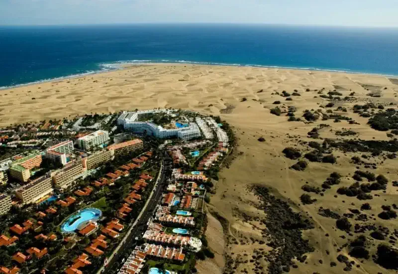 The Maspalomas dunes, where the Canarian Camino begins
The history of the Camino in Gran Canaria
According to oral tradition, in the early 15th century a group of Galician sailors survived a fierce storm. In gratitude, they carried an image of Santiago "el Chico" (Saint James "the Younger") from Maspalomas up to the highlands of Tirajana to build him a chapel, of which today only the memory remains.
To get there they followed the paths that the island's transhumant shepherds had walked for generations in search of pasture. Today that route is known as the Camino or Ruta de la Plata (careful — not to be confused with the Vía de la Plata, which runs from Seville to Santiago).
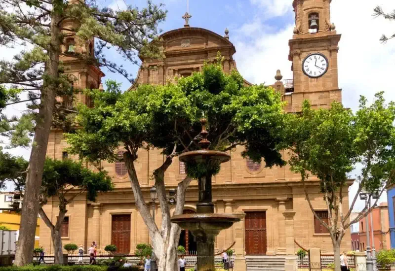 The Temple of Santiago de los Caballeros, in Gáldar
That devotion to the Apostle, shared by the conquerors who arrived from the mainland, led to the building of the Templo Matriz de Santiago de los Caballeros in Gáldar in 1486, although the Jacobean seat had already existed since 1482. It is the oldest Jacobean seat outside mainland Europe.
The route: from dunes to volcanoes
The Camino starts on the coast, at the Maspalomas dunes, and climbs north between the Tirajana and Tejeda calderas and the volcanoes at the island's center — a cultural landscape declared a UNESCO World Heritage Site. On the final stretch it descends to the Montaña de Gáldar, back on the north coast.
That's why it's also known as the "Route Among Volcanoes": in just 66 kilometers you pass through coastline, ravines, pine forests, mountains and volcanoes.
It's also rich in heritage along the way. Highlights include the historic center of Gáldar, a Site of Cultural Interest, the Arteara necropolis, the Cueva Pintada Museum and Archaeological Park, and the Maspalomas Lighthouse. Don't miss the local food either, especially the queso de flor (flower cheese), which holds Protected Designation of Origin status.
The stages and waymarking
It can be done in two long stages, but to enjoy it properly we suggest splitting it over three days:
- Stage 1: Maspalomas – Tunte (28 km).
- Stage 2: Tunte – Cruz de Tejeda (17 km), with a possible variant between El Garañón and the village of Tejeda.
- Stage 3: Cruz de Tejeda – Gáldar (21 km).
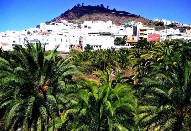 The Gran Canaria highlands, right on the Camino
To find your way, just follow the waymarks of three of the island's trails: S-54 (Maspalomas – Tunte), S-50 (Tunte – Cruz de Tejeda) and S-01 (Cruz de Tejeda – Gáldar). If you want to see it in detail, here's the full route on the map.
Practical tips for the trip
- When to go: the island's climate makes it walkable year-round. In summer it's best to start early, especially on the first stage, the hottest one. In winter, the highlands can be cold and foggy, so bring something warm.
- Difficulty: this isn't a flat walk. You start almost at sea level and climb to nearly 1,500 meters at Cruz de Tejeda, before descending toward Gáldar. You'll need a reasonable level of fitness and good hiking boots.
- Getting there and back: from Gran Canaria airport there are guaguas (as local buses are called in the Canary Islands) to Maspalomas, and from Gáldar there are also buses back to Las Palmas de Gran Canaria.
- Where to sleep: in Tunte and around Tejeda there's rural accommodation and hotels, but rooms are limited, so it's worth booking ahead.
- Water and food: there are long stretches between villages with no services. Carry plenty of water and something to eat.
Its own pilgrim passport and Jubilee in Gáldar
This route has been carefully looked after by local authorities: it has historical grounding, heritage value, infrastructure and waymarking. And just like the official routes that reach Santiago, it has its own pilgrim passport, which you can get at several points on the island, including San Bartolomé de Tirajana, Tejeda, Gáldar and Las Palmas de Gran Canaria.
The Church has also protected it throughout history. In 1965, Pope Paul VI granted those who visited the church of Santiago de Gáldar the same privileges as those granted during the Compostela Holy Year. In 1993, Pope John Paul II made these Jacobean graces permanent.
So every time there's a Jacobean Holy Year in Santiago de Compostela, there's one in Gran Canaria too, and by walking this Camino you can earn the Jubilee indulgence.
And afterward, why not carry on to Santiago?
Whether you live in Gran Canaria or not, this island Camino is a one-of-a-kind experience. And if it leaves you wanting more, from Cádiz you can connect with the Andalusian Jacobean routes or choose any of the routes that reach Santiago. Whenever you're ready, we can help you organize your Camino at your own pace, with your accommodation booked and your luggage moved from stage to stage.