


Attention: Route not available for walking between November 1 and January 15
The Winter Way was established as the route traditionally used by pilgrims to avoid the snows of O Cebreiro during winter months. A solitary and little-traveled path that penetrates Galicia through the Sil River valley and traverses important towns in the Ribeira Sacra until reaching Santiago de Compostela.
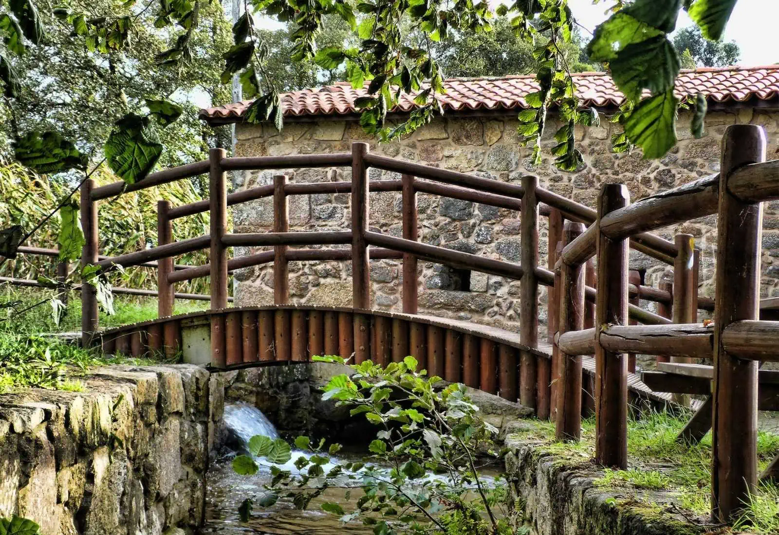
It is the perfect route for all those pilgrims who wish to escape the overcrowding of other routes. It will allow you to discover places of great scenic beauty and historical interest such as the Templar castle of Ponferrada, the Roman exploitation of Las Médulas, medieval bridges, riverside walks, wineries, and hundreds of vineyards that create a unique setting.
Photos

Accommodations
- Most popular
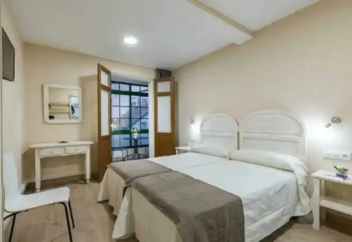
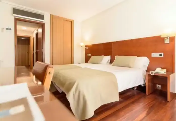
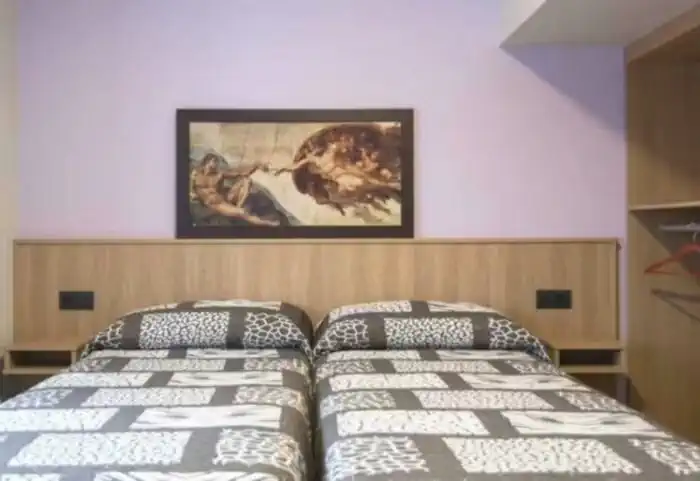
Private comfort (Guesthouses, rural houses and small hotels)
The perfect balance between charm and comfort. Guesthouses, B&Bs and country houses await you in the villages along the Camino with private rooms, private bathrooms, TV, and daily cleaning service. Simple and welcoming, they are the ideal place to truly rest and enjoy the peaceful rural essence that only the Camino can offer.
Services
Included in all our routes
- Accommodation
13 days / 12 nights
- 13 days / 12 nights accommodation
- Complete documentation (Dossier and material for the Camino)
- Luggage transfer during the stages. (1 piece per person max 15 kgs)
- On-the-road emergency telephone assistance
- Pilgrim's Credential
- Travel insurance
Optional
- Supplement for single room
- Extra night in Santiago de Compostela
- Breakfast
- MP (Breakfast and dinner)
- Cancellation Insurance
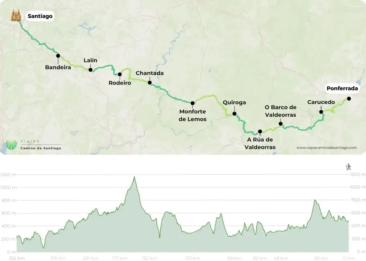
Map of the Winter Way
Stages
- day 1
Arrival at Ponferrada
- day 2
Stage 1. Ponferrada - Carucedo (20 km)
We leave Ponferrada heading towards Carucedo to immerse ourselves in the surroundings of the famous Médulas. We exit the city crossing the bridge over the Boeza River and begin the ascent up Mount Pajariel. After a few kilometers of walking, we will arrive at the town of Toral de Merayo, where it is worth taking a break to visit the hermitage of Santo Cristo and the church of San Salvador.
Once we resume our march, we will cross the towns of Villalibre de la Jurisdicción, Priaranza del Bierzo, and Santalla del Bierzo. In Villalibre, we can visit the Romanesque hermitage of Vera Cruz, while in Santalla we will have the opportunity to enjoy stunning views of the Bierzo valley from its viewpoint.
The next point of interest on our route is the hermitage of the Virgen del Carmen de Rioferreiros. From here, we continue towards Borrenes to finally reach our destination in Carucedo.
Things to consider
If you feel up to it, it is possible to organize the day to arrive in Carucedo by midday. This way, you can spend the entire afternoon getting to know the natural setting of Las Médulas, located just 5 minutes away by transport from the center of Carucedo.
Places of interest
- Castle of the Templars (Ponferrada)
- Basilica of la Encina (Ponferrada)
- Hermitage of Santo Cristo del Nogaledo (Toral de Merayo)
- Castle of Cornatel (Priaranza del Bierzo)
- Viewpoint of Santalla
- Romanesque church of Carucedo
- Lake of Carucedo
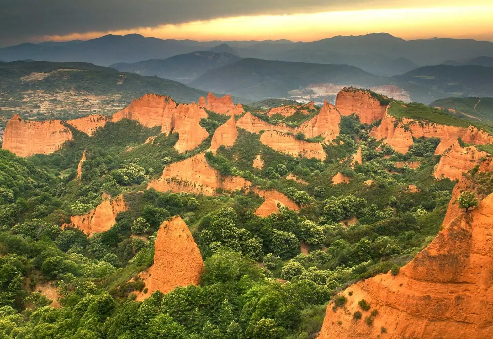
- Las Médulas
Typical dishes
- Botillo del Bierzo
- Roasted pepper croquettes
- Chestnut and cheese crepes
- Maragato stew
- Blood sausage and León sausages
- Game meat
- Roasted Bierzo peppers
- Reineta apple and conference pear
- day 3
Stage 2. Carucedo - Barco de Valdeorras (28 km)
Today we say goodbye to Carucedo and its lake to pass again through Las Médulas, this time on foot, heading towards O Barco de Valdeorras. From here, we continue towards Puente Domingo Flórez following the Royal Way. Once we have arrived, we will follow the course of the Sil River and then cross it upon entering Quereño.
From this point, we have two options to continue to Barco de Valdeorras: we can follow the Rubiá variant, which takes us into the Enciña da Lastra mountain range and is considerably longer, or continue along the course of the Sil River. We recommend taking the second option, which passes through Pumares, Sobradelo, and Entoma until we reach the center of O Barco.
Things to consider
This border area between León and Ourense was subjected to strong Roman pressure due to the richness of its mineral resources. The Romans were great lovers of wine, which explains the deep-rooted winemaking tradition of the region that continues to this day.
Places of interest
- Chapel of San Roque – Puente Domingo Flórez
- Archaeological remains of the XVIII Way of the Antonine itinerary
- Roman bridge of Entoma
- Monastery of Xagoaza – O Barco
- Fortress tower of O Castro – O Barco
Typical dishes
- Botelo (typical sausage of the area)
- Lacón with grelos
- Roast kid
- D.O. Valdeorras wines
- day 4
Stage 3. Barco de Valdeorras - A Rúa de Valdeorras (14 km)
We begin the route between O Barco de Valdeorras and A Rúa de Valdeorras, walking through beautiful landscapes of vineyards. We will pass through places such as Arcos and the central nucleus of Vilamartín de Valdeorras, where we can visit wineries located in the ancient caves historically created by the search for gold.
From this point, we will continue towards A Rúa, the site of the supposed oldest settlement nucleus in Valdeorras: the Forum Cigurorum, home of the Cigurros or Egurros. These ancient inhabitants, located in the current province of Ourense, maintained a lifestyle based on the mining activity typical of the region. Like other Asturian towns, they usually lived in castros, among which the aforementioned Forum Cigurorum stands out.
Things to consider
The most interesting monument of the stage is somewhat away from the main route: the emblematic bridge of A Cigarrosa, of Roman origin. This structure features four pointed arches and one semicircular arch. We can visit it by taking a 1.4 km walk from the center of A Rúa, continuing straight along Progreso street.
Places of interest
- Roman bridge A Cigarrosa (A Rúa de Valdeorras)
- Church of San Esteban de A Rúa (A Rúa de Valdeorras)
- Casa Grande de Fontei (A Rúa de Valdeorras)
Typical dishes
- Botillo
- Empanada de costrelas
- Tortas de roxóns
- Lacón con grelos
- Roast kid
- D.O. Valdeorras wines (Godello and Mencía)
- day 5
Stage 4. A Rúa de Valdeorras - Quiroga (26.3 km)
Today we leave A Rúa de Valdeorras to head towards Quiroga. We will cross the historic Roman bridge of A Cigarrosa in the direction of the town of Petín. Subsequently, our path will continue for several kilometers following the layout of the national road that leads to Monforte de Lemos.
Upon reaching the height of Albaredos, we will advance along one side of the village towards the church of Santa Bárbara to head towards Montefurado. This town owes its name to the impressive engineering work carried out in the 2nd century, when the Romans altered the course of the Sil River to facilitate gold mining operations.
This historical milestone involved the perforation of the mountain to divert the river, hence the name "Monte furado" (hollowed mountain). From this point, we will continue towards O Ermidón and proceed to Bendilló, passing through Os Novais and O Castelo before reaching our stage end in Quiroga.
Things to consider
The stage between A Rúa de Valdeorras and Quiroga features technical sections, particularly challenging for pilgrims on bicycles carrying panniers. The ascent from Montefurado to Ermidón and the descent from Bendilló are notably difficult. For them, the best recommendation is to follow the LU-933 road, which offers a pleasant environment and has very little traffic.
Places of interest
- Roman tunnel of Montefurado
- Church of San Miguel (Montefurado)
- Oil mill of Bendilló
- Castle of Novaes
- Geological Museum (Quiroga)
- Riverwalk of Quiroga
Typical dishes
- Local meats
- Oil from Quiroga (unique in Galicia)
- Wine D.O. Ribeira Sacra
- Honey from Quiroga
- day 6
Stage 5. Quiroga - Monforte de Lemos (35.4 km)
We will begin walking from Quiroga towards Monforte de Lemos. The first point of interest we will encounter is San Clodio, from where we will continue to Nocedo and then arrive at Carballo de Lor.
From here, we will continue walking along natural paths, crossing valleys and beautiful landscapes until we reach Barxa de Lor. From this point, we will ascend to the summit of O Castro da Lama, the site of an ancient Roman gold mining operation, and then continue our climb towards Castroncelos.
The next reference point is A Pobra do Brollón, a perfect place to rest and regain strength in the recreational area next to the Saa River. After the break, we will head towards Cereixa, passing by a wayside cross with a carving of Santiago Peregrino before starting the ascent to Alto da Serra.
Once at the top, we will be very close to our destination. The final push involves descending the Moncai mountain to Reigada, from where there are only 3 flat kilometers left to finish the day in Monforte.
Things to consider
If the stage seems excessively long, you can split it into two by staying overnight in A Labrada or in the rural accommodations of Salcedo. Upon arriving in Monforte, you will discover the culture of "tapeo": it is very common to receive free tapas with your order. Additionally, if your visit coincides with the Cume Tapas festival, you will be able to taste exclusive creations of the local cuisine.
Places of interest
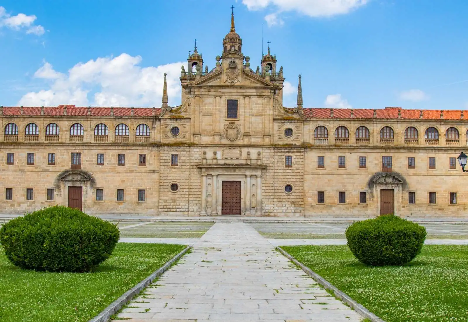
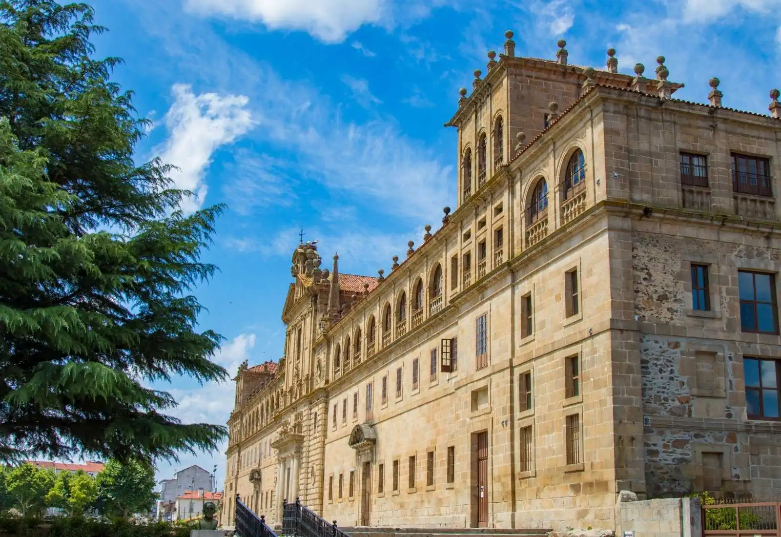
- Benedictine Monastery of San Vicente del Pino
- Keep Tower (Monforte de Lemos)
- Galicia Railway Museum
- Sacred Art Museum
- School of the Calasanz Fathers
- Ponte Vella (Monforte de Lemos)
Typical dishes
- Octopus á feira with Monforte potatoes
- Empanada de iscos (chorizo and bacon)
- Trout and eels (in season)
- Tetilla cheese
- Larpeiras from Monforte and Bicas
- D.O. Ribeira Sacra wine
- day 7
Stage 6. Monforte de Lemos - Chantada (29.7 km)
Today we leave Monforte de Lemos and head towards Chantada, crossing the Cabe River via the historic medieval bridge of the city. Our first point of reference on the way will be Pantón, which we will reach after crossing the Carboeiro stream and visiting the church of San Salvador de Moreda.
We continue our journey passing in front of the majestic pazo of O Reguengo, where its 15th-century chapel stands out. From here, the route takes us along ascending dirt tracks and paths that traverse the areas of Castrotañe, Piñeiro, and Castillón. Alternating stretches of asphalt with uphill and downhill trails, we will continue along the "Camiño Grande" until we reach A Barxa.
Throughout our journey, we will cross the municipality of O Saviñao, specifically passing through the parishes of San Lorenzo de Fión, Diomondi, Rendal, and Fontela. The path continues among meadows, oak groves, and beautiful rural settings of great scenic value.
The final stretch of the stage leads us downhill towards the Miño River through the famous "Cóbados de Belesar", following the remnants of an ancient Roman road that zigzags towards the reservoir. After crossing the Miño River, we will begin a final ascent that, after passing through several small population centers, will take us directly to Chantada, our stage end.
Things to consider
You are in the heart of the Ribeira Sacra, an area famous for its heroic viticulture. You will find numerous small wineries where you can stop to taste their exquisite varieties of wines with Denomination of Origin.
Places of interest
- Church of Santa María de Camporramiro
- Belesar Bridge
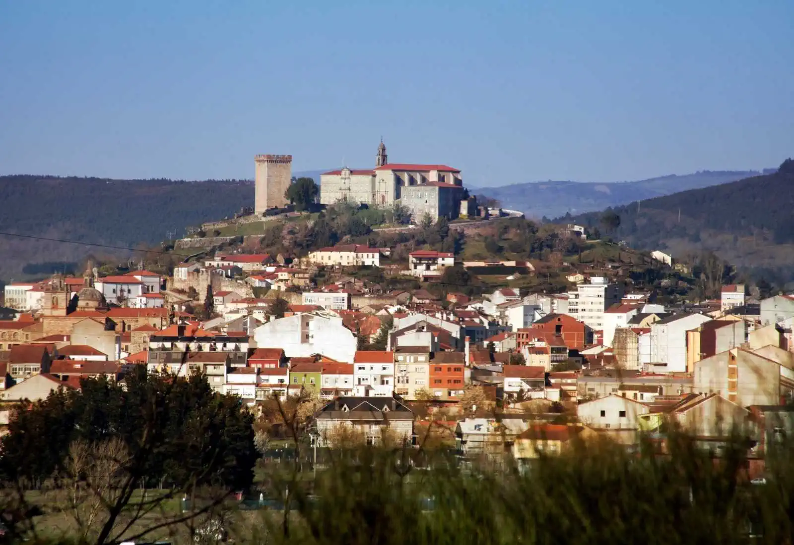
- Fortress of Chantada
- Church of San Cristóbal de Fornas (Chantada)
Typical dishes
- Chestnuts (in all their varieties)
- Red fruits: strawberries, raspberries, blackberries, and cherries
- Maria cookies
- Beef and Galician veal
- Wines from Ribeira Sacra (especially Mencía and Godello)
- day 8
Stage 7. Chantada - Rodeiro (25.4 km)
On today's stage, we bid farewell to Chantada as we head towards Rodeiro. We will leave the town via a local road, and the first villages we will pass through are Centulle and Casasoa. Our path winds through trails and dirt roads amidst the beautiful landscapes of the Galician interior. After crossing a local road again, we continue along trails until we reach the place of Boán.
Subsequently, the path leads us to the small village of Lucenza. From here, we will walk along a succession of dirt paths and paved tracks with a slight ascent until we arrive at Penasillás, a good place to stop and rest to regain strength for the remainder of the stage.
Once we resume our march, we will encounter the highlight of the day: the ascent to the hermitage of Our Lady of O Faro. The path takes us along forest tracks with a steep upward slope until we pass by the "Path of the Virgin," which leads us to the hermitage, reaching an elevation of just over 1000 m. The panoramic views of the landscape from the summit will make the effort worthwhile.
After the climb, it is time for the well-deserved descent. We will follow the signs to a large monolith that marks the way to the Pazo de Camba. From here, we continue through the Hermida valley until we reach the river and subsequently pass through the place of Mouriz before reaching our stage end in Rodeiro.
Things to consider
From Penasillás, there is the Mouricios variant, well marked and 1.2 km shorter than the official route. This path skirts the Sierra do Faro to the east and is a much simpler alternative; however, by taking it, we will miss the visit to the hermitage of O Faro and the spectacular views from the mountain.
Places of interest
- Hermitage of Our Lady do Faro
- Church of Santiago de Requeixo
- Pazo de Camba
- Church of San Vicente de Rodeiro
- Porta de Arcos – Rodeiro
Typical dishes
- Octopus á feira
- Galician stew
- Ham with turnip tops
- Game meat (mainly wild boar)
- Artisanal empanadas
- Roasted chestnuts or in syrup
- day 9
Stage 8. Rodeiro - Lalín (23.5 km)
We leave Rodeiro taking the local road towards Lalín. After reaching A Ponte, we leave behind the asphalt to walk through charming wooded paths and dirt tracks. Following intermittently the course of the Arnego River, we will pass through the places of Penerbosa, A Puza, A Penela, and Eirexe de Pedroso.
From Eirexe de Pedroso, we continue along an asphalted stretch until we reach the place of Laxas, famous for the quality of its trout. After crossing a stone bridge and continuing briefly along the road, we will divert towards the Val do Boi to begin a gradual ascent towards the Coto de Anta.
Following the signs, we will reach the stream of O Rego de Ribadeiro, from where we will advance along a charming rural path to Palmaz. Finally, we will cross with extreme caution the road that connects Lalín with Monforte to continue towards Lagazós, located near our destination.
Things to consider
We will not find many services during this day, so it is advisable to leave with enough water and food. In this stretch, your route merges with the Sanabrés Way and with the last stretch of the Silver Way. We are very close to reaching the goal, let’s go!
Places of interest
- Church of San Xulián de Pedroso
- Medieval Bridge of Pedroso
- Romanesque Church of San Martiño (Lalín de Arriba)
- Municipal Museum Ramón María Aller
- Chapels of Dolores, Montserrat, and San Antón
- Church of Goiás
- Statue of the pig (Symbol of local gastronomy)
Typical dishes
- Cocido de Lalín (The star dish of the region)
- Lacón with grelos
- Artisanal sausages
- Meat products from "La Lalinense"
- Octopus á feira
- day 10
Stage 9. Lalín - Bandeira (17 km)
- day 11
Stage 10. Bandeira - Santa Cruz de Rivadulla (15 km)
Today you will leave Bandeira by the national road to continue along a dirt track to Dornelas, with its magnificent church. The route continues alternating road and dirt track until San Miguel de Castro and Taberna do Seixo, where you can stamp your credential and recharge your batteries before starting the descent to Ponte de Ulla. From here you will follow the same national road to the river Ulla, stopping at the chapel of Nuestra Señora de Gundián, of great devotion in the area. After crossing the old bridge over the river Ulla, you will say goodbye to the province of Pontevedra and enter A Coruña through Santa Cruz de Rivadulla, where the stage will come to an end. In Santa Cruz de Rivadulla your path crosses one of the most popular routes for lovers of vegetation during the winter season: the route of the camellias. The pazo of Santa Cruz de Rivadulla has one of the most exotic and interesting gardens in Galicia. Of course, one of the jewels of the botanical walk is the camellia and its many subspecies, how many will you be able to distinguish? - day 12
Stage 11. Santa Cruz de Rivadulla - Santiago de Compostela (22 km)
Today we recommend leaving early to make the most of the day in Santiago. During the first three kilometres of the stage you will walk under lush forests until you reach Lestedo, where you can take a detour to the Pico Sacro, which has impressive panoramic views of the area. After reaching A Susana, you will be in the municipality of Santiago. The Way enters the city through the Sar district and, after crossing its Roman bridge, goes up through Castrón Douro to enter the historic centre through the Mazarelos Arch. Savour your last steps through the old town of Compostela and enjoy your triumphal entry into the Plaza del Obradoiro. Congratulations! You are in Santiago! Feel happy and proud to have completed your Camino de Santiago. Now we just need to pick up the Compostela certificate and enjoy an incredible day getting to know the Galician capital. - day 13
End of the Camino
After arriving... End of the Camino
Frequently Asked Questions
-
What is the route of the Winter Way like?
The Winter Way offers a route full of breathtaking scenery and moderate challenges. This alternative route crosses a variety of territories, from the reddish formations of Las Médulas in El Bierzo to the terraced vineyards of the Ribeira Sacra, where it skirts the spectacular canyons of the river Sil. Along its 260 km, the route crosses the Sierra de O Courel, with dense forests and mountains reaching an altitude of 1200 metres, providing some challenging gradients but incredible views. As you descend into the Galician valleys, the landscape softens with fields and traditional villages until you reach Santiago de Compostela. -
What kind of weather can be expected on the Winter Way?
The Winter Way, which crosses northwestern Spain, offers a varied climate throughout its stages, with significant differences depending on the season and altitude of the areas it crosses. In general, the climate that can be expected on this route is as follows:- Winter: In mountainous areas, such as the sierras of O Courel and El Bierzo, it is common to find low temperatures, snowfall and frost. Rain is also frequent, especially in Galicia, so it is advisable to be well equipped for the cold and damp.
- Spring and autumn: These are the best times to walk the Winter Way, with moderate temperatures and milder weather. However, in spring, rain can be frequent, especially in Galicia. During autumn, mornings and evenings can be cool, but days are usually pleasant.
- Summer: Low-lying areas and valleys may experience high temperatures during the summer, especially in the regions of El Bierzo and the stretches near Ourense. However, mountainous areas can offer cooler weather, although it is important to be prepared for the heat in the sunnier and drier stretches.
-
What difficulties does the Winter Way present?
The Winter Way, a less travelled alternative to the French Way, is known for its beautiful scenery, and arises as an alternative to the passage of O Cebreiro. However, it presents some difficulties that pilgrims should be aware of:- Mountainous terrain: The Winter Way crosses mountainous areas, such as the mountain ranges of O Courel and El Bierzo, with steep slopes that can be demanding, especially for pilgrims with little experience in mountain routes. The constant ascents and descents require good physical preparation.
- Changeable weather: Despite its name, this route can be walked all year round, but in winter the weather conditions can be more severe, with cold, snow and ice in the higher areas. During the summer, the heat can be intense in certain areas, especially in the valleys.
- Limited infrastructure: Unlike more popular routes such as the French Way, the Winter Way has fewer hostels and services along its route. It is essential to plan the stages well and book accommodation in advance, especially at peak times.
- Less signage: Although it has improved in recent years, the signage on some sections of the Camino de Invierno may not be as clear as on other busier routes. Pilgrims should be attentive to the markings and use maps or support applications.
-
How long is the Winter Way?
The Winter Way is a route of about 260 km divided, generally, into 11 stages. Therefore, divided in this way, its duration is 11 days to complete the entire Camino on foot. Each stage would be the distance you walk in one day, from the starting point to the end of the walk, where you will spend the night. The stages can vary in distance and difficulty, and it is important to note that they can be adjusted according to your pace and physical condition. Some pilgrims choose to divide certain long or hard stages, or lengthen those that are shorter or easier to walk. It all depends on having a place to sleep. -
How many km is the Winter Way?
The total km of the Winter Way are about 260 km from Ponferrada, its beginning. Keep in mind that this distance may vary depending on the possible variants or complementary and alternative paths that the pilgrim decides to take during the route.

Reviews
Bea Gomez
Sergio Navarro
Alvaro Moreno
Javier Ruiz
David Torres
Enrique Gallego Viana
Aitana Robles Cuenca
Jorge Villarroel Castaño
Miriam Salcedo Vega
Carlos Benavente Garrido