


Attention: Route not available for walking between November 1 and January 15, 2025
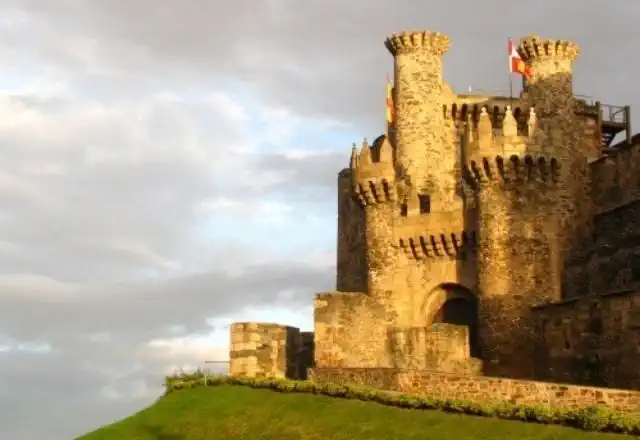
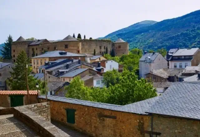
Ponferrada is the capital of the region of Bierzo, the best prelude to Galicia. Emerged under the protection of the Camino de Santiago in the eleventh century, it has become throughout history an essential site for the French Way, so the former Templar capital will be the best starting point for your Camino. In this stretch of the French Way from Ponferrada to Santiago, you will discover a lot of similarities between the Leonese region of El Bierzo and the Galician community, both in its culture and nature as well as in its language and gastronomy.
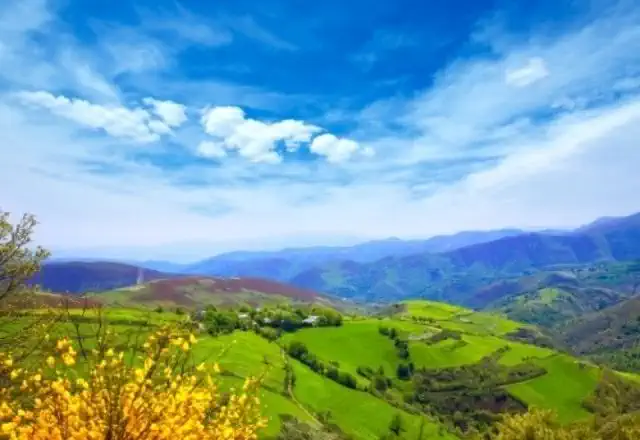
You will discover medieval villages, cathedrals, Templar castles and beautiful natural landscapes such as the Bierzo Valley and O Courel.
Entering the ancient forests of chestnut and oak trees, you will make your way to Compostela. Numerous hórreos, castros, hermitages and cruceiros will guide you through the small villages that make up the deepest Galicia, where delicious delicacies are grown and worked that will become that comforting prize at the end of each stage.
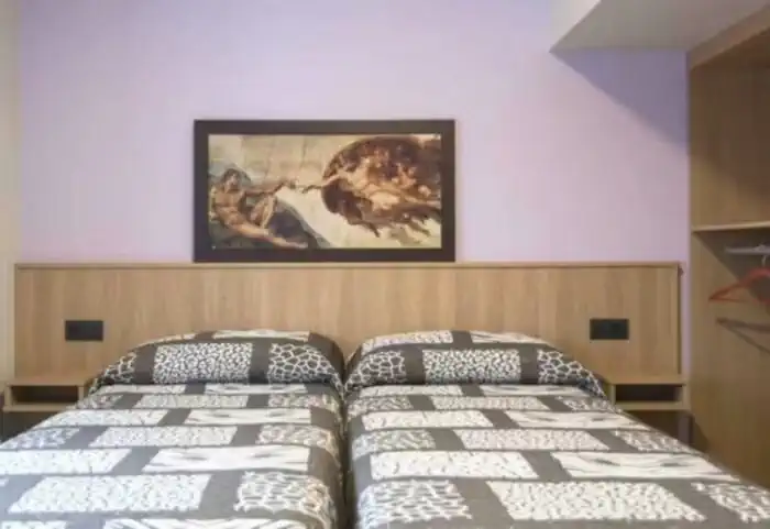
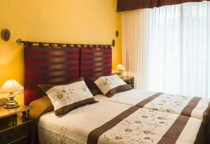
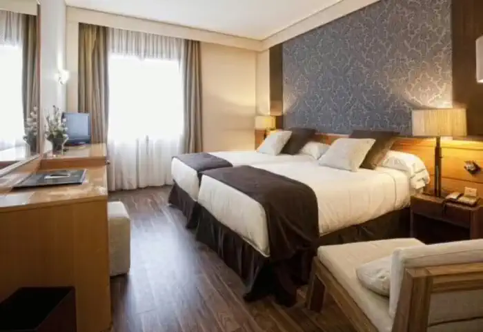
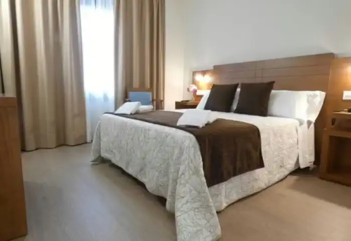
Photos
Accommodations
- Most popular
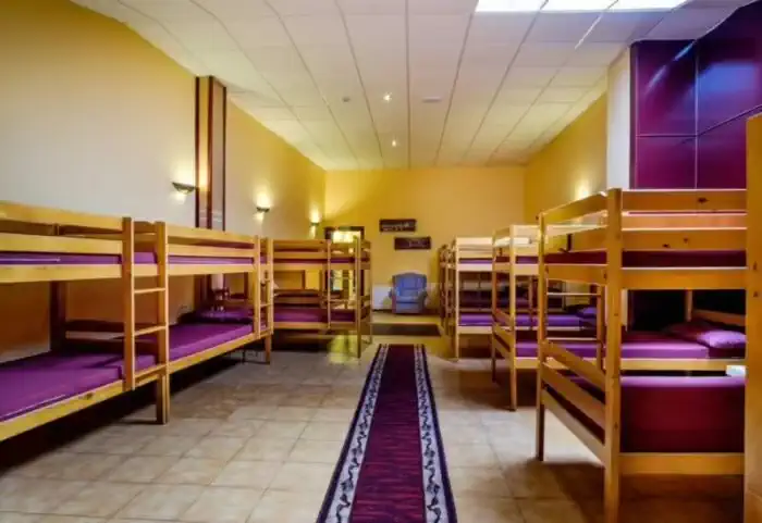
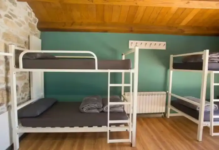
Basic accommodation (Private hostels)
423 €
The most authentic accommodation on the Camino. Hostels are the ideal option for those traveling on a tight budget, solo pilgrims, or anyone who wants to experience the Camino de Santiago in its purest form. They are the perfect place to socialize, share stages, and connect with fellow walkers along this ancient route.
- Most popular
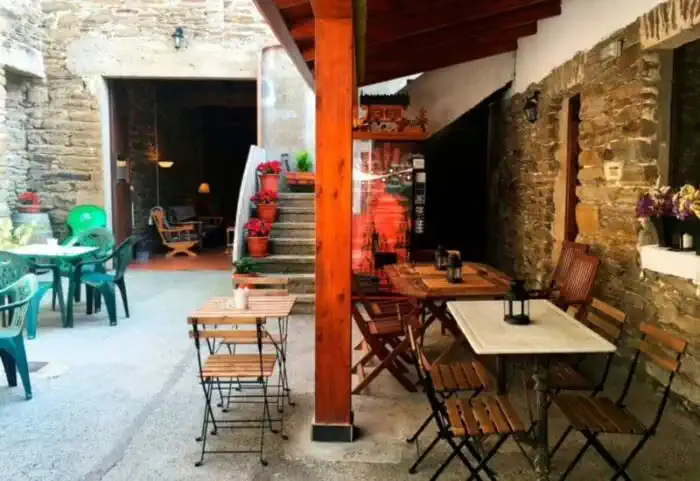
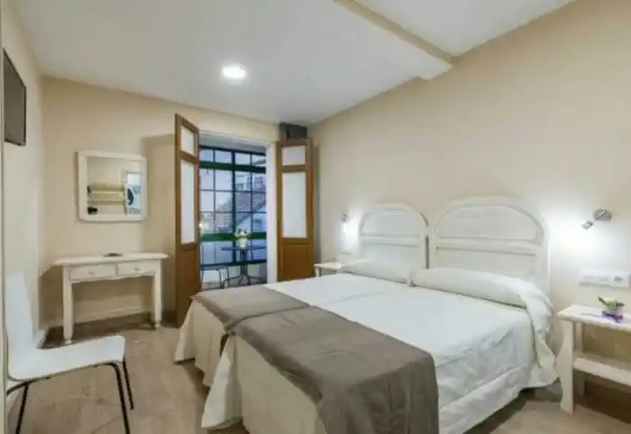
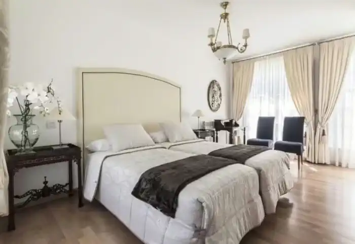
Private comfort (Guesthouses, rural houses and small hotels)
768 €
The perfect balance between charm and comfort. Guesthouses, B&Bs and country houses await you in the villages along the Camino with private rooms, private bathrooms, TV, and daily cleaning service. Simple and welcoming, they are the ideal place to truly rest and enjoy the peaceful rural essence that only the Camino can offer.
- Most popular
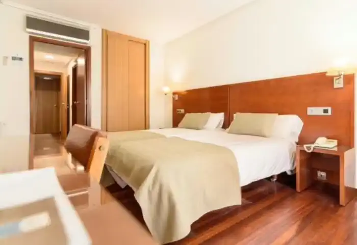
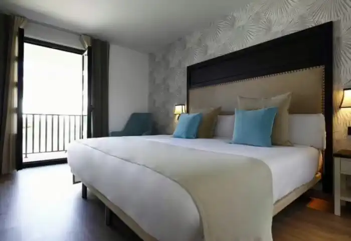
Superior accommodation (Charming hotels)
967 €
For those who want to reach each stage and recover in complete comfort. The best hotels and manor houses along the Camino de Santiago, featuring elevators, restaurants, private bathrooms, and quality services. Gardens, terraces, and swimming pools to end each day the way a pilgrim who values well-being deserves.
Services
Included in all our routes
- Accommodation
11 days / 10 nights
- Complete documentation (Dossier and material for the Camino)
- Luggage transfer during the stages. (1 piece per person max 15 kgs)
- On-the-road emergency telephone assistance
- Pilgrim's Credential
- Travel insurance
Optional
- Supplement for single room
- Extra night in Santiago de Compostela
- Breakfast
- MP (Breakfast and dinner)
- Cancellation Insurance
Map of the French Way from Ponferrada to Santiago de Compostela

Stages
- day 1
Arrival at Ponferrada
The capital of El Bierzo is a great place for a relaxing day before starting your French Way from Ponferrada. So you know, enjoy. You are in the land of the Templars and you will have the opportunity to visit one of the best preserved castles of this medieval order. The Templar Castle of Ponferrada is the main tourist attraction of the city and can be visited almost 100%. And if you like museums, there are four not to be missed: the Energy Museum, the Railway Museum, the Radio Museum and the Bierzo Museum. And after the cultural visits… what better than enjoying a good dinner with products from the region. The best cecina of Castilla y León is here! - day 2
Stage 1. Ponferrada - Villafranca del Bierzo (24.2 km)
The familiar yellow arrows of the Camino lead us through the ancient streets of the capital of Bierzo, up to the walls of the famous Castillo del Temple. We leave Ponferrada, after crossing the bridge over the river Sil. The current route avoids the industrial areas by turning off to the northwest towards the small towns of Columbrianos and Fuentes Navas, continuing towards Camponaraya. Shortly after passing this last town, the reference point is the wineries of the Cooperative of El Bierzo, where you take a dirt track on the left that crosses the A-6 motorway again and after a hill the road runs through pleasant fields of vines to the capital of cherries: Cacabelos. - day 3
Stage 2. Villafranca del Bierzo - O Cebreiro (27.8 km)
We leave Villafranca del Bierzo towards O Cebreiro crossing the river Burbia and we find a fork with two options: The historical road or the mountain road, both of them join in Trabadelo.
Option A) Historic route: We continue straight on along a secondary road that leads to the national road, with hardly any traffic. We go along the hard shoulder next to the river Valcarce and we reach Pereje by a detour on the right. We cross Pereje by the main street and continue without complications until Trabadelo.
Option B) Mountain path: We continue to the right and start a steep climb. This path has 400 meters of positive slope and is 1.5 km longer than the historical route. Before starting the steep descent to Trabadelo, we pass through the small village of Pradela. This option is not suitable for cyclists.
We leave Trabadelo and pass several times over the gigantic viaducts of the A-6. After 2 kilometres the Camino ends, in a very dangerous way, right at one of the exits of the busiest motorway. We recommend extreme caution. In Portela de Valcarce, we find a service station with cafeteria where we can make the first stop of the day. It also has a small supermarket where they sell typical products from El Bierzo.
We leave Portela behind us and after a long stretch walking along the left-hand side of the N-VI, we reach a crossroads where we must turn off towards Ambasmestas, from where we continue straight on to Vega de Valcarce, where we find all the services.
The path continues gently uphill until it reaches the villages of Ruitelán and Las Herrerías. At the latter, we pass the fountain and come to a fork that leads either to the Molino Verde or to La Faba, which is the option we should take. As soon as you cross the wooden bridge the climb becomes steeper and steeper. We leave the road and turn off onto a path that gives us a break as we cross the Refoxo stream. Now we start an important zigzagging ascent that leads us to the next high point, we arrive at La Faba.
We leave the village along an ancient Roman road and contemplate the beautiful landscape of Atlantic forests in the distance. We continue along a mountainous stretch where there is hardly any vegetation and we approach Laguna de Castilla, the last village in Castilla y León on the French Way. Here there is a restaurant and a hostel where we can stop. We leave La Laguna and continue in the same direction, advancing halfway up the slope of a mountain range and slowly gaining altitude.
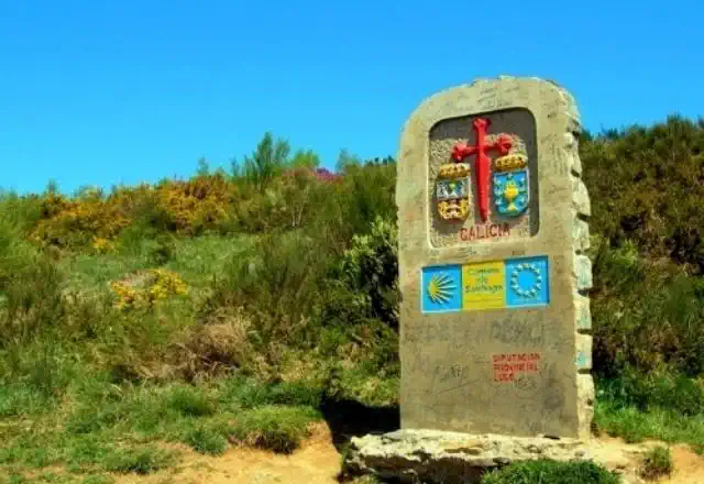
We enter, at last, in Galicia. A stone cairn marks the entrance to the Autonomous Community and indicates that we only have 152 km to Santiago de Compostela.
The last effort takes us past an uninhabited stone house. And so we arrive at the Gaiteiro monument, which recalls a medieval legend that tells of a German pilgrim who got lost in the mountains and was able to reach this place guided by the sound of a bagpipe.
Once at the top, the views are spectacular. We pass in front of a crossroads, constructions that once marked the crossroads and with which we must become familiar from now on.
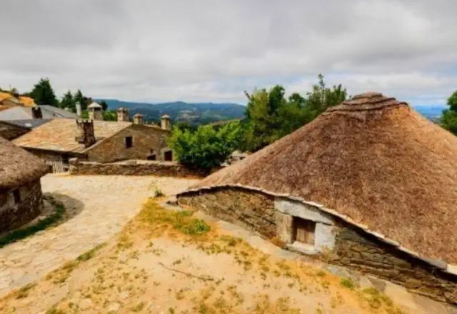
The path takes us to the end of the stage at the back of the church of Santa María la Real. We arrive to O Cebreiro and we enjoy a magical day among pallozas, and cobbled streets that keep secrets of important legends and miracles.
To consider
The stage between Villafranca del Bierzo and O Cebreiro has several points to take into account when preparing the stage. On leaving Villafranca del Bierzo, we find the Pradela variant, also known as the "mountain road", well signposted. Despite being 1.5 km longer, it is a perfect option for pilgrims seeking solitude and silence. The path crosses spectacular Atlantic forests and gives us beautiful panoramic views of the Valcarce valley. This option is not recommended for cyclists.
In O Cebreiro accommodation is scarce and is usually full in high season. We recommend getting information in advance or spending the night in one of the villages along the way, such as Las Herrerías or Laguna de Castilla, which has a hostel.
Places of interest
- Church of San Juan Bautista - La Portela de Valcarce
- Church of Nuestra Señora del Carmen - Ambasmestas
- Castle of Sarracín - Vega de Valcarce
- Church of San Julián - Las Herrerías
- Pallozas de O Cebreiro - O Cebreiro
- Church of Santa María la Real - O Cebreiro
Typical dishes
- Cheese D.O. O Cebreiro
- Chestnuts
- Galician stew
- Slaughter by-products
- Galician Empanada
- Meat from autochthonous livestock
- day 4
Stage 3. O Cebreiro - Triacastela (20.8 km)
We leave O Cebreiro towards Triacastela, leaving behind the hostel and we follow a dirt path that goes up the Pozo de Area mountain, until we gain 100 metres of height difference and reach 1,332 metres. From the top we can contemplate the spectacular panoramic view: to the north we can see the beautiful Navia valley and the imposing Picos de Ancares, to the south the extraordinary Sierra de O Courel.
We continue along a forest track until we reach Liñares, where we come across the church of San Esteban, a pre-Romanesque church dating back to the 15th century. VIII. From here the path begins to ascend over Os Ancares, taking us through a succession of ups and downs through forests. After reaching the Alto de San Roque (1,270 m) we can admire the bronze statue of a pilgrim fighting against the wind, created by the sculptor José María Acuña as a tribute to all the pilgrims who have overcome these passes.
After this ascent, we continue parallel to the road and reach the village of Hospital da Condesa. We continue our route through a complicated stretch due to the steep slopes until we reach Padornelo, where we find the church of San Xoán (15th century).
We leave the church behind and take strength for the hard ascent of the Alto do Poio which, at 1,337 metres, is the highest peak of the Way of St. James in Galicia. The ascent is hard, but it is compensated by the extraordinary views that give us strength to reach the top. Once we reach the top, we can take a well-deserved rest in the Albergue del Puerto bar.
We continue our stage descending along a dirt track to Fonfría, which preserves the old hospital for pilgrims Santa Catalina and in its parish church there is a 17th century gilded silver chalice.
We continue descending until we reach the villages of O Biduedo and Fillobal and As Pasantes in the municipality of Triacastela. We advance quickly, but not before stopping at an imposing centenary chestnut tree. We arrive at the small village of Triacastela and put an end to our first fully Galician stage.
To consider
If we do the stage in winter, we must be attentive to the weather, as we are in an area of frequent snowfalls that make it impossible for pilgrims to pass through. In case of snow it is recommended to follow the road to avoid getting lost.
Places of interest
- Church of San Estevo de Liñares
- High of San Roque
- Church of San Xoán do Hospital
- Alto do Poio
- Chapel of San Mamede - Triacastela
Typical dishes
- Cheese D.O. O Cebreiro
- Meat from autochthonous livestock
- Slaughter by-products
- Galician stew
- Chestnuts from Os Ancares
- Typical homemade sweets from Os Ancares
- day 5
Stage 4. Triacastela - Sarria (17.9 km)
We leave Triacastela and on our way to Sarria we are presented with two well signposted options: Samos or San Xil? Both options are of great interest, so the decision is yours.
Stage Triacastela - Sarria via San Xil (17.9 km)
After crossing the avenue Camino José Cela we take the detour on the right, which takes us to a local road towards San Xil. After passing A Balsa, along a steep slope we arrive at the Fonte dos Lameiros, with a large shell.
We continue up an asphalted track to San Xil, where we find a vending machine. We continue by road to the vicinity of the top of Riocabo, where we leave the asphalt to enjoy the most beautiful stretch of the stage. Lush forests of chestnut, oak and birch trees escort us down to the small village of Montán.
We continue down to Fontearcuda and cross the road to take a path that avoids the long detour of the road. We cross a river and continue along a path that comes back to the road. The centenary forests give way to green meadows, a landscape that we will see until Furela, where we can regain strength in the bar at the roadside.
We leave behind the village of Furela and enter, at last, the municipality of Sarria. We arrive at Pintín, where there is also a bar and a restaurant. We continue close to the road and we enter a wooded stretch that leads us to the public hostel of Calvor.
After passing Aguiada, Airexe and San Mamede do Camiño we start to see Sarria in the distance. We continue the last stretch through small slides, we pass by a campsite and we arrive at Sarria.
Stage Triacastela - Sarria through Samos (25 km)
At the fork we turn left towards Samos. In this variant we will have to be guided by the arrows, since we will not see cairns. We leave following the road until we reach San Cristovo do Real, where we can see the pazo of Lusío and the Casa Forte. We continue past the village of Renche, walking through a beautiful natural environment on the banks of the river Oribio. We arrive at Lastres and Freituxe, from where we go up to the parish of San Martiño, with a Romanesque church.
At the exit of San Martiño we cross the road through a tunnel and go straight down to Samos, enjoying an impressive panoramic view over the monastery. The spectacular Benedictine monastery of Samos is one of the oldest in Spain. It was founded in the 6th century and has 1500 years of almost uninterrupted monastic life. There are guided tours and you can get your credential stamped.
After the usual visit, we leave Samos by road and arrive at Teiguín, where we cross the road to take a track that goes up by hand. From here the path alternates paths with asphalted tracks and enters the small villages of Gorolfe, Veiga and Sivil. In the latter, we cross the river Sarria over a medieval bridge with a chapel.
We arrive at the concello of Sarria through the village of Perros, where we see a manor house. We cross the road to get to Aguiada, where we connect with the variant by San Xil and we do the last 4 kilometres to Sarria, our end of the stage.
To consider
The stage through San Xil is 6.6 kilometres shorter and crosses one of the most beautiful valleys of the French Way. If we decide to do this stage, it is advisable to leave with enough water and food, as we will not find many services where we can stock up.
On the other hand, the Samos stage is a little longer and goes through spectacular oak and chestnut forests on the banks of the river Oribio. Undoubtedly the most interesting part of the stage is the visit to the Benedictine Monastery of Samos, one of the most impressive monuments in Galicia.
Although it is a difficult decision, whichever path we take, we are sure to get it right.
Places of interest
- Church of San Cristovo do Real - Por Samos
- Benedictine Monastery of Samos - Around Samos
- Church of San Esteban - By San Xil
- Church of San Salvador - Sarria
Typical dishes
- Porco Celta
- Octopus á Feira
- Galician Veal
- Fried Milk
- Roscones
- Filloas of milk or blood
- day 6
Stage 5. Sarria - Portomarín (22 km)
We say goodbye to Sarria, with our minds set on Portomarín, along the rúa Maior and follow the arrows until we reach a viewpoint adorned with a cross, from where we have an excellent panoramic view of the town.
We pass by the Convent of La Magdalena and go down to the river Pequeño to cross the medieval bridge of Aspera. The path takes us through meadows and orchards, we cross the railway tracks and then a small stream over a wooden bridge. We climb up a steep slope to Paredes, where there is a pre-Roman fort.
From Paredes we arrive at Vilei, where we find a fabulous rest area with all kinds of vending machines and a stamp with which we can decorate our credentials. We continue on asphalt to Barbadelo, where we must visit the Romanesque church, paying attention to its façades and capitals.
We leave Barbadelo behind and continue along a path to the villages of Rente and Mercado da Serra, where we find a tavern. We continue straight on along a wooded path that leads us to the fountain of Pelegrín, the mascot of Xacobeo 93. We pass by the Marzán Mill and a little further on we cross the road to go through Leiman and Peruscallo. We leave the asphalt to advance to Cortiñas and Lavandeira.
Between stone walls and forests we reach Brea and Morgade, where we find the much photographed milestone of the 100 kilometres.
The road continues along the asphalted track to Mirallos, where we find the Restaurant O Mirallos, a spectacular place to eat. Next we can see the Romanesque church of Santa María, which was moved stone by stone from Ferreiros. After passing A Pena, we advance to O Couto and Rozas, where it is common to find cattle. We leave the asphalt to take a wooded path in slight ascent. We pass the village of Moimentos and arrive at Mercadoiro, where there is also a bar.
Then we visit Moutrás, and after an obligatory stop at the Peter Punk shop, we gently descend along the basin of the river Miño, interspersed with asphalt and dirt while we can see Portomarín in the background. Without further ado we reach Parrocha, we cross a road to Vilacha.
We now start a steep descent that takes us to the Miño river and the beautiful village of Portomarín, which shines with its white facades and grey roofs. After crossing the long bridge over the reservoir, we go up the steps of the chapel of A Virxe das Neves and enter the centre of the village. We finish the stage and enjoy a pleasant afternoon in one of the most beautiful villages of the French Way in Galicia.
To consider
The stage between Sarria and Portomarín has all the necessary services for the pilgrim. We won't have any problems with refreshments, every few kilometres we will find a great variety of places to rest and have a drink.
There is a belief that says that if we don't climb the Portomarín staircase in one go we will have bad luck for the rest of our Camino. So you know... No stopping!
Places of interest
- Church of Santiago de Barbadelo
- Church of San Xulián de Chorente
- Santa María de Ferreiros
- Church of San Nicolás - Portomarín
Typical dishes
- Eels
- Cake of Santiago (the best of all the Way of St. James)
- Aguardiente (Gastronomic feast)
- Stones of Portomarín
- day 7
Stage 6. Portomarín - Palas de Rei (25 km)
We leave Portomarín in the direction of Palas de Rei from the Church of San Nicolás and descend along the Rúa Compostela to the road, which we must cross to the right to continue along the hard shoulder of the road. We cross the river over a footbridge, turn right and enter a beautiful uphill path.
We cross the road at the height of a factory and pass by a couple of farms before arriving at Toixibó, where we will be struck by a beautiful granary. We continue ascending to Gonzar, where we can make the first stop to regain strength.
From here, the Way continues along a slope that climbs up to Castromaior with a final steep slope (about 600 metres). At this point it is worth taking a detour from the Camino to visit the Castro de Castromairor, a Celtic site that bears witness to the past of the Galician community.
We leave Castromaior looking for the road, which we cross to go along a path for a kilometre and a half until we reach O Hospital do Alto da Cruz. We leave the village crossing a bridge over the road, we turn left onto an asphalted track that leads us to Ventas de Narón, with a very well preserved temple.
We advance ascending until crowning the Ligonde mountain range, enjoying some stupendous panoramic views.
We follow the path that descends to A Previsa and Os Lameiros, where we will find one of the most famous and unique crosses in Galicia, dating from 1679, from here the path turns off the road along a path on the left, following a steep ramp that leads us to Airexe to visit the church of Santiago, with Romanesque remains and sepulchre, a cruceiro and a rectory house.
We continue down the path until we find a washhouse and arrive at the village of Portos, where some huge ants will welcome us. From here, we can leave the path for a moment to visit the Romanesque temple of Vilar de Donas, which houses several sarcophagi of Knights of the Order of Santiago.
We follow the road and arrive at Lestedo, where on the right hand side we see its rectory, now converted into a rural house. The road continues without loss to A Brea and Alto del Rosario. If the day is clear we can see the Sacro peak, a mountain very close to Santiago de Compostela.
Before arriving at Palas de Rei, we will cross the village of Rosario, which owes its name to the prayer of the walkers as thanks for the good luck during the journey. The last stretch of the stage we take a path on the left side of the road, we pass next to the Os Chacotes hostel and we enter Palas de Rei, ending our stage.
To consider
Those pilgrims who wish to visit the monastery of Vila de Donas, should deviate 2.3 km from the Camino. A neighbour has the keys and acts as a guide.
Places of interest
- Church of Santa María de Gonzar
- Castro de Castromaior
- Church of Santa María de Cortapezas - Castromaior
- Monastery of Vilar de Donas
- Double-sided cross - Os Lameiros
- Church of San Tirso - Palas de Rei
Typical dishes
- Rustic bread from wood-fired oven
- Galician octopus
- Lacón with turnip tops
- Arzúa-Ulloa D.O. Cheese
- day 8
Stage 7. Palas de Rei - Arzúa (29 km)
This is the longest stage of the French Route within the Galician community, so we recommend taking it easy and enjoying the surroundings, as it is also one of the most beautiful stretches of the route. A stop in Melide, the capital of Galician octopus, is a must for every pilgrim. After regaining strength, the last few kilometres won’t take much effort. You will also find a small oasis in Ribadiso de Abaixo, where, if the weather is fine, you can take a dip. - day 9
Stage 8. Arzúa - O Pedrouzo (19 km)
This stage is a pleasant walk on flat and comfortable terrain, with plenty of bars and restaurants that will encourage you to take it easy. You will alternate between villages and pine and eucalyptus forests. Small towns like Salceda mark the halfway point of the stage, a perfect stop to recharge your batteries before the last kilometres of the stage. - day 10
Stage 9. O Pedrouzo - Santiago de Compostela (19 km)
At last the last stage of your journey is here. As we said before, the sooner you start walking today the better, because the sooner you will get to Santiago de Compostela. Once you arrive at Monte do Gozo, you will discover that pleasant sensation when you first see the towers of the cathedral. A perfect panoramic view before savouring your last kilometres and making the triumphal entrance to the Plaza del Obradoiro. - day 11
End of the Camino
After arriving... End of the Camino
Frequently Asked Questions
-
Is the French Way of Santiago difficult?
The French Way of Santiago is the most popular and traveled route of the Camino, but its difficulty level can vary depending on the section and the pilgrim's preparation. While the total route covers approximately 768 kilometers from Saint-Jean-Pied-de-Port in France to Santiago de Compostela, it is divided into stages that allow the journey to be adapted to each person's abilities. Here are the main factors that determine its difficulty:- Elevations and terrain: The early stages, particularly the crossing of the Pyrenees from Saint-Jean-Pied-de-Port to Roncesvalles, are among the most challenging, with significant elevation changes and mountainous terrain. However, other sections, such as the Meseta of Castile, are much flatter and more accessible.
- Climate: The weather can greatly impact the difficulty. In summer, the heat in the Meseta can be exhausting, while in spring and autumn, rain and mud can complicate the journey. In winter, some mountainous stages can be tougher due to snow.
- Duration: The duration of the Camino is another factor. Completing the full route can take between 30 and 35 days, requiring good physical stamina. However, many pilgrims choose to walk only the final stages, especially from Sarria, covering the last 100 kilometers in about 5 days.
Based on the pilgrim's experience, we can recommend the following sections:- For experienced pilgrims: They will find a challenge in mountainous stages like the Pyrenees or the ascent to O Cebreiro, but will be rewarded with breathtaking scenery.
- For beginners: While the full Camino may be demanding, it's possible to walk only more accessible sections, such as the last 100 kilometers from Sarria, without facing major difficulties.
-
What are the most important towns on the French Way?
The French Way of Santiago passes through a series of towns and cities rich in history, culture, and unique landscapes. Some of the most important towns and cities along the French Way are:- Saint-Jean-Pied-de-Port (France): The starting point of the French Camino, this picturesque town at the foot of the Pyrenees is known for its cobbled streets and the impressive Santiago Gate.
- Roncesvalles: After crossing the Pyrenees, Roncesvalles marks the entry into Spain. Its collegiate church and historical significance make it a key spiritual stop for pilgrims.
- Pamplona: Famous for its San Fermín running of the bulls, Pamplona is a vibrant city with rich medieval heritage, highlighted by its cathedral and city walls.
- Logroño: The capital of La Rioja, known for its wines and delicious gastronomy. Logroño is an excellent place to enjoy tapas on the famous Laurel Street.
- Burgos: Burgos boasts one of the most impressive Gothic cathedrals in Spain, a UNESCO World Heritage Site. Its historic center is also a must-see on the Camino.
- Carrión de los Condes: This small town in the province of Palencia stands out for its rich medieval history and Romanesque churches, offering a more intimate experience on the Camino.
- León: With a majestic Gothic cathedral, the Convent of San Marcos, and vibrant urban life, León is one of the most important cities along the route, ideal for taking an extended break.
- Astorga: This city features the Episcopal Palace designed by Gaudí and a beautiful cathedral, serving as a crossroads between the French Camino and the Via de la Plata.
- Ponferrada: Famous for its Templar castle, Ponferrada is the gateway to the El Bierzo region and an important stop before tackling the mountains of Galicia.
- O Cebreiro: This charming mountain village is one of the most iconic stops on the Camino, known for its traditional palloza houses and its connection to the Holy Grail.
- Sarria: A starting point for many pilgrims who wish to complete the final 100 kilometers required to earn the Compostela. Sarria is an essential stop.
- Portomarín: This town is notable for its unique history, having been relocated stone by stone after the construction of the Belesar reservoir. Its fortress-like church of San Nicolás and its location by the Miño River make it a special stop before reaching Santiago.
-
How long does it take to do the Camino de Santiago from France?
The French Camino de Santiago is one of the longest routes of the Camino, spanning around 768 km and typically divided into 33 stages. Therefore, with this division, it takes 33 days to complete the Camino de Santiago starting from Saint Jean A-Pied-De Port (France) on foot. Each stage represents the distance you cover in a day, from the starting point of the stage to the endpoint, where you'll spend the night. The stages can vary in distance and difficulty, and it’s important to remember that they can be adjusted according to your pace and physical condition. Some pilgrims choose to break up longer or more challenging stages, while others may extend the shorter, easier ones. It all depends on finding a place to stay. -
Where does the French Way start?
The French Way of the Camino de Santiago begins in Spain at Roncesvalles (Navarra), coming from Saint Jean Pied de Port. However, there is also another starting point after crossing the Somport Pass, in Candanchú (Huesca), known as the French Way through Aragón or the Aragonese Way. This route merges with the French Way from Roncesvalles in Puente la Reina (Navarra). -
What are the most beautiful stages of the French Way?
Some stages of the French Way stand out for their natural beauty, historical richness, and cultural significance. Here is a selection of the most beautiful stages of the French Way:- Saint-Jean-Pied-de-Port - Roncesvalles
- Burgos - Hontanas
- León - Hospital de Órbigo
- Rabanal del Camino - Cruz de Ferro - Ponferrada
- Ponferrada - Villafranca del Bierzo
- O Cebreiro - Triacastela
- Triacastela - Sarria
- Sarria - Portomarín
- Mystical Landscapes: O Cebreiro, a small mountain village, is known for its traditional "palloza" architecture and its almost magical atmosphere, especially when enveloped in mist. From here, the Camino winds through mountains and valleys, offering spectacular views of the Sierra de O Courel.
- Culture and Tradition: O Cebreiro is a place of great historical significance on the Camino. It is home to the Church of Santa María la Real, dating back to the 9th century, known for housing the legendary miracle of the Holy Grail. This village is also the entry point into Galicia, a region rich in Jacobean traditions and culture.
- Variety of Landscapes: As the path descends towards Triacastela, pilgrims transition from mountains to valleys, crossing lush forests, small streams, and charming Galician villages. The diversity of landscapes in a single stage is what makes it so special.
- Spiritual Experience: Many pilgrims describe this stage as one of the most spiritual on the Camino, thanks to its tranquility, natural beauty, and connection with ancient Galician traditions.
-
What are the toughest stages of the French Way?
Throughout all the routes and stages of the Camino de Santiago, there is abundant beauty, nature, and heritage. However, these come amidst dozens of kilometers, with some sections and stages being easier to traverse and others more challenging. The latter are often characterized by significant elevation changes and, at times, long uphill stretches. Below, we’ll inform you about the most talked-about stages and climbs due to their physical demands on the French Way. For many, these are considered some of the toughest stages of the Camino de Santiago.- Saint-Jean-Pied-de-Port – Collado Lepoeder
- Cizur Menor – Alto del Perdón
- Hospital – O Cebreiro
- Boente – Arzúa
-
How many kilometers is the French Way to Santiago?
The total distance of the French Camino is approximately 768 km from Roncesvalles. It's important to note that this distance can vary depending on the complementary or alternative routes a pilgrim might choose along the way. Another possible starting point for the French Camino is from Somport, known as the Aragonese Camino, which adds around 160 additional kilometers. -
Where does the French Way start in France?
The French Way of the Camino de Santiago begins in France at Saint Jean Pied de Port, one stage before Roncesvalles and before entering Spain. It can also start at Somport, another entry point from France that connects with the Aragonese Way, which in turn links up with the French Way at Puente La Reina. Another option is to start from any French city, as they will eventually connect with either Saint Jean Pied de Port or Somport.
French Way from Ponferrada to Santiago de Compostela
From 423 €

Reviews
Javier Ortega Gil
Raúl Navarro Soto
Sara Iglesias Peña:
María Fernández López
Carlos Ruiz Navarro
Sergio Martínez Vázquez
Isabel Torres Rodríguez
Alejandro Muñoz Fernández
Iván León Cabrera
Carla Rivas Ortega