

Vicentina Route: complete hiking guide on the southwest coast of Portugal
23 March, 2025
The Vicentine Route is a coastal journey in the south of Portugal, known for its stunning cliff landscapes, pristine beaches, and picturesque fishing villages. The route extends from Santiago do Cacém to Cape São Vicente, offering pilgrims and hikers a unique experience in nature, combining natural beauty and cultural heritage. Ideal for those seeking an alternative to the Camino de Santiago, while enjoying an equally enriching environment.

The Vicentine Route is one of the best hiking destinations in Europe. Its more than 750 kilometers between Alentejo and Algarve connect cliffs, wild beaches, and rural villages where time moves slowly. If you are looking for an authentic, flexible experience close to nature, the Vicentine Route is the perfect place to walk, disconnect, and discover the southwest of Portugal step by step.
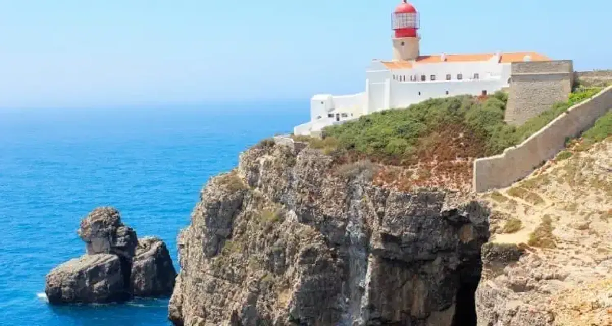
Cabo San Vicente
What is the Vicentine Route and why is it worth it?
South of Lisbon, where the Atlantic bites cliffs and calms endless beaches, the Vicentine Route weaves paths that smell of salt, thyme, and village chimneys. More than a path, it is a network: about 750 kilometers of trails between Alentejo and Algarve, designed for walking or biking, at your own pace, without rush, and with the ocean almost always in the background.
Here, there are no Gothic cathedrals or large cities. There are white villages with blue doors, dogs sleeping in the sun, cafés where time is measured in bicas and pastéis, and a coastline that changes mood several times a day: fog, wind, scorching sun, sunsets that paint the cliffs orange.
The Vicentine Route is worth it because:
- It combines wild coast and rural countryside, without the feeling of a theme park.
- It is well marked and designed for "normal" hikers, not just for experts.
- It passes through villages where people still live off fishing, agriculture, and grazing.
- It is flexible: you can do a couple of days, a week, or chain routes together like Lego pieces.
Two main protagonists structure everything: the Historical Way, which delves into the rural heart of Alentejo, and the Fishermen's Trail, always close to the sea. Around it, a constellation of circular routes that allow for improvised half-day getaways or a full day.
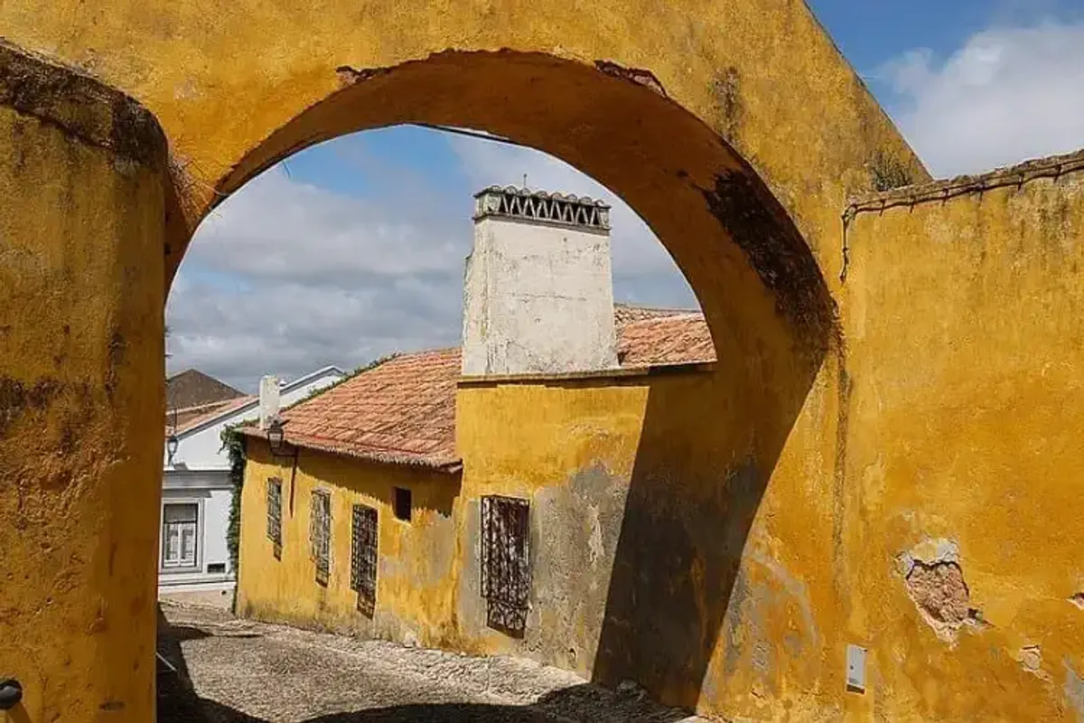
Santiago de Cácem
Historical Way: the rural interior of Alentejo
The Historic Way is the most serene face of the Vicentine Route. Less foam, more cork oaks; fewer seagulls, more storks. It connects villages that lived off the land and today see colorful backpacks passing between cork warehouses and whitewashed walls.
It is not a spectacular path at every step, but one that wins you over through persistence: pastures, cultivated fields, calm rivers, old mills, isolated farmhouses, villages where the square bar is everything. Ideal if you prefer to walk for a long time rather than stop every ten minutes to take photos of the sea.
Stages of the Historic Way
The route is structured in multiple stages that can be linked or chosen à la carte. Practically, it is usually traveled between Santiago do Cacém and Cape São Vicente, with villages that sound like rural novels: Cercal do Alentejo, Odemira, São Teotónio, Odeceixe, Aljezur, Vila do Bispo…
The stages, in general:
- Range around 15–25 km.
- Are designed to be done one per day, without the need to rush.
- Almost always start and end in areas with some accommodation and a bar or restaurant.
- Connect with the Fishermen's Trail at various points, allowing you to "jump" from inland to coast whenever you feel like varying.
It works well for both a multi-day crossing and weekend getaways: you choose two villages, look at the stage that connects them, and you already have the route.
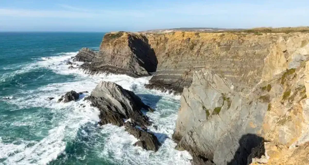
Coast of São Teotónio
Landscapes and Difficulty
The Historic Way is not a mountain race, but neither is it a shopping mall stroll. The norm is to walk through:
- Dirt tracks between cultivated fields, gardens, and livestock farms.
- Cork and pine forests, where the ground is covered with leaves and the shade is appreciated.
- Gentle valleys and waterways, with small bridges, mills, and walkways.
- Rural areas with livestock, where you will share the path with cows, sheep, and dogs that look at you with professional curiosity.
As for the difficulty:
- The gentle slopes are suitable for anyone accustomed to walking for several hours.
- The terrain is generally comfortable and stable, except for occasional muddy stretches after rain.
- The great "enemy" is not the incline, but the heat if you go during scorching months. A hat, water, and sunscreen are not optional.
If you are looking to start on multi-day routes, without the need to be an athlete, the Historical Way is a very good introduction.
Aljezur
Fishermen's Trail: walking along the Atlantic
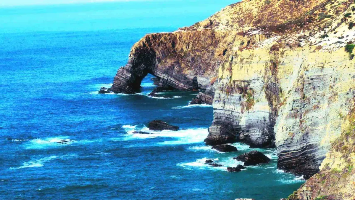
Then there is the hyperactive twin, the one that looks great in all the photos: the Fishermen's Trail. A trail that hugs the cliffs, goes up and down dunes, overlooks secluded coves, and passes through fishing villages where boats rest upside down.
Here, the protagonists are the sea and the sand. And this is noticeable in your legs: walking on sandy ground is more tiring, but the views more than make up for it. It is the kind of route where you take twice as long because you stop to admire every viewpoint, every deserted beach, every rock that seems to have come out of a movie.
Current stages of the Fishermen's Trail
The Fishermen's Trail connects small coastal hubs: Porto Covo, Vila Nova de Milfontes, Almograve, Zambujeira do Mar, Odeceixe, Arrifana, Carrapateira, Vila do Bispo, Sagres…
The idea is simple:
- Stages of 10 to 22 km, always with the Atlantic nearby.
- Start and finish in places with accommodation and some restaurant.
- Several variants and loops that allow for distance adaptation.
Logistically, this part of the Vicentina Route is especially rewarding if you enjoy walking and arriving in the afternoon at a village with a beach, bar, and sunset over the ocean. It is easy to imagine the end of the day: shoes filled with sand, a cold beer, hair salty, and that feeling of having spent many hours "outside".
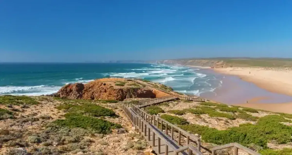
Fishermen's Trail
Difficulty and coastal views
This trail is more demanding than the Historical Way, not so much due to the elevation as because of the terrain:
- Long stretches over sand and dunes, which punish ankles and calves.
- Short but frequent ups and downs, as it crosses ravines and coastal inlets.
- Almost constant wind, which sometimes refreshes and at other times exhausts.
In exchange, we can say about the views:
- Vertiginous cliffs where the waves break with a hypnotic consistency.
- Endless beaches that suddenly open at the end of a descent.
- Atlantic colors: deep blue, white foam, coastal vegetation, reddish or golden cliffs depending on the light.
- Fishing villages where clothes dry in the sun and restaurants announce fresh fish on chalkboards.
If you enjoy seaside landscapes and don't mind ending the day with tired legs, this is your path.

Fishermen's Trail
Circular routes: half-day and one-day excursions
The circular routes of the Vicentina Route are perfect loops for those looking to walk without long stages. They allow you to explore cliffs, ribeiras, forests, and viewpoints without worrying about transportation and work very well for short trips, fixed bases, or groups with different levels. There are circular routes that mix coast and inland, paths along rivers, and walks designed for half a day. Many end in villages where it is easy to wrap up the day on a terrace.
How can they be combined with the main routes?
They are the perfect complement to the Historical Way and the Fishermen's Trail. You can use them as an extra day to get to know a village better, as a plan B if you arrive early at the end of a stage, or as plan A if you prefer to travel without moving luggage and leave each day from the same accommodation.
Can the Vicentina Route be done by bike?
Yes, but with important nuances. The Historical Way and several inland routes are quite suitable for mountain or gravel biking: dirt tracks, rural roads, and few technical sections. The Fishermen's Trail, on the other hand, is designed for walking. The sections over cliffs and dunes are fragile, narrow, and in many places, incompatible with bikes for safety and environmental conservation.
If you want to cycle:
- Check which sections are specifically enabled for bikes.
- Choose a bicycle with wide and sturdy tires.
- Adjust distances: what is a stage on foot can be a ride on a bike, so you can link several sections in one day.
In any case, the spirit of the Vicentina Route remains, above all, one of hiking. The bike is a good ally inland, but the essence of the coastal route is best enjoyed on foot.
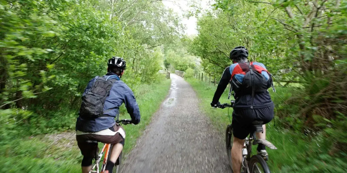
It is advisable to be accustomed to riding a bicycle and to train before embarking on a long route.
Accommodation, transport, and services for the hiker
One of the advantages of the Vicentina Route is that it does not develop in the middle of nowhere. Towns and villages serve as support points, with a network of services that, while not massive, is sufficient for traveling with a certain level of comfort.
On the route, you will find:
- Varied accommodations: rural houses, small family hotels, simple lodgings for hikers, and some campsites. No giant resorts, but clean beds, hot showers, and hearty breakfasts.
- Restaurants and cafés: local bars with daily menus, simple seafood restaurants by the port, cafés where life revolves around the bar. Perfect for replenishing energy with soup, fish, grilled meat, and sweets.
- Limited but useful public transport: buses connecting the main towns and roads that allow you to take a taxi if you want to skip a section or return to the start of the stage. With some planning, you can organize a trip without a car.
- Taxis and luggage transfers: in many towns there is taxi service, and there are companies that offer backpack transfers between accommodations. Ideal if you wish to walk light and let your luggage travel by road.
It is advisable to book accommodation in advance during high season (spring and, especially, summer), and check bus schedules, which are not always daily or frequent.
Local gastronomy and culture on the way
Part of the charm of the Vicentina Route is found at the table. After a whole day of walking, any dish tastes better, but here the product helps:
- From the sea: gooseneck barnacles when available, grilled sardines, sea bass, dourada, squid, fish of the day depending on what has come into port.
- From the land: hearty soups, migas, pork dishes, chorizo, cheeses from the interior, and bread that truly crunches.
- Sweets: almond cakes, flans, and, of course, the omnipresent pastéis and other Portuguese classics.
In the towns the rhythm remains the same: elderly people at the door of their homes, radios on, life in the square, local festivals that mix mass, music, and food stalls. The way not only teaches landscapes but also serves as a window to a Portugal that lives calmly, facing the sea.
Portuguese landscape
Practical safety and signaling tips
Although the Vicentina Route is prepared for the average hiker, it is still open nature. The Atlantic can be temperamental and the countryside deceptive. A little common sense and preparation make the difference between a good anecdote and a scare.
Marks and types of signaling
On the route you will find:
- Paint marks on posts and stones, with two parallel stripes (usually white and colored) indicating the correct path.
- X crosses when you should not follow a detour.
- Directional posts with the name of the route and often the distance to the next point.
Even so:
- Always carry a map or track on your mobile and sufficient battery.
- Do not blindly trust following other hikers: there are variants, links, and circular routes that can confuse you.
Rules and recommendations on the route
To ensure that the path remains enjoyable for everyone, follow our advice:
- Respect private properties and livestock: if you cross farms, close gates and doors as you found them.
- Do not approach the edge of cliffs more than is reasonable, especially in strong winds.
- Avoid shortcuts through dunes and fragile areas: they are not just sand, they are delicate ecosystems.
- Carry enough water, especially on hot days. There are not always water sources on the route.
- Dress in layers and account for the wind: on the coast, it can shift the thermal sensation by several degrees.

Vicentine Coast
Best time to do the Vicentine Route
The calendar here matters almost as much as the boots:
- Spring (March to May): for many, this is the ideal time. Green landscape, flowers everywhere, mild temperatures, longer days. It may rain, but the light and contrasts are a spectacle.
- Autumn (September and October): another great window. The summer heat relaxes, the sea still retains some warmth, and the afternoon light turns golden. Perfect if you want to avoid summer crowds.
- Summer: the ocean refreshes, yes, but the sun is unforgiving, especially on inland stages. If you can only go in summer, it's better to rise early, avoid the central hours, and adjust distances.
- Winter: fewer people, melancholic atmosphere, short days. The weather can be changeable, with rain and wind, but in return, you will enjoy a quiet route, almost just for you.
Vicentine Route: an unforgettable natural and cultural experience
The Vicentine Route is not a path for collecting checkpoints, but rather to let the landscape and the villages set the pace for you. One day you walk among cork oaks listening to the silence of the interior. The next, the waves crash beneath your feet as you walk along a cliff.
There is no need to cover the 750 kilometers to understand it. It is enough to link a couple of stages, sit in a village bar with your boots filled with dust or sand, and feel that mix of fatigue and calm that only comes from a well-trodden path. Then, when you return home, the sound of the Atlantic waves will continue to appear from time to time, like an echo. And perhaps, without realizing it, you will already be thinking about the next time you will follow the marks of the Vicentine Route, inland or by the sea.