

10 exciting hiking routes to discover Galicia
29 January, 2026
Discover the best hiking routes in Galicia beyond the Camino de Santiago. From mountains like Pena Trevinca to unique landscapes such as Fragas do Eume or the Sil Canyon, here’s a must-see selection for nature lovers.

When thinking about hiking routes in Galicia, probably comes to mind the Camino de Santiago, where a good handful of Galician Jacobean routes have as a goal in Santiago de Compostela and the Finisterrae. However, beyond these, in Galicia we have an endless number of hiking trails, offering high mountains, lush forests, wild seas and bucolic rivers. In this post we want to offer you a selection of the best ten routes for hiking in Galicia.
 There are several approved trails, and in this article we will highlight the route PR-G 199 Pena Trevinca by Sestil Alto, a linear path from A Ponte to Sestil Alto. Be sure to contact and visit the Visitor Center of the ZEC Pena Trevinca (A Veiga), where you can get all the information you need. It would be a route of high difficulty, with about 18 kilometers round trip, although if we want to climb Pena Trevinca, the distance would rise to 21.6 kilometers. Without a doubt, it is a good Sunday plan.
It is a linear route of about 5.5 kilometers long, easy level, although we will find some somewhat demanding climb but assisted by a rope. From my own experience, it is suitable for children and dogs. If you decide to visit it, please contact the Fragas del Eume Interpretation Center (Pontedeume) beforehand, as they can complete our information, and also in high season there are traffic restrictions to get there.
 There are many trails that you will find in this mountain, which you can consult at the Centro de Interpretación de Rutas del Monte Pindo y Fervenza del Ézaro CIR (Dumbría). All offer breathtaking views that combine the salty aroma of the sea with the green landscapes of the villages surrounding the Pindo. At the end you can visit Carnota or Lira, small villages with two of the longest hórreos in Galicia, as well as the nearby Ézaro, with its waterfall or fervenza where the Xallas river flows into the sea.
We leave the port of Laxe and from there we set out to skirt the cape and Monte da Insua, through fishermen's trails and plant tunnels that lead to the Lighthouse of Laxe. We reach the lighthouse picnic area and the suggestive statue of "La espera", a woman who, with her son in her arms, longs for the arrival of the beloved sailor embarked in distant waters. The Furna de la Espuma and the Piedra de los Enamorados await us on the way back, backdrops of the famous Playa de los Cristales, which you will only enjoy at low tide.
 Very close to the village of O Cebreiro, a key point of the French Way of St. James, the 13.5 km circular route starts at the church of San Lorenzo de Piornedo and climbs from 1,300 m above sea level to reach 1,500 m above sea level at the Cabaña de los Extremeños. The ascent continues until reaching the Mustallar Peak, which will give us wide panoramic views of the entire mountain of Lugo. Keep in mind the time of the year to walk it, as it is very easy to find snow at this point.
 It is a circular route of 17 kilometers among old trails, dirt tracks and a lot of centennial chestnut trees. It starts in the village of Parada de Sil and passes through the well-known Balcón de Madrid, and then approaches the Monastery of Santa Cristina de Ribas de Sil, on the slopes of the Sil River Canyons, in an exceptional environment.
A simple linear route that runs through the Sierra del Galiñeiro from north to south, covering about 8.9 kilometers. From the Alto de San Xiao (631 meters), where there was a castro, the views are spectacular. Also, be sure to visit the Cyclopean Wall. In the Interpretation Center Engineer Rafael Areses (Tui) you can get more information.
A circular route of about 11.5 kilometers that begins in the village of Belelle (Neda) and then runs along trails between eucalyptus, laurel, birch and oak trees that lead to viewpoints, bridges and finally, in a slight ascent, to the waterfall, which with unusual force, is "one of the most emotional landscapes of Galicia", as the Galician writer Otero Pedrayo said.
 Of medium difficulty, we will have a respectable ascent that takes us to San Lorenzo de Barxacova (Parada de Sil), where we can admire a medieval necropolis with tombs carved into the rock. We continue along a narrow path with hardly any slope that will take us to different villages and then descend to this beautiful river.
The name Fuciño do Porco ("pig's snout", literal translation into Spanish) refers to the similar shape and profile of the face of a pig on this rocky outcrop in the Cantabrian Sea, which will offer you unique snapshots.
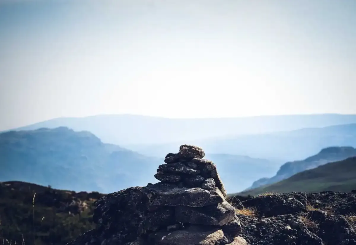
Pena Trevinca along the Sestil Alto PR-G 199 (Ourense)
Located east of the province of Ourense and northwest of the province of Zamora, Pena Trevinca is a natural border between Galicia and Castilla y León. Referred to as the "roof of Galicia", it is indeed the highest peak of the Autonomous Community, with 2,127 meters of altitude.Viewpoint of Pena Trevinca
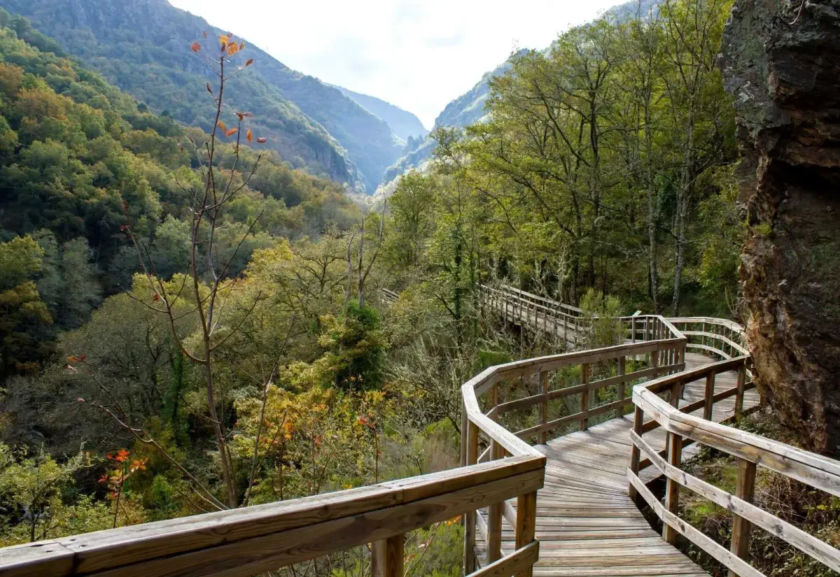
Fragas del Eume (A Coruña)
The Fragas del Eume Natural Park is one of the natural treasures that we can find in Galicia. A dense and lush Atlantic riverside forest, one of the best preserved in Europe and with a precious ecological value. Very close to the English Way of St. James from Ferrol there are several trails that can be found in the Fragas del Eume, but we are left with the path of the Encomendeiros.It is a linear route of about 5.5 kilometers long, easy level, although we will find some somewhat demanding climb but assisted by a rope. From my own experience, it is suitable for children and dogs. If you decide to visit it, please contact the Fragas del Eume Interpretation Center (Pontedeume) beforehand, as they can complete our information, and also in high season there are traffic restrictions to get there.
Monte Pindo (A Coruña)
Monte Pindo is a granite mass defined by experts as the highest non-marine cliff in Galicia. With its 627 meters high, this stone colossus is located in the municipality of Carnota, dominating the estuary of Muros and Noia, and is considered the Olympus of the Celtic gods, as it is the subject of many ancient legends of giants, castles and queens.The shore of Monte Pindo
Laxe - Punta Insua PR-G 70 (A Coruña)
In the heart of the Costa da Morte you can enjoy a circular route in Laxe, just over 5 kilometers long, signposted and safe. This is the route PR-G 70 Sendero Laxe - Punta Insua, which coincides with a section of the fourth stage of the Camino de los Faros.We leave the port of Laxe and from there we set out to skirt the cape and Monte da Insua, through fishermen's trails and plant tunnels that lead to the Lighthouse of Laxe. We reach the lighthouse picnic area and the suggestive statue of "La espera", a woman who, with her son in her arms, longs for the arrival of the beloved sailor embarked in distant waters. The Furna de la Espuma and the Piedra de los Enamorados await us on the way back, backdrops of the famous Playa de los Cristales, which you will only enjoy at low tide.
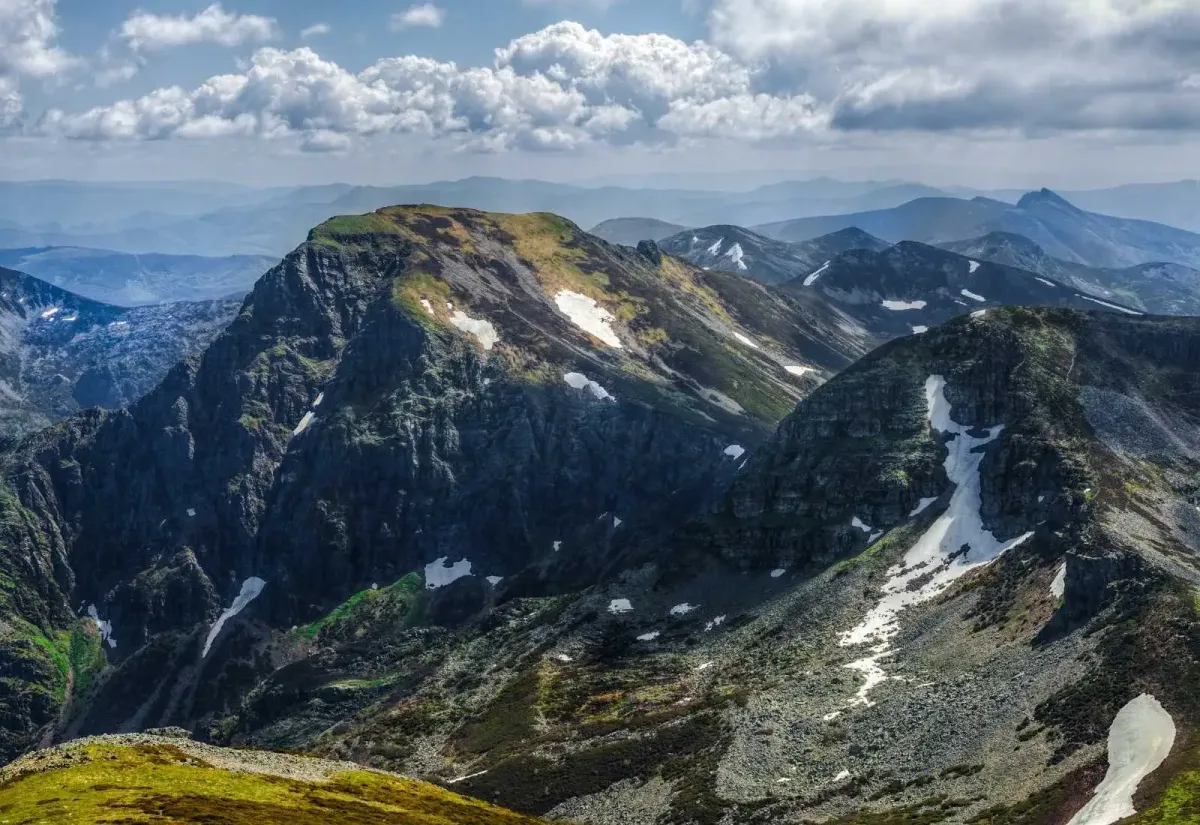
Piornedo - Mustallar Peak (Lugo)
Hidden in the mountains of the Ancares of Lugo we find the village of Piornedo (Cervantes), where the Pico Mustallar divides Galicia from Castilla y León and stands as one of the highest mountains of this mountain range, with its 1,935 meters above sea level.Mustallar Peak Viewpoint
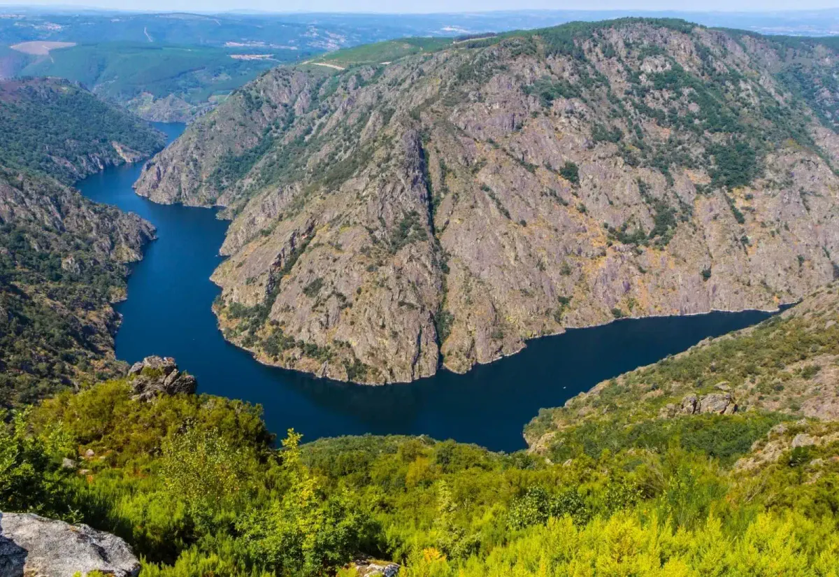
Sil Canyon PR-G 98 (Ourense)
Here we present the PR-G 98 route through the Sil Canyon, an approved route that runs through one of the most emblematic natural landscapes of Galicia.Sil Canyon
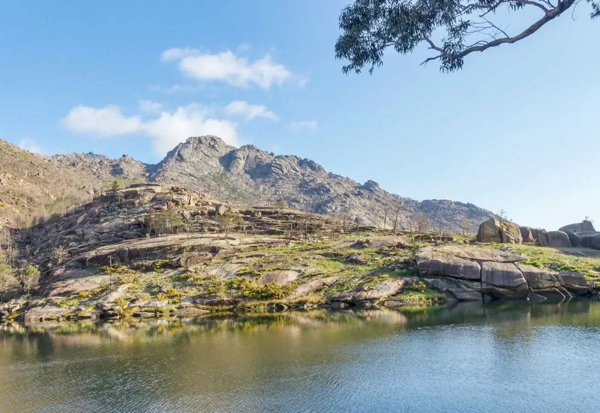
Mount Aloia PR-G 2 (Pontevedra)
The PR-G 2 route offers beautiful panoramic views of Vigo and its estuary, as well as of all the surrounding territory, thanks to Monte Aloia, declared a Natural Park in 1978, the oldest in Galicia.A simple linear route that runs through the Sierra del Galiñeiro from north to south, covering about 8.9 kilometers. From the Alto de San Xiao (631 meters), where there was a castro, the views are spectacular. Also, be sure to visit the Cyclopean Wall. In the Interpretation Center Engineer Rafael Areses (Tui) you can get more information.
Belelle river waterfall (A Coruña)
One of the best known waterfalls in Galicia is located within this route that runs between the municipalities of Neda and Fene, near the English Way of St. James. A waterfall of 45 meters in a river, the Belelle, which rises from the Fragas del Eume and flows into the Ferrol estuary.A circular route of about 11.5 kilometers that begins in the village of Belelle (Neda) and then runs along trails between eucalyptus, laurel, birch and oak trees that lead to viewpoints, bridges and finally, in a slight ascent, to the waterfall, which with unusual force, is "one of the most emotional landscapes of Galicia", as the Galician writer Otero Pedrayo said.
Mao river canyon PR-G 177 (Ourense)
It is a circular route of 16 kilometers that begins in the known as Fábrica de Luz, from where we will ascend through the Mao River Canyon, to discover an ancient necropolis and see the Sil River Canyon, in the middle of the Ribeira Sacra of Ourense.Mao River Canyon
Fuciño do Porco Route (Lugo)
In this case we travel to O Vicedo, in the Mariña Lucense, to enjoy a round trip of just 4 kilometers and low difficulty. Ideal to go with the family, as it allows you to discover the charm offered by this coast, with its beaches, cliffs and natural viewpoints. It should be noted that in the middle months of the summer you must book a ticket on the official website enabled by the Xunta de Galicia, although access to the route is free.The name Fuciño do Porco ("pig's snout", literal translation into Spanish) refers to the similar shape and profile of the face of a pig on this rocky outcrop in the Cantabrian Sea, which will offer you unique snapshots.