- A bit of history
- The Stages
- Stage 1: Portela de Home – Lobios (12.80 km)
- Stage 2: Lobios – Castro Leboreiro (14.90 km)
- Stage 3: Castro Leboreiro – Cortegada (26.30 km)
- Stage 4: Cortegada – Ribadavia (13.10 km)
- Stage 5: Ribadavia – Pazos de Arenteiro (19.70 km)
- Stage 6: Pazos de Arenteiro – Soutelo de Montes (29.60 km)
- Stage 7: Soutelo de Montes – O Foxo (27.5 km)
- Stage 8: O Foxo – A Gándara (20.70 km)
- Stage 9: A Gándara – Santiago de Compostela (9.10 km)
- Things to keep in mind
- A Camino for the senses
The Miñoto Ribeiro Camino de Santiago is a route that connects the north of Portugal with the city of Santiago de Compostela. A Jacobean route still unknown to most of the pilgrim community, but which in the last two decades has been the subject of research and promotion by historians, associations, and local governments from both Portugal and Spain. We want to do our bit, and in this article, we’ll learn more about this route, which, recently recognized by the Church and allows pilgrims to obtain the Compostela, combines history, nature, thermalism, and wine on the way to Santiago de Compostela.
A bit of history
Roman roads and trade routes have always played a role in the shaping of the various pilgrimage routes to Santiago de Compostela, serving as pre-existing paths that facilitated the passage of travelers and pilgrims. On the Camino de Santiago we have examples like the Via XIX on the Portuguese Camino de Santiago or the Via XVIII on the Camino da Geira e dos Arrieiros. Along this very same Via XVIII, also known as the Via Nova, the Miñoto Ribeiro Camino shares segments as well as stage beginnings and ends.
These routes were used during the Middle Ages once pilgrimage to Santiago de Compostela began to develop, and in the case of the Miñoto Ribeiro Camino, the Via XVIII formed the backbone of this Jacobean route. Evidence from hospitals, bridges, monasteries, historical documents, and wine production and trade support the historical validity of this path.
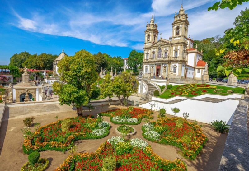
Bom Jesus do Monte, Braga
The Stages
Starting in the lands of Braga, the Miñoto Ribeiro Camino crosses the region of Baixa Limia, the Sierra do Xurés, and following the course of the Miño River, enters the wine-producing region of O Ribeiro in the province of Ourense. From there, it heads north toward Santiago de Compostela, passing through the provinces of Pontevedra and A Coruña.
From Braga, there are three options to enter Galicia, but we will focus on the main one that begins in Galician territory, which at one point reenters Portugal before coming back into Spain. As always, each pilgrim can configure the stages to their liking, but the standard division is nine stages, totaling approximately 174 kilometers.
Stage 1: Portela de Home – Lobios (12.80 km)
From Portela do Home the path enters Galicia across the border, connecting Terras de Bouro in Portugal with Lobios in Galicia. A series of Roman milestones guide the pilgrim, with the Caldo River as a companion. Before reaching Os Baños, the path passes the ruins of the Roman mansion of Aquis Originis, before completing the final stretch to Lobios, which offers accommodation and services.
Stage 2: Lobios – Castro Leboreiro (14.90 km)
This stage begins in Lobios, and pilgrims will step on stone-paved paths and ancient bridges, such as the one in Pacín. A more mountainous stage offering captivating examples of churches, cruceiros (stone crosses), and stone washhouses. In this stage, we temporarily leave Spain to overnight in the Portuguese end-stage town of Castro Leboreiro, with accommodation, services, and a spectacular waterfall.
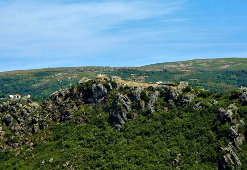
Viewpoint of Castro de Leboreiro
Stage 3: Castro Leboreiro – Cortegada (26.30 km)
On this stretch of the Camino, we leave behind Castro Leboreiro and Portugal. The descent continues along paved paths, through bucolic and authentic villages toward Monterredondo. The Miño River appears, and breathtaking panoramic views alongside lush nature accompany the walker to Cortegada, which has accommodation, services, and thermal waters.
Stage 4: Cortegada – Ribadavia (13.10 km)
One of the shortest stages begins in Cortegada, although there is a longer and more challenging alternative. A simple and flat stage, through forests of cork oaks, oaks, and pines lining the trails, showcases a surprising natural environment and small villages like San Bieito, where you can see the Meréns wayside shrine. Still accompanied by the Miño River, you reach Arnoia and later Ribadavia, former capital of the Kingdom of Galicia, with accommodations, services, a beautiful historic center, and delicious Ribeiro wines.
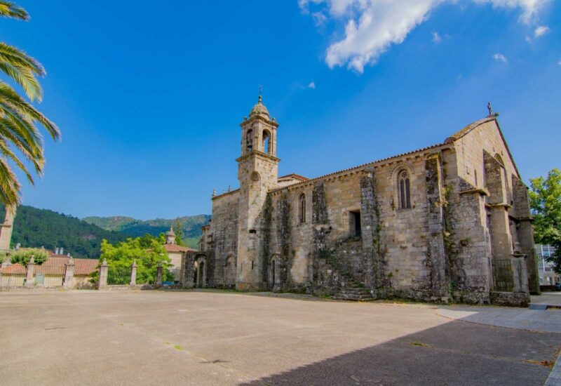
Church of San Domingos da Ribadavia
Stage 5: Ribadavia – Pazos de Arenteiro (19.70 km)
We leave behind the beautiful Ribadavia, at the confluence of the Avia and Miño Rivers. The path heads toward Beade and the Monastery of San Clodio, with the Avia River still accompanying us. Bridges, churches, cruceiros, and many medieval remains will be faithful companions until the end of the stage in Pazos de Arenteiro, which offers accommodation and services.
Stage 6: Pazos de Arenteiro – Soutelo de Montes (29.60 km)
This is the longest and most demanding stage of the entire route, a tough stage with mountain climbs. Starting in Pazos de Arenteiro, more bridges, medieval stone paths, and small villages appear, through trails dotted with mámoas, Neolithic burial mounds, until concluding this stage in Soutelo de Montes, with services and accommodation.
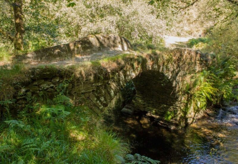
Bridge of Soutelo de los Montes
Stage 7: Soutelo de Montes – O Foxo (27.5 km)
We leave the town of Soutelo de Montes to undertake another long stage, but one that gradually descends. Stunning landscapes accompany this stretch, passing through Gaxín and the medieval bridge of Gomail. The path traverses remarkable scenery until finishing in O Foxo, where there are services and accommodation.
Stage 8: O Foxo – A Gándara (20.70 km)
Leaving O Toxo, the route heads toward the villages of A Mamoela and O Piñeiro, among others. Today we will discover another historic bridge, that of Sarandón, in a stage that connects with an important Jacobean route, the Via de la Plata. The walk ends in the village of A Gándara, with full services and accommodation.
Stage 9: A Gándara – Santiago de Compostela (9.10 km)
The last stage of the Camino, the shortest and the one that brings us to the finish line. A journey full of anticipation, from A Gándara to Santiago de Compostela, entering through the Arco de Mazarelos, one of the city’s seven medieval gates and the one through which Ribeiro wine used to arrive. Time to enjoy the journey completed and all the magic experienced in the past days in beautiful Compostela.
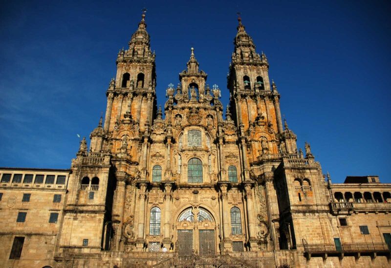
Cathedral of Santiago
Things to keep in mind
This route is gradually being signposted by the local councils involved, but is not yet fully marked. We always advise to follow a GPS track, which you can download from the official website of the Miñoto Ribeiro Camino. Like every pilgrim, follow the yellow arrow as the unmistakable sign of your good path.
Also, keep in mind that this route runs parallel to the Camino da Geira e dos Arrieiros, and sometimes even shares the same path, so you may also find signs for another Jacobean route.
Although there are accommodations and services, we strongly recommend booking your accommodation in advance, and you should know that you will rarely find pilgrim hostels. Check with local tourism offices or the official website of the Camino for more information.
This route can be walked at any time of the year, although in autumn and winter months, temperatures will be low and cold, and you may encounter rain.
A Camino for the senses
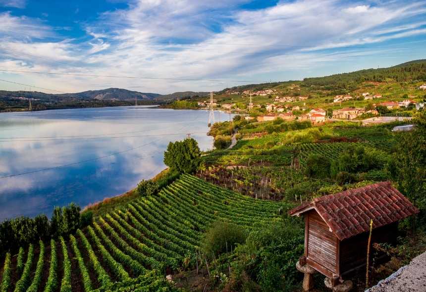
In addition to all its historical and cultural heritage, the Miñoto Ribeiro Camino is a wonderful experience for the senses, offering the best thermal waters of the province of Ourense along with its finest Ribeiro wines. A solitary path, where the magic and tranquility of the stages will make your experience truly moving, and as you look back from the Plaza del Obradoiro, you’ll recall with great joy this journey full of sensations and emotion.
 Skip to content



Leave A Comment