


Attention: Route not available for walking between November 1 and January 15
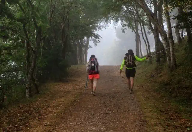
The small village of Roncesvalles is considered the first stop of the Jacobean route in Spanish territory and the starting point for thousands of pilgrims heading towards Compostela.
The section of the French Way from Roncesvalles to Logroño is characterized by its beautiful Pyrenean mountainous landscape; native forests and natural surroundings of great beauty, which will gradually transform into the vineyard landscape so characteristic of La Rioja.
Photos


Accommodations
- Most popular
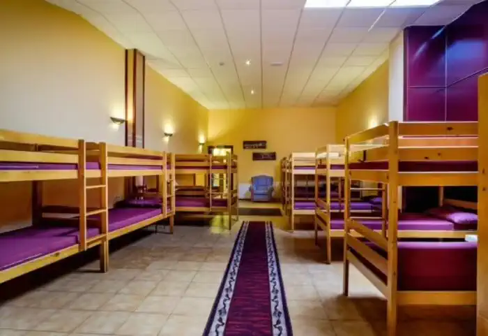
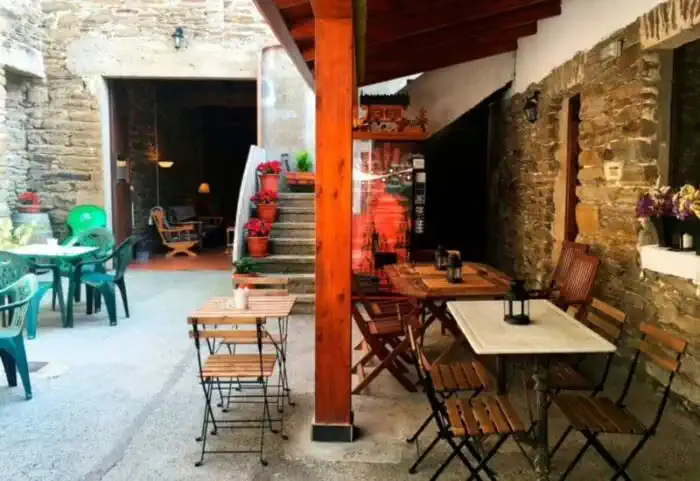
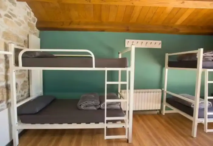
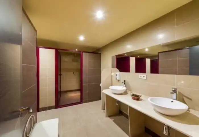
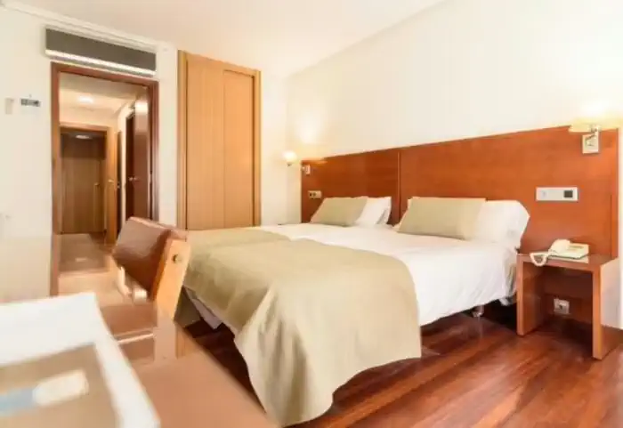
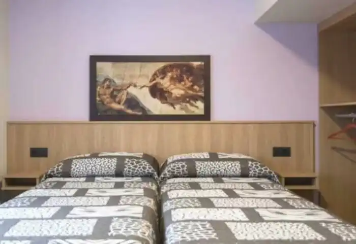
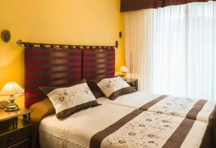
Pilgrim Essence (Hostel)
347 €
The most authentic accommodation on the Camino. Hostels are the ideal option for those traveling on a tight budget, solo pilgrims, or anyone who wants to experience the Camino de Santiago in its purest form. They are the perfect place to socialize, share stages, and connect with fellow walkers along this ancient route.
- Most popular
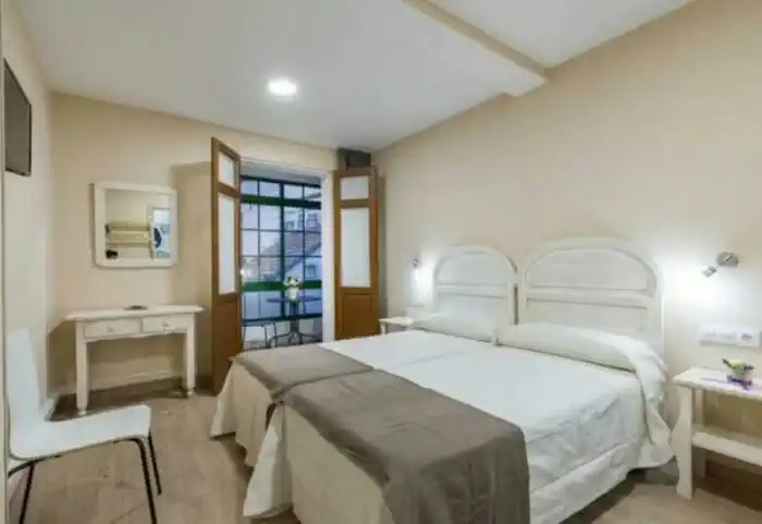
Accommodation (Guesthouse, B&B or Country Cottage)
604,50 €
The perfect balance between charm and comfort. Guesthouses, B&Bs and country houses await you in the villages along the Camino with private rooms, private bathrooms, TV, and daily cleaning service. Simple and welcoming, they are the ideal place to truly rest and enjoy the peaceful rural essence that only the Camino can offer.
Services
Included in all our routes
- Accommodation
8 days / 7 nights
- Complete documentation (Dossier and material for the Camino)
- Luggage transfer during the stages. (1 piece per person max 15 kgs)
- On-the-road emergency telephone assistance
- Pilgrim's Credential
- Travel insurance
Optional
- Extra night
- Transfer from Pamplona to Roncesvalles
- Supplement for single room
- Breakfast
- MP (Breakfast and dinner)
- Cancellation Insurance
Map of the French Way from Roncesvalles to Logroño

Stages
- day 1
Arrival at Roncesvalles
We start the stage crossing the Puerta de Santiago, in the upper part of the town. This is the traditional passage of the pilgrims who crossed this route to Roncesvalles, and was declared a World Heritage Site by Unesco in 1998. After this, we will cross the Rue d'Espagne, crossing the wonderful river Nive, an ancient place of trade of artisans. Once we leave the bridge, we will venture to start, really, the French Way, saying goodbye to the ancient 17th century Citadel on the hill of Mendiguren. This is where the adventure begins, and where the route forks into two variants:
- Official itinerary: Napoleon Route (25.7 km)
ATTENTION: From November 1 to March 31 the Napoleon Route is closed for safety reasons; it is therefore mandatory to go via Valcarlos. The fine for non-compliance can reach 12,000 euros.
We start our French Way from the medieval bridge over the Nive River and cross the centenary village of Saint Jean, surrounded by its ancient and beautiful wall. We follow the French signs Chemin de Saint Jacques de Compostelle along a rural road that passes through residential areas, such as Iruleya, Erreculus or Huntto, until we reach a spectacular viewpoint.
After leaving Orisson, where there is a bar-restaurant, the mountain road shows us the landscapes of the French Aquitaine. At kilometer 11.3 of the route we can see, if the fog does not prevent us, the Virgin of Biakorri, adorned with flowers, necklaces, crosses, shells and other pilgrim offerings.
After descending to Arnéguy we see next to the right shoulder a stone cairn with a carved wooden sign with the inscription Roncevaux/Orreaga. We leave the road and go through the mountain. We pass by the cross of Thibault and walk under the slopes of the Leizar Atheka peak towards the Bentarte pass, where we find the Fuente de Roldán. Already entering Navarra, the road continues to climb steeply up to 1430 meters to reach the pass of Lepoeder, the highest point of the stage.
From this point to reach Roncesvalles we have two well signposted options:
We can take the shorter option on the left and ride 3.6 km to Roncesvalles which, despite having steep slopes passes through the Don Simon forest. The option on the right goes through the Ibañeta pass, where the chapel of San Salvador is located and is only 400 meters longer.
- By-pass through Valcarlos (23.4 km)
With a more affordable challenge and slightly less ambitious views, we find the Variante through Valcarlos. This variant is the mandatory variant in winter due to snowfall, as well as the proximity to the national road. It is a safer route, especially under stormy and adverse conditions, or under the pilgrim's own physical condition.
We leave Saint Jean crossing the river Nive, following the signs until we reach the national road and the Route d'Arneguy. We continue on the road and take a paved track that crosses the river over a bridge. After 7 km of walking we arrive at Ventas de Arnéguy, on the border of Spain with France, where we can take advantage of its numerous stores, bars and restaurants to stop.
We cross the border and enter Spain. In front of Venta Peio we continue to the right on a dirt track that in just under a kilometer takes us to the center of Arnéguy. We cross again the river and the border to continue along a paved road, a beautiful stretch that climbs through lush forests until we reach Ondarolle, where we see Valcarlos from the viewpoint. We go down to the river and cross over a footbridge until we reach Valcarlos.
We leave Valcarlos by the N-135 road and descend to the small village of Gainekoleta. We continue along a path that returns to the national road and we alternate until we leave it on the left.
After an ascent, we reach the top of the Puerto de Ibañeta, where the legend places the Battle of Roncesvalles and, in his memory, a monolith was erected. We also find the modern chapel of San Salvador, whose bell served as a beacon for pilgrims disoriented by the fog.
After passing the Bird Migration Center, we descend through a beech forest, listening to the Otezul River in the background, until we reach Roncesvalles and put an end to our first stage.
To be taken into account
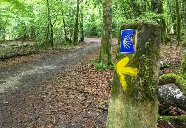
In France, the Camino is signposted with GR-65 markings in red and white, although there are also some yellow arrows.
If you are not used to long hikes in the high mountains, we recommend that you completely discard the stage along the Napoleon Route and opt for the variant of Valcarlos or start the Camino in Roncesvalles.
There is the possibility of dividing the stage into two sections. Overnight in the refuge of Orisson (essential to book in advance); from Saint Jean Pied de Port it is only a two-hour walk in great ascent with a difference in altitude of 628 meters, perfect to do in the afternoon and continue the route the next day.
The variant by Valcarlos has a positive difference in altitude of 885 meters, runs through the valley of Valcarlos, always near the national road, at a lower altitude than the main road by Honto. In case of snow or bad weather forecasts it is the most sensible option, although its attractiveness is somewhat lower.
Lugares de interés
- Ciudadela - Saint Jean Pied de Port
- Puerta de Saint Jacques - Saint Jean Pied de Port
- Iglesia de Notre Dame - Saint Jean Pied de Port
- Virgen de Biakorri - Ruta de Napoleón
- Fuente de Roldán - Ruta de Napoleón
- Iglesia de la Asunción - Arnéguy.
- Iglesia Santiago Apóstol - Valcarlos.
- Monumento al peregrino de Jorge Oteiza - Valcarlos.
- Puerto de Ibañeta
- Capilla de San Salvador
- Silo de Carlomagno - Roncesvalles
- Iglesia Colegiata de Nuestra Señora de Roncesvalles Roncesvalles
Typical dishes
- D.O. Ossau - Irati, Roncal or Idiazabal cheeses
- Stews in clay pots
- Trout stuffed with ham
- Chistorra
- Tortas Txantxigorri
- Pacharán, cider and wine
- day 2
Stage 1. Roncesvalles - Zubiri (21.4 km)
We bid a sad farewell to Roncesvalles along a path parallel to the N-135 in direction to Zubiri, which enters from the right into the Robledal de Brujas. A leafy forest where some of the most famous covens of the 16th century were held, which led to a notorious repression that ended up leading to the burning of nine people in the area. We will continue our route passing by the Cross of Roland, where the feats of Charlemagne are commemorated, until we reach the town of Burguete, where we will find bars where we can stock up on supplies.
We leave from
Burguete
and we cross the stream of the Urrobi river, going through a path between green meadows to Espinal, a small village surrounded by the landscape that Ernest Hemingway loved, who catalogued this stage as the most damned wildest territory of the Pyrenees. Just before the road leaves El Espinal, we turn off to the left and begin the ascent to the Mezkiritz pass, where we will enjoy spectacular views over the Erro valley.We descend until we reach Bizkarreta-Guerendiáin with half of the route behind us, it is a good time to stop to catch our breath.
We leave Bizkarreta along a path that runs to the left and reach the next village, Linzoáin. From here we begin to ascend to the Alto del Erro, combining steep slopes with stretches of ascent that make it difficult to reach the top. But the effort is rewarded with the majesty of the surroundings: forests of pine, birch and oak trees that give breath and strength to the pilgrim. After passing some electric towers, we will make a short stop to enjoy the incredible views offered by the viewpoint before starting the descent to Zubiri.
The descent gets harder and harder, so it is very important to take extreme precautions, especially in the rain. After the long descent of the Alto del Erro, we reach the Puente de la Rabia bridge over the river Arga, where we reach the end of the stage, Zubiri.To consider
Many pilgrims who start in Roncesvalles decide to finish their stage in Larrasoaña, 5.5 kilometres beyond Zubiri.
In Burguete the path runs along a road without a hard shoulder, so we must be extremely careful.
Although the climb is moderate, the ascent to the Alto del Erro is not difficult.Places of interest
- The White Cross or the Cross of Roldán
- Church of San Nicolás de Bari - Burguete
- Church of San Pedro - Gerendiain
- Medieval Stelae of the El Espinal Cemetery
- La Rabia Bridge - Zubiri
Typical dishes
- Pocha beans in Navarrese style with piperrada
- Veal from Navarre
- Roncal Cheese
- Trout
- Mushrooms and mushrooms (variety beltza mushroom)
- Shepherd's crumbs
- day 3
Stage 2. Zubiri - Pamplona (20.4 km)
We will say goodbye to Zubiri in the direction of Pamplona in the same way we arrived: crossing the iconic Puente de la Rabia. We arrive at the huge Magna factory, where the local magnesite deposit is extracted. It is a curious place, to say the least, that we will have to go around to get to Ilarratz, a small village where we can rest, refill our canteens. We follow the Camino and arrive at Larrasoaña, a village with an important Jacobean tradition. We continue the route crossing the Bridge of the Bandits, where in ancient times the pilgrims who dared to cross it were robbed.
We will continue to Akerreta, where we will find the church of the Transfiguration, which still preserves medieval elements such as the tower, the façade and the baptismal font.
We continue along a beautiful path that takes us to the bridge of Zuriain, where we can stop at the bar La Parada de Zuriain, take the detour to Ilurdotz and cross the river Arga again to go to Irotz. We leave the church of San Pedro behind us and continue on to the Iturgaiz bridge, of Romanesque origin, and continue along a path that runs parallel to the national road. When we reach some farmhouses we have two options: To go up to the village of Zabaldika or to go along the left side of a cultivated field.
We continue on our way and we are presented with a new dilemma with two itineraries. On the one hand, we can follow the comfortable river walk, which will take us to Huarte, a village that is now part of the outskirts of Pamplona, or follow the path of the original Pilgrims' Route to Santiago de Compostela, which continues from the same recreation area. Both variants come together a couple of kilometres further on.
We cross the national road through a tunnel and find the turn-off to Huarte. We continue in the same direction and go down to Trinidad de Arre, one of the most spectacular points of the stage and where the Camino de Baztan meets. It is worthwhile to take a break in the village and visit the Basilica of the Trinity and the church of San Roman.
We return to the road passing through the main street of Villava, famous all over the world for being the birthplace of the cyclist Miguel Induráin. We are now at the gates of Pamplona. Almost without transition we reach Burlada, cross the Magdalena Bridge over the Arga River, go around part of the wall and enter the old part of Pamplona, putting an end to our stage.
To consider
If we plan to arrive in Pamplona between the 6th and 14th of July we must be proactive or book in advance, as the accommodations are usually full and prices increase exorbitantly. We can also choose to extend the stage to Cizur Menor, which would mean walking about 5 kilometres more.
Places of interest
- Church of San Nicolás de Bari - Larrasoaña
- Bridge of the Bandits - Larrasoaña
- Bridge of Irotz
- Ultzama Bridge
- Hermitage of La Trinidad de Arre
- Cathedral of Santa María la Real - Pamplona
- Town Hall - Pamplona
- Navarre Palace - Pamplona
- Plaza del Castill - Pamplona
Typical dishes
- Tudela artichokes with clams
- Piperrada and gazpacho from Navarre
- Asparagus and piquillo peppers
- Roncal and Idiazábal D.O. Cheeses
- Beef T-bone steak/beef brisket
- Chilindron lamb
- Salmon from Bidasoa, kokotxas, hake Navarrese style
- Roscos blessed by San Blas
- Pacharán
- day 4
Stage 3. Pamplona - Puente la Reina (23.9 km)
We start the stage from the Town Hall Square and say goodbye to Pamplona and head towards Puente la Reina, crossing the medieval bridge of Azella, which crosses the river Sadar. The road takes us to Cizur Menor. After a crossroads, we see a detour to Guenduláin, an abandoned hamlet where only the ruins of a church and a mansion remain.
We continue in a slight ascent until we reach Zariquiegui, where we can stock up on supplies and visit the Church of San Andrés. Here begins the dreaded rise of the Alto del Perdón, we pass by the Fuente de la Reniega, where, according to legend, the devil used to tempt pilgrims with water in exchange for renouncing their faith.
With patience and strong winds, we finally reached the top of the Alto del Perdón, one of the most famous and photographed points of the Camino de Santiago, both for the spectacular views and for the unique sculptures representing a family of pilgrims from the Middle Ages.
In an inscription we can read: "Where the path of the wind crosses the path of the stars. After a well-deserved stop, the descent to Uterga begins. The descent is quite steep in the first stretch and the track is uneven, so it is advisable to take extreme caution.
We pass Uterga, a pretty village at the foot of the mountain, and without difficulty we reach Muruzábal. In the middle of the village we find the detour to the wonderful Romanesque chapel of Santa María de Eunate, which is worth a visit at the cost of lengthening the stage by 3.2 km.
If we do not take the shortcut we will arrive at Óbanos, where the Mystery of Obanos is commemorated annually, which is a Festivity of National Tourist Interest. We continue the last stretch along the path of the river Robo, which will take us to Puente de la Reina.
To consider
In the Alto del Perdón the wind usually blows hard, so we recommend to do the stage with warm clothes even in summer. The detour to the hermitage of Santa María de Eunate is perfectly signposted. It is an octagonal Romanesque church of great beauty which, we insist, is well worth a visit.
You won't have any supply problems during the stage, as you will find a lot of bars where you can make your stops. Even in the Alto del Perdón there is usually a mobile bar from Easter to October.
Places of interest
- Church of San Miguel - Cizur Menor
- Church of San Andrés of Zariquiegui
- Muruzábal Palace
- Church of San Esteban de Muruzábal
- Hermitage of Santa María de Eunate
- Church of the Crucifix - Puente la Reina
- Church of Santiago - Puente de la Reina
- Plaza Mayor and Casa de los Cubiertos - Puente de la Reina (Bridge of the Queen)
Typical dishes
- Wines of Señorío de Sarria
- Ribs to the Sarmiento
- Campollano Beans
- Cheeses of Urbasa
- Lean meats with tomato
- Trout with ham
- Cod in ajoarriero sauce
- day 5
Stage 4. Puente la Reina - Estella (21.6 km)
We start the stage from Puente la Reina to Estella, crossing the river Arga and ascend to the village of Mañeru, where many battles of the Carlist Wars were fought in the past. We can take the opportunity to visit the church of San Pedro. We continue for several kilometres, accompanied by vineyards and olive groves, on a quiet and pleasant walk to the village of Cirauqui, which is characterised by its wall, which we must cross.
We leave Cirauqui following an old Roman road, cross the Roman bridge and follow the signs and cross the motorway until we reach the Canal de Alloz, near the Salado river.
The story goes that this river brought death, as it was said that its water was poisoned, and that the locals urged the pilgrims to drink from it, and thus steal their belongings.
We cross the dual carriageway again by an underpass, and then we go uphill to Lorca, a town closely linked to the Camino since the 13th century, where we will find the church of San Salvador. On the outskirts of Lorca the road coincides with a path that leads to the cross of Maurien, which dominates the landscape from the heights. Between rural paths, fields and hills we arrive at Villatuerta.
We leave Villatuerta on the last stretch of the stage that runs along the plain to the hermitage of San Miguel, where many pilgrims leave their wishes and thoughts. We descend to a picnic area, where a stone cairn crowned by a virgin reminds us of a deceased Canadian pilgrim. We cross the road through a tunnel and reach a bridge over the river Ega. We enter Estella through Curtidores Street and we finish the day enjoying the charms of this beautiful Jacobean town known as "Toledo of the North".
To consider
The stage does not present great difficulties, except for a short slope in which we climb 135 meters in approximately 1 km. In addition, along the route you will find a large number of bars and restaurants where you can have a drink and refresh yourself.
Places of interest
- San Pedro Church - Mañeru
- Church of San Román - Cirauqui
- Church of the Assumption of Villatuerta
- Church of San Pedro de la Rúa - Estella
- Palace of the Kings of Navarre - Estella
- Church of the Holy Sepulchre - Estella
- Urban wall - Estella
Typical dishes
- Rocks of the Puy
- Idiazabal D.O. Cheeses
- Dishes such as trout Navarrese style
- Red beans with bacon or oxtail
- Piquillo peppers
- day 6
Stage 5. Estella - Los Arcos (21.3 km)
Once we have left Estella behind , we head towards Los Arcos, crossing the river Ega, leaving behind the Palace of the Kings of Navarre and the Church of San Pedro. We will advance until we reach the manor of Ayegui, where we can find the curious forge of Ayegui, where the craftsman Jesús Angel Alcoz reproduces in the hot iron the typical shapes of the Way of St. James.
We leave Estella leaving behind the Palace of the Kings of Navarre and the church of San Pedro. We follow the signs and, almost without noticing, we arrive at Ayegui, as it is practically absorbed by Estella. In the San Pelayo square, a signpost invites us to turn left and go up to the Irache Monastery.
We arrive at one of the great landmarks of the whole Camino, the famous Bodegas Irache and its Wine Fountain where, under a carving of Santiago, two taps are born, one for water and the other for wine.
After refreshing ourselves as tradition dictates, we continue to the Irache Monastery, a mixture of Gothic, Renaissance and Baroque whose cloister can be visited. We leave Irache along dirt and gravel paths, until we reach a crossroads where we see two alternatives: on the one hand, we find a slightly shorter one that crosses the slopes of Montejurra through a wooded area to Luquin, and the second, which is the original route, passes through Azqueta and Villamayor de Monjardín. We continue along the traditional path, through Azqueta, which takes us through a housing estate and a tunnel until we enter a wooded path.
We arrive at Azqueta, a town that welcomes pilgrims with a nice graffiti. Here we will meet one of the most endearing people of the whole Camino. Known as Pablito el de las Varas or "the man who has become famous for giving sticks", as he is called in the village. Pablito has been giving walking sticks to pilgrims for 25 years and explaining to them how to use them correctly. It has its intricacies!
Equipped with a good stick, a masterly lesson and a very pleasant time with our friend, we continue to Villamayor de Monjardín. Shortly before arriving we find the Fuente de los Moros (Fountain of the Moors), which used to quench the thirst of medieval pilgrims. Once in the village, we must visit the church of San Andrés, with its silver processional cross and its capitals. At the top of the village we can see the remains of the castle of San Esteban de Deyo, declared of National Historic Interest. Its bell is still working, and they say that if you ring it, its tolling can be heard all over the region.
We continue through monotonous farm fields for several kilometers. If we are lucky, and we are in high season, we will find La Flecha Amarilla. A mobile bar that serves from cold drinks to mixed dishes for pilgrims passing by. And we enter the final stretch to Los Arcos, where we can rest from a day full of emotions of the Camino, as well as enjoy the heritage of the Church of Santa Maria de Los Arcos, one of the most important in Navarre.
To consider
This stretch of the French Way between Estella and Los Arcos is quite long and monotonous. It is important to stock up with plenty of water as there are no services. Also, if you do the Camino in the hottest months of the year, it is advisable not to start walking without a hat or cap and sunscreen.
Places of interest
- Forge of Ayegui
- Wine Fountain
- Irache Monastery
- Castle of San Esteban de Deyo - Villamayor de Monjardín
- Church of Santa María de Los Arcos - Los Arcos
- Portal de Castilla - Los Arcos
Typical dishes
- Variety of wines from the Irache wineries
- Sausages from Navarre
- Cheeses D.O.
- Hake a la koskera
- Pollack ranch
- Fried milk
- day 7
Stage 6. Los Arcos - Logroño (27.6 km)
We will start our stage towards the capital of La Rioja leaving behind the chapel of San Lázaro. The first village we will find after leaving Los Arcos on our way to Logroño will be Sansol, where we will find a pharmacy, a hostel and a bar. We leave the village crossing the road and descend to a solitary house located in the middle of a bend. An arrow guides us to the left down a cobbled chute. We go through a tunnel, over a bridge and find a fountain that offers us water at the gates of Torres del Río.
Torres del Río is a small town famous for the church of the Holy Sepulchre (12th century) which has a tower attached to it that may have been used as a lighthouse to guide pilgrims in the Middle Ages.
After the stop, we continue to Viana on a steep and uncomfortable climb with a road surface that varies between asphalt, flagstones, gravel and dirt. We cross the road with caution several times until we reach the hermitage of the Virgen del Poyo. We go down again to the road that takes us to Bargota, where it is said that a sorcerer who was condemned by the Inquisition was given shelter. We continue straight on and descend to the Cornava ravine, with a steep slope of more than 125 metres, where we must take extreme precautions.
We continue along a path of pines and fruit trees, at the bottom of the ravine we see some plots of vineyards and olive trees. We continue between slides until we reach Viana, where we can visit the fabulous Gothic church of Santa Maria, which has an original Renaissance façade.
The stretch from Viana to Logroño is a walk for our already tired legs, although with more asphalt than we would like, forcing us to cross the road several times and extreme caution.
As a curiosity, in this section we will find the stall of another of these endearing characters of the Camino, Mrs. Felisa. Felisa was a hospitalera who lived her life on the edge of the Camino de Santiago, welcoming pilgrims from all over, offering them water and a snack (usually figs from her own fig tree). After Felisa's death in 2002, her affectionate character and her willingness to help others remained so strong in her family that one of her daughters, Mari, has been doing this work for some time.
After the last road crossing, a comfortable path leads us to the entrance of Logroño, which we enter through a park. We cross the Ebro by the bridge of San Juan de Ortega and we put an end to our stage enjoying the attractions of this emblematic historical capital.
To consider
The stage between Los Arcos and Logroño runs between quite a few gravel roads that can be a bit desperate if you don't step firmly on it.
Places of interest
- Church of the Holy Sepulchre - Torres del Río
- Hermitage of the Virgin of Poyo - Bargota
- Viana Town Hall
- Church of San Bartolomé - Logroño
- Co-cathedral of La Redonda - Logroño
Typical dishes
- Wines D.O. La Rioja
- Potatoes and eggs Rioja style
- Lamb chops
- White tuna with tomato Rioja style
- Tapeo in the streets Laurel and San Juan in Logroño
- day 8
End of the Camino
After arriving... End of the Camino
Frequently Asked Questions
-
How can I get to the start of the Camino de Santiago route?
Depending on the route and starting location you choose, you will have different options. Many times it will be a combination of plane, bus, train, and even taxi. Of course, you can also arrive in your private car.
If you are going to do the Camino de Santiago with us and want to know how to get to Sarria, how to get to Tui, or how to get to Roncesvalles, among other starting points, contact us and we will help you start your adventure.
-
Is the French Way of Santiago difficult?
The French Way of Santiago is the most popular and traveled route of the Camino, but its difficulty level can vary depending on the section and the pilgrim's preparation. While the total route covers approximately 768 kilometers from Saint-Jean-Pied-de-Port in France to Santiago de Compostela, it is divided into stages that allow the journey to be adapted to each person's abilities. Here are the main factors that determine its difficulty:- Elevations and terrain: The early stages, particularly the crossing of the Pyrenees from Saint-Jean-Pied-de-Port to Roncesvalles, are among the most challenging, with significant elevation changes and mountainous terrain. However, other sections, such as the Meseta of Castile, are much flatter and more accessible.
- Climate: The weather can greatly impact the difficulty. In summer, the heat in the Meseta can be exhausting, while in spring and autumn, rain and mud can complicate the journey. In winter, some mountainous stages can be tougher due to snow.
- Duration: The duration of the Camino is another factor. Completing the full route can take between 30 and 35 days, requiring good physical stamina. However, many pilgrims choose to walk only the final stages, especially from Sarria, covering the last 100 kilometers in about 5 days.
Based on the pilgrim's experience, we can recommend the following sections:- For experienced pilgrims: They will find a challenge in mountainous stages like the Pyrenees or the ascent to O Cebreiro, but will be rewarded with breathtaking scenery.
- For beginners: While the full Camino may be demanding, it's possible to walk only more accessible sections, such as the last 100 kilometers from Sarria, without facing major difficulties.
-
What is on-the-road telephone assistance?
In your travel documents, you'll find an emergency telephone number where we're accessible while you're on the road. This ensures you'll journey with peace of mind, knowin our team members will assist you with any problems, incidents, or questions you encounter along your Camino de Santiago.
-
What is travel insurance?
It is the guarantee that you can enjoy your Camino in a safe way. In our trips you already have an insurance included with your trip to be protected during the Camino de Santiago. We will send you the insurance policy along with all the documentation of your trip, so you will have everything you need to enjoy the Camino with peace of mind. Walk without worries! -
What does the private transfer service consist of?
We have a taxi service that you can hire whenever you need it. You can hire it, for example, to go from the airport to the start of your Camino, or to go from Santiago to your starting point to pick up your car once you finish the stage. The price of the transfers will depend on the distance from your point of origin to the destination. If you have any questions about this service do not hesitate to contact us. -
Where are the accommodations located?
In your travel documents, you will find the names of the accommodations assigned to you, as well as their contact telephone number and location. As a general rule, all accommodation are located in the centre of the different towns along the Pilgrims' Route to Santiago de Compostela, without the need to deviate too far from the route. But sometimes, due to lack of availability, it is possible that some accommodation may be a little far from the village or even in neighbouring towns. For all the accommodations that are at a considerable distance from the route of the Camino, we will provide you with a free taxi service that you can use to get to your accommodation and return to the Camino the next morning. In any case, these are exceptions that we will inform you at the time of booking. -
What coverage does the travel insurance have?
The basic travel insurance included in our packages offers extensive coverage against unforeseen events, ensuring you'll receive guaranteed medical assistance and numerous benefits. You can review the specifics in the General Conditions of Travel Insurance.
-
How do I make a reservation?
To make a reservation, you can follow these steps:
- Through our website: Select the route you want and follow the steps indicated in the form. Provide your personal information and that of your companions, choose the type of accommodation, room distribution, meals, transfers, bike rental, etc.
- By email: If you prefer to make the reservation by email or need a personalized trip, you can send us an email to info@viajecaminodesantiago.com. We will provide you with the necessary information to complete the reservation via email.
It is important to note that if the routes or services available on the website do not meet your specific needs, you can request a personalized quote by sending an email to info@viajescaminodesantiago.com.
-
Can I choose the dates I want?
Yes, you will have total freedom to choose your departure date. However, if you want to do your Camino de Santiago in the months of December, January and February, we recommend that you check availability before making your reservation. At this time of year most accommodation is closed and many services may not be available. -
What does Camino de Santiago on your own mean?
In this modality you will do the Camino de Santiago at your own pace and you will only have to worry about choosing the route you like the most, the type of accommodation and your departure date. If you choose this option you will travel alone or with the people that appear in your reservation, and you will have all the services included so that you only have to worry about walking and enjoying the experience. -
What is luggage transport and how does it work?
Luggage transport service by default is included in all our trips and it is not necessary to request it. You can enjoy the Camino de Santiago without the burden of carrying your luggage on your back, knowing that your suitcase will be waiting for you at your next accommodation upon your arrival. Along with your credential, you'll also receive stickers. Cover these stickers with the requested information and stick them in a visible place on your suitcase. Upon arrival at your accommodation, we suggest asking at the reception where you can leave your luggage. You'll need to leave your luggage at the designated spot early in the morning for our carrier to pick it up. This ensures that when you arrive at your next accommodation, your luggage will already be waiting for you. -
What services are included in the Camino de Santiago on your own?
The Camino de Santiago at your own pace includes the following services:
- Accommodation for resting.
- Luggage transport so you do not have to carry it.
- An informative dossier with details about the stages.
- The Pilgrim Passport.
- A 24-hour assistance phone number available at all times.
- A travel insurance for your peace of mind.
Additionally, you have the option to customize your experience by adding extra services:
- You can choose whether to include breakfast or half board.
- We offer private transfers to take you to the start of the stage from Santiago de Compostela, from its airport, or any other point.
- We can take your vehicle from the starting point to the end of your Camino.
- You have the option to book extra nights at the beginning or end of your trip.
Unlike group trips, we do not include a guide or support vehicle between stages. However, we provide you with a 24-hour assistance phone number to resolve any issues or unforeseen events you may encounter on your journey.
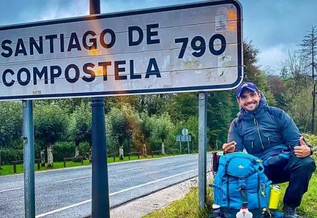
French Way from Roncesvalles to Logroño
From 347 €

Reviews
Ana Lloret
Luis M
Fernando
SARA TORRES
Olga
Pere Roca