

The Castro of Castromaior
05 June, 2026
The Castro de Castromaior, located along the French Way between Portomarín and Palas de Rei, is a spectacular fortified settlement from the Iron Age. Its visit allows the pilgrim to discover history, archaeology, and unique landscapes without straying far from the route.

Walking between Portomarín and Palas de Rei means crossing hills, oak groves, and villages that seem asleep, but right at kilometer eighty-two awaits a surprise that sparks the imagination. Declared an Asset of Cultural Interest (BIC) in 2010, the Castro de Castromaior is hidden just a few meters from the French Way, like a stage frozen in the Iron Age on the Camino de Santiago. Along this Jacobean route, this small detour on the Camino will make you feel like you’re traveling two thousand years back in time, without missing a single step toward Compostela.
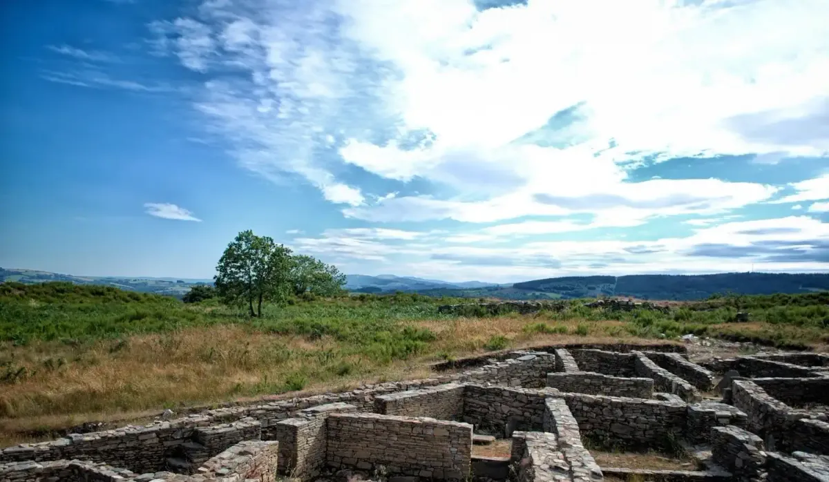
Castromaior is special because, being settled on a moderate elevation, its inhabitants multiplied their defenses until they built six concentric lines that still impress today. Walking through its terraces allows you to read the topography like an ancient engineering manual: slopes that cut the wind, parapets that protect from assault, and zigzag entrances designed to confuse the enemy. Wandering around at dawn offers a raking light that highlights every relief and seems to rebuild the walls in the visitor’s mind.
With the arrival of Rome, Castromaior maintained a certain autonomy for a time, but the new administration preferred the valleys, where it was easier to farm and, above all, collect taxes. Perhaps for this reason, around the 1st century AD, families abandoned the castro and merged with the farming settlements of the plain, leaving behind a stony shell that vegetation covered like a protective shroud.
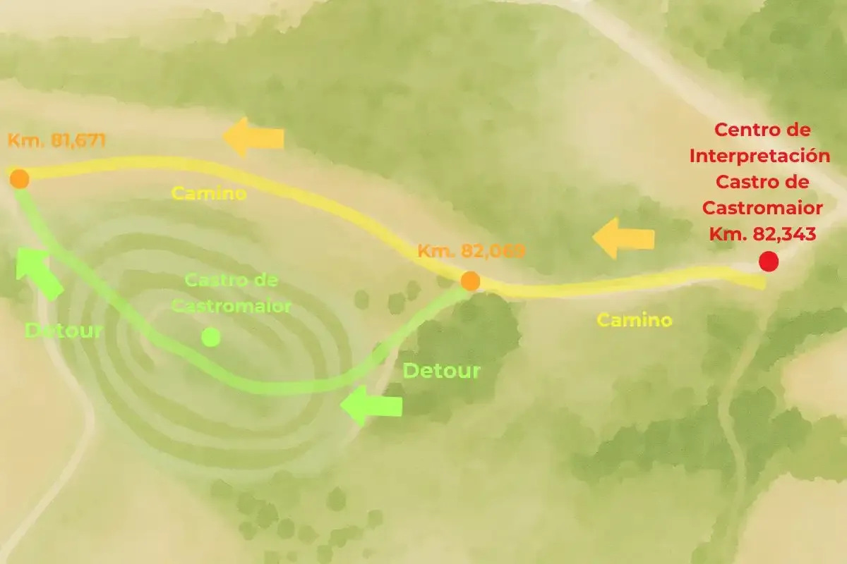
At milestone km 82.069, which indicates to go straight ahead, if you look to your left, a sturdy tree and an information panel invite you to leave the official route. That’s the way to the castro, which is somewhat signposted, but the trail is clearly visible and proceeds for a few dozen meters between gorse and young oak trees, soon crossing the first ditch of the castro. Little by little, you’ll reach the castro’s gate: within the enclosure, it’s best to walk slowly, read the land formations, and avoid climbing the walls to prevent erosion damage.
After crossing the populated core, the path descends and rejoins the French Way at km 81.671, so there’s no need to go back or risk losing your way: the next milestone confirms the remaining distance to Santiago.
From the top, you can see the winding river, the vineyard terraces cascading down to the water, and the gentle hills announcing the Terra de Melide. When the wind blows, the rustling of leaves mixes with the creaking of the walls, and it’s easy to imagine the Gallaecian sentinels scanning the horizon for smoke columns. If you pass by at dawn, the mist rising from the Miño adds an almost mystical aura; if you arrive at sunset, the horizon turns ochre and orange, transforming the walls into a natural amphitheater.
This brief detour transforms this stage of the Camino into an archaeological experience that enriches your steps and your perspective. We’d love to accompany you in every detail of the itinerary and help you with any questions: your Camino deserves every treasure hidden along the trail, and Castromaior is one of the most precious.
On the French Way from Sarria, don’t miss a visit to the Castro de Castromaior
What is a castro? The magnificent example of Castromaior
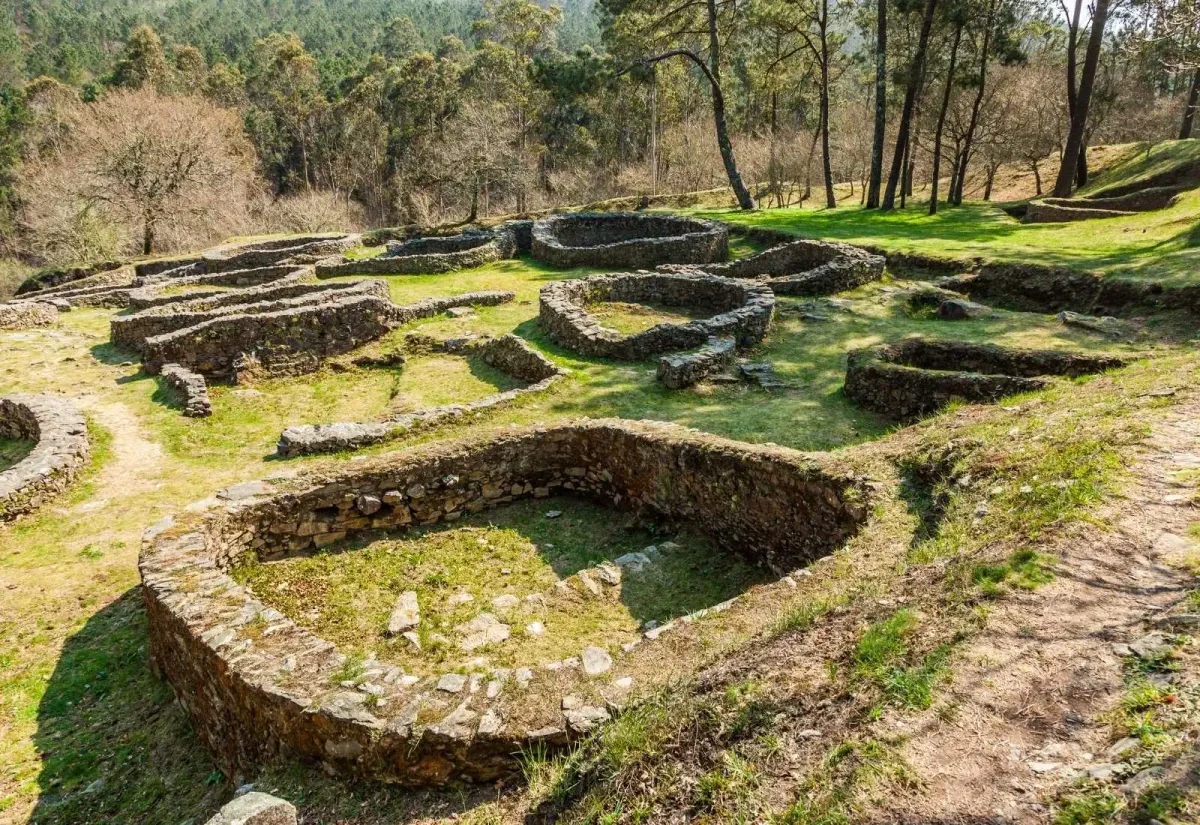
The castros were fortified villages that emerged from the 5th century BC in the northwest of the Iberian Peninsula. They chose dominant hills to control the valleys, and even coastal peninsulas surrounded by sea, encircling their living space with stone walls and digging ditches to deter any intruder.Castromaior is special because, being settled on a moderate elevation, its inhabitants multiplied their defenses until they built six concentric lines that still impress today. Walking through its terraces allows you to read the topography like an ancient engineering manual: slopes that cut the wind, parapets that protect from assault, and zigzag entrances designed to confuse the enemy. Wandering around at dawn offers a raking light that highlights every relief and seems to rebuild the walls in the visitor’s mind.
Castros in Galicia are typical pre-Roman constructions
History of the Castro
The first inhabitants arrived at the hill around the 4th century BC, drawn by the fertility of the Miño riverbanks and the proximity of a natural pass toward Lugo. During the last two centuries of the pre-Roman era, the village experienced its golden age, when its rectangular dwellings with softly rounded corners are dated.With the arrival of Rome, Castromaior maintained a certain autonomy for a time, but the new administration preferred the valleys, where it was easier to farm and, above all, collect taxes. Perhaps for this reason, around the 1st century AD, families abandoned the castro and merged with the farming settlements of the plain, leaving behind a stony shell that vegetation covered like a protective shroud.
Where is the Castro de Castromaior?
Administratively it belongs to the Municipality of Portomarín, province of Lugo, and stands on the right bank of the Miño River. Its position dominates old cattle paths that later became Roman roads and, centuries later, stages of the Camino de Santiago. Today, as we mentioned, pilgrims can enjoy this example of ancient architecture on the second stage of the French Way from Sarria, between Portomarín and Palas de Rei, before reaching Hospital, the highest point of this stretch. And if you're visiting by car, you’ll find it at kilometer 83 of the provincial road LU-633.Sketch map of the Camino to reach the Castro de Castromaior
How to get to the castro?
Leaving Portomarín, the first kilometers pass through shaded country paths and small climbs. Upon reaching the milestone km 82.343 you’ll find the concrete building of the Interpretation Center, whose roof floats over pillars and offers very welcome shade. Continue a few meters and the main path ascends slightly.At milestone km 82.069, which indicates to go straight ahead, if you look to your left, a sturdy tree and an information panel invite you to leave the official route. That’s the way to the castro, which is somewhat signposted, but the trail is clearly visible and proceeds for a few dozen meters between gorse and young oak trees, soon crossing the first ditch of the castro. Little by little, you’ll reach the castro’s gate: within the enclosure, it’s best to walk slowly, read the land formations, and avoid climbing the walls to prevent erosion damage.
After crossing the populated core, the path descends and rejoins the French Way at km 81.671, so there’s no need to go back or risk losing your way: the next milestone confirms the remaining distance to Santiago.
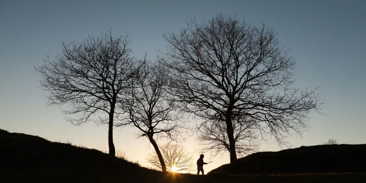
Young pilgrim atop the Castro de Castromaior
Discover the Castro de Castromaior
In the 21st century, excavations have uncovered around five hectares of urban layout, stone-paved corridors, remains of circular dwellings, and the foundations of a communal granary where you can still see the holes that held the wooden floor. In 2022, an interpretation center was opened to provide shelter to pilgrims, explain the findings through tactile panels, and offer a panoramic view that stretches from the mountains of O Courel to the first foothills of Pico Sacro.From the top, you can see the winding river, the vineyard terraces cascading down to the water, and the gentle hills announcing the Terra de Melide. When the wind blows, the rustling of leaves mixes with the creaking of the walls, and it’s easy to imagine the Gallaecian sentinels scanning the horizon for smoke columns. If you pass by at dawn, the mist rising from the Miño adds an almost mystical aura; if you arrive at sunset, the horizon turns ochre and orange, transforming the walls into a natural amphitheater.
This brief detour transforms this stage of the Camino into an archaeological experience that enriches your steps and your perspective. We’d love to accompany you in every detail of the itinerary and help you with any questions: your Camino deserves every treasure hidden along the trail, and Castromaior is one of the most precious.