


The Winter Way Map
20 October, 2026
The Winter Way leaves Ponferrada and reaches Santiago in around 255 km through the Sil valley and the Ribeira Sacra. This map shows its stages, the elevation profile, where it joins other Caminos and what to keep in mind when planning it.

This map gives you everything you need to plan yourWinter Way, the route that, according to tradition, pilgrims took to avoid the snow and cold of O Cebreiro during the winter months. It starts in Ponferrada, on the French Way, and enters Galicia through the Sil valley and the Ribeira Sacra. It is around 255 km to Santiago, along one of the quietest and most scenic Caminos of all.
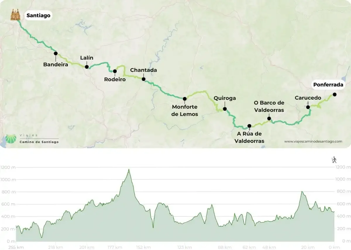
Map and elevation profile of the Winter Way, from Ponferrada to Santiago.
How to read the Winter Way map
On the map, Ponferrada is on the right and Santiago on the left: you walk west and pass through 2 autonomous communities and 5 provinces, León, in Castile and León, and Ourense, Lugo, Pontevedra and A Coruña, in Galicia. We organise it in 11 stages:
- Ponferrada – Carucedo, near Las Médulas.
- Carucedo – O Barco de Valdeorras, already in Galicia.
- O Barco de Valdeorras – A Rúa de Valdeorras, the shortest stage.
- A Rúa de Valdeorras – Quiroga, alongside the Sil River.
- Quiroga – Monforte de Lemos, the longest stage.
- Monforte de Lemos – Chantada, in the heart of the Ribeira Sacra.
- Chantada – Rodeiro, with the climb to Monte Faro.
- Rodeiro – Lalín.
- Lalín – Bandeira.
- Bandeira – Santa Cruz de Rivadulla.
- Santa Cruz de Rivadulla – Santiago de Compostela.
The elevation profile at the bottom shows a Camino of ups and downs. The highest point comes with the climb to Monte Faro, between Chantada and Rodeiro, where you go over 1,100 m according to the map's profile. Earlier, on the first stage, there is another climb that passes 800 m.
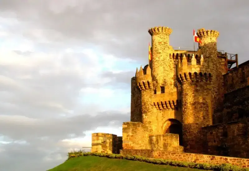
The Templar Castle in Ponferrada, the starting point of the Winter Way.
Where it joins other Caminos
The Winter Way begins in Ponferrada, one of the stops on the French Way. At the end, around Lalín, it joins the Sanabrian Way, the Galician section of the Silver Way (Vía de la Plata), and shares the last stages to Santiago with it. Here is the Sanabrian Way map.
Stretches with few places to stay: keep them in mind
You will find villages with services along the route, but the biggest problem on the Winter Way is the limited accommodation on some stages. That is why it pays to plan ahead, map in hand, and book before you set off. With an agency you make sure you have a bed every night, even on the stages with fewer places.
Where do I start the Winter Way?
The original starting point is Ponferrada. From there you cross regions as special as El Bierzo, Valdeorras or the Ribeira Sacra, which are the whole point of this route: starting further along would make it lose much of its meaning. If you have fewer days, we can tailor it to you. Here is our Winter Way from Ponferrada.
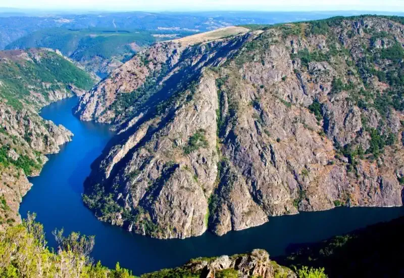
The Sil Canyon, in the Ribeira Sacra.
A Camino of scenery, wine and tranquillity
It is one of the least travelled Caminos, although it has more and more pilgrims as interest in the Ribeira Sacra grows. As it passes Quiroga it enters the Montañas do Courel Geopark, declared a UNESCO Global Geopark in 2019. And it is a Camino of great wines: it crosses the Valdeorras and Ribeira Sacra areas, so if you enjoy good wine, mark it on your map.
When you reach Santiago, remember that you can ask for the Compostela. And if you want to compare with other options, here are all the Camino de Santiago routes.
Once you know how many days you have and how you want to do it, calculate the price of your Winter Way here and get ready to discover the most inland Galicia.